Issue Date: Saturday, May 21st, 2022
Issue Time: 9AM MDT
— Flooding is NOT expected today
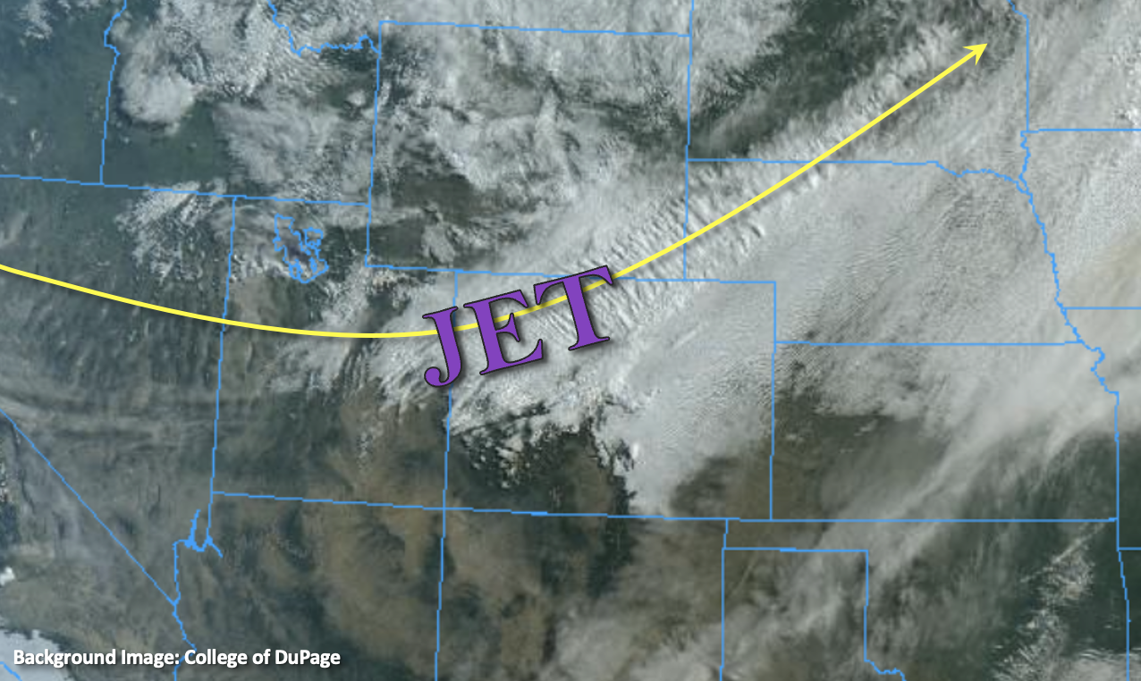
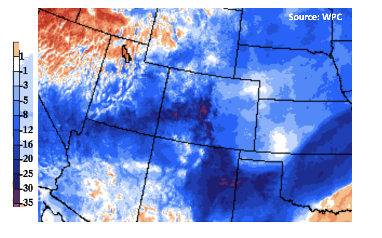
The late season winter storm will continue today, but the good news is that it should be winding down in both intensity and coverage after this morning. The base of the trough and accompanying jet are located over the Colorado and New Mexico border producing very cold air on its north side. Below is the 24-hour temperature change from yesterday (as of 5AM), and you can see even colder temperatures across the state behind that second front that came through.
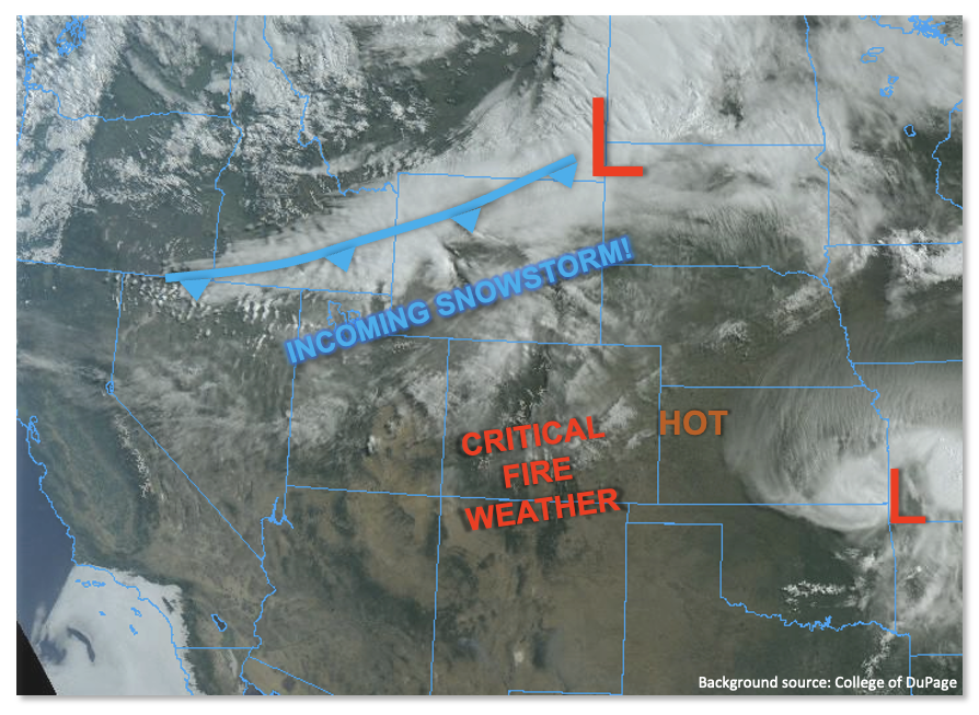
Not much change in the general synoptic pattern throughout the day, which means the best dynamics and moisture will be over southeast Colorado through this afternoon. So, expect the scattered rain/snow mix to continue for this area. Precipitation begins to wind down further north and west with a bit of a drier air mass moving in and weaker dynamics; however, lingering snow over the central mountains is likely. Precipitation is expected to temporarily pause statewide this evening before another round of snow develops over the southern Front Range/northern Southeast Mountains overnight. Due most precipitation accumulating as snow today and only gradual rainfall forecast, there is NO flood threat issued. One other quick thing to mention, this was a widespread event with a large area receiving at least 0.75 inches of liquid precipitation equivalent. As this begins to melt later today and into tomorrow, it will likely cause a spike in local streams/creeks. At this time flooding is not expected, but we do anticipate a rise in streamflow over the next couple of days.
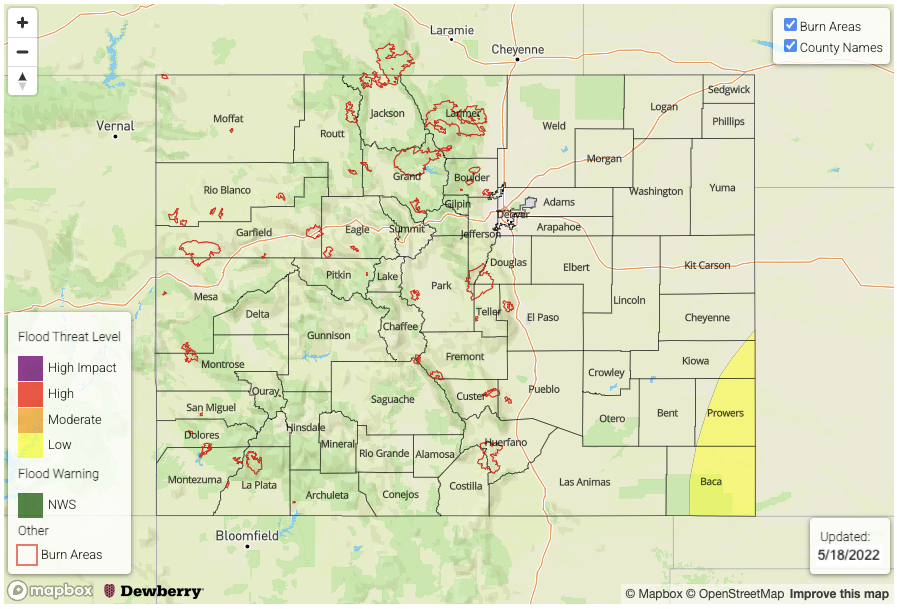
Today’s Flood Threat Map
For more information on today’s flood threat, see the map below. If there is a threat, hover over the threat areas for more details, and click on burn areas to learn more about them. For Zone-Specific forecasts, scroll below the threat map.

Zone-Specific Forecasts:
Front Range, Southeast Mountains, Palmer Ridge, Raton Ridge & Southeast Plains:
Best coverage of precipitation today will be over these zones, which includes the southern portions of the Front Range and Palmer Ridge. Snow will begin to turn over to a cold rain across the Southeast Plains as the freezing line rises this morning. Max liquid equivalent totals up to 0.60 (adjacent eastern plains), 0.30 (east), 1.0 (ridges) and 1.5 (SE mtns) inches will be possible. Flooding is NOT anticipated today with a brief pause in precipitation forecast this evening. Overnight snow should generally be light over the southern Front Range/northern Southeast Mountains with up to 0.2 inches of liquid equivalent possible translating to a couple more inches of snow during this period. Light showers may linger over the far eastern Palmer Ridge into the morning hours.
Primetime: Ongoing to 4AM
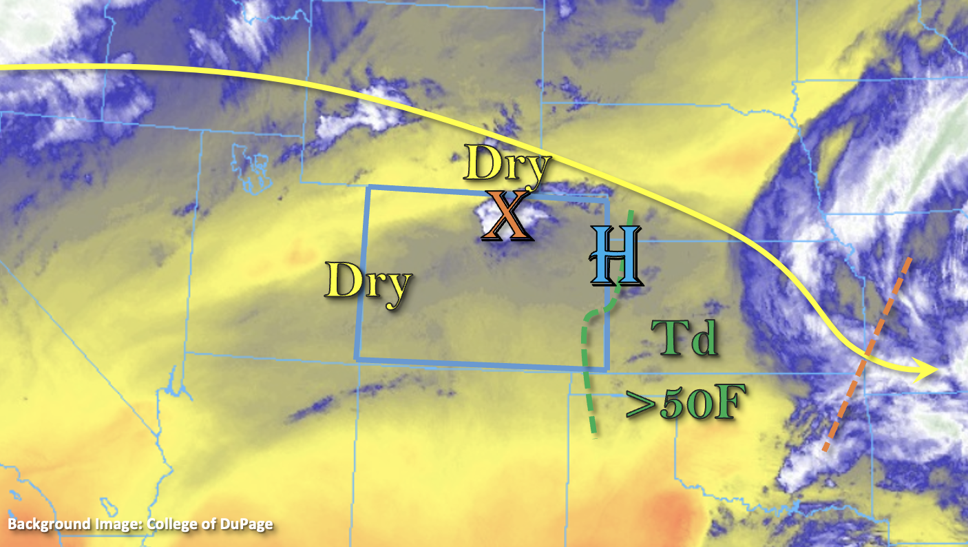
Central Mountains, Northern Mountains, Northwest Slope, Northeast Plains, San Luis Valley, Urban Corridor, Southwest Slope, Grand Valley & San Juan Mountains:
Precipitation will continue to decrease over the Urban Corridor as the morning progresses. Only a couple more inches of snow are forecast. Isolated snow may be possible over the Central Mountains and San Juan Mountains as well as the elevated plateaus of the Grand Valley this morning/afternoon near the Continental Divide. Otherwise, it will remain dry for these zones with highs returning to the 60Fs across the lower elevations west. Highs in the mid-40Fs to low 50Fs are forecast for the lower elevations east, which will kick off the melting.