FTB 06-02-2022: Warmer With Isolated Heavy Rainfall Expected Over Southeast Colorado

Issue Date: Thursday, June 2nd, 2022
Issue Time: 10:30MDT

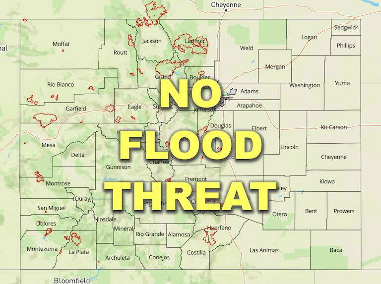
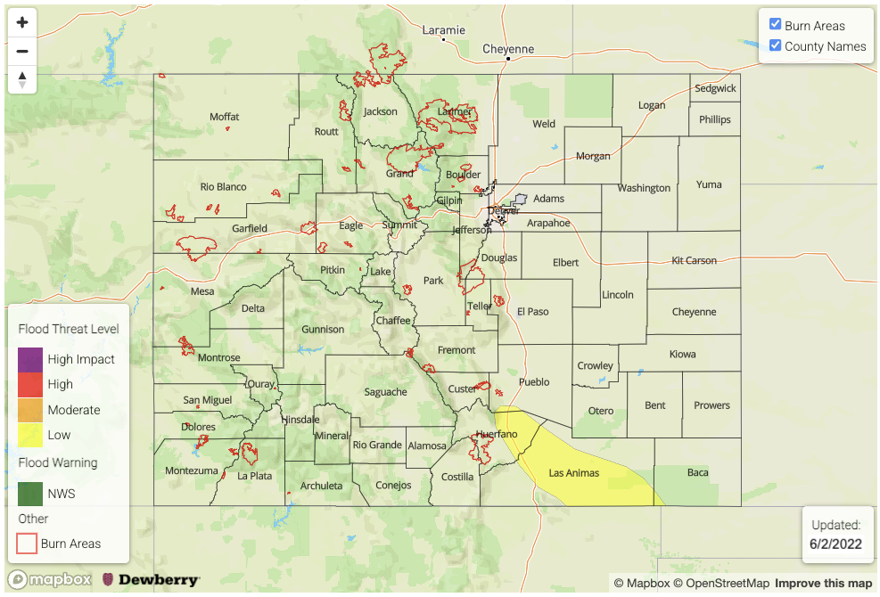
— A LOW flood threat has been issued for the Raton Ridge and parts of the Southeast Plains

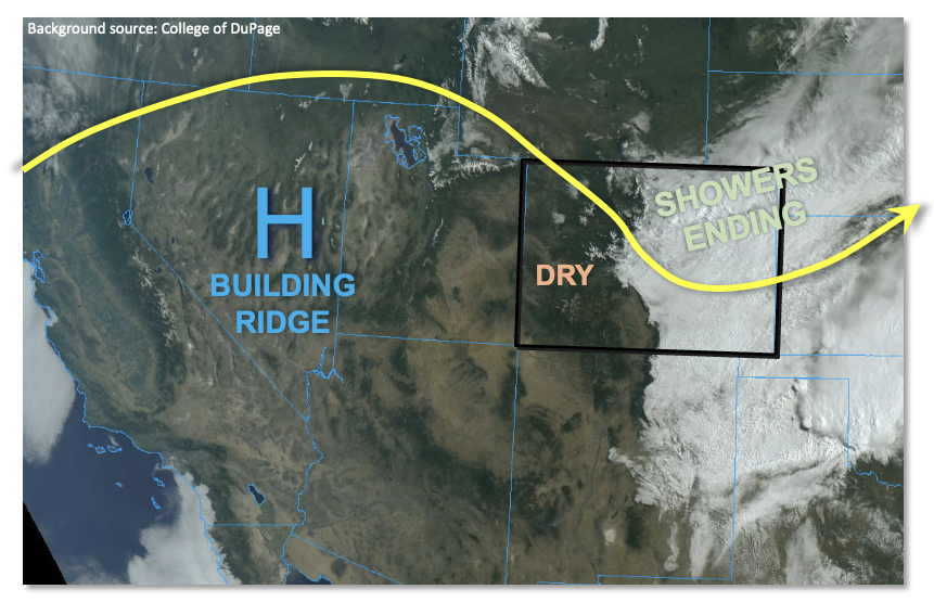
With a weak ridge moving into our state, warmer temperatures are expected statewide today. As shown in the visible satellite image, below, a stubborn low cloud deck still remains over southeast Colorado. However, the vertical extent of that cloud deck has decreased down to only 1k-2k feet in depth. With the strong May sunshine, the clouds should quickly dissipate by noon. Once the sunshine is out in full, instability will quickly jump into the 500 – 1,200 J/kg CAPE range over the Palmer Ridge, Raton Ridge and Southeast Plains. Synoptic scale forcing is weak today, but we are in Colorado, so who needs synoptic scale forcing when you have our topography? Diurnal upslope flow will help drive isolated to scattered showers and storms today with the highest coverage along the NM border. Storm motion will be rather slow, in the 20-25mph range, which will help increase rain intensity over a given location.

PW this morning was 0.56 inches at Denver, and 0.37 inches at Grand Junction. Statewide, PW ranged from 0.2 – 0.4 inches west of the Continental Divide, to 0.5 – 0.8 inches to the east. Weak southeasterly advection from the southern Great Plains will increase moisture a bit over southeast Colorado by later this afternoon, with PW expecting to approach 1.0 inch over parts of the Southeast Plains. With relatively deep boundary layer moisture present today, isolated heavy rainfall is expected by late afternoon mainly over the Raton Ridge and surrounding plains. A LOW flood threat has been posted for isolated flash flooding, debris slides and mud flows. Storms are expected to subside by 10PM, through isolated weaker storms could persist through the early overnight hours.

Today’s Flood Threat Map

For more information on today’s flood threat, see the map below. If there is a threat, hover over the threat areas for more details, and click on burn areas to learn more about them. For Zone-Specific forecasts, scroll below the threat map.
Zone-Specific Forecasts:

Northeast Plains, Southeast Plains, Urban Corridor, Palmer Ridge, Southeast Mountains & Raton Ridge:

Becoming partly cloudy and warmer with isolated to scattered showers and thunderstorms mainly over the Palmer Ridge, Southeast Plains and Raton Ridge. Max 30-min rain rates up to 0.9 inches possible, with max 1-hour rainfall up to 1.2 inches. A LOW flood threat has been posted for southern portions of the area for isolated flash flooding, debris slides and mud flows. Severe weather is also possible with the stronger storms.

Primetime: 2PM through 10PM, though an isolated storm cannot be ruled after through 1AM

Northwest Slope, Northern Mountains, Front Range, Grand Valley, Central Mountains, San Juan Mountains, Southwest Slope & San Luis Valley:

Mostly sunny and warmer today with temperatures near or slightly above seasonal normal. An isolated shower or weak storm cannot be ruled out over the Front Range and San Juan Mountains and adjoining foothills. Max 1-hour rainfall up to 0.3 inches. Flooding is NOT expected today.

Primetime: Noon through 7PM
FTB 06-01-2022: A Cool Start To June

Issue Date: Wednesday, June 1st, 2022
Issue Time: 9:30AM MDT

— Flooding is NOT expected today

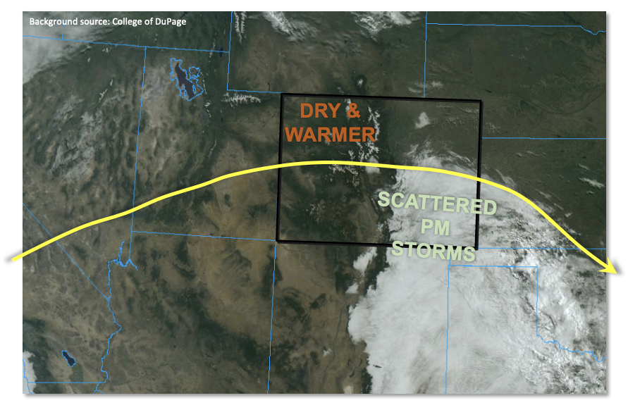
After the welcome soaking rain and snow over a majority of northern and eastern Colorado over the past 24 hours, this morning we see clouds and precipitation remain below about 10,000 feet over eastern areas. This is shown beautifully in the visible satellite image below. Meanwhile, along and west of the Continental Divide, clear skies abound.

The disturbance responsible for the recent precipitation will quickly move out of the state by early afternoon taking with it all remaining rain showers. PW this morning showed a strong gradient across the state with Grand Junction at 0.43 inches while Denver was at 0.70 inches. With an incoming upper-level ridge, dry westerly flow will slowly erode the cloud deck over the eastern part of the state. However, keyword: slowly. Given the depth of the saturated atmosphere, clouds are expected to persist for a good part of the day over eastern and southern areas. As such, high temperatures will remain well below normal under areas with the most persistent cloud deck.

To the west, seasonably cool temperatures and plenty of sunshine will make for a pleasant Wednesday. Low relative humidity is expected again over southwest Colorado, but a lack of wind has at least temporarily precluded the Red Flag Warnings.

Today’s Flood Threat Map

For more information on today’s flood threat, see the map below. If there is a threat, hover over the threat areas for more details, and click on burn areas to learn more about them. For Zone-Specific forecasts, scroll below the threat map.

Zone-Specific Forecasts:

Northeast Plains, Southeast Plains, Northern Mountains, Front Range, Urban Corridor, Central Mountains, Palmer Ridge, Southeast Mountains & Raton Ridge:

Mostly cloudy early with some leftover rain showers mainly over the eastern Plains. Max 1-hour rainfall up to 0.4 inches possible. Some clearing is expected by late in the day, but even so, temperatures will be 10-25F below normal!

Primetime: Ongoing to 1PM

Grand Valley, San Juan Mountains, Southwest Slope, San Luis Valley & Northwest Slope:

Mostly sunny and pleasant today with temperatures running a few degrees below normal.

FTB 05-31-2022: Next Low To Provide Widespread Precipitation To Eastern Colorado

Issue Date: Tuesday, May 31st, 2022
Issue Time: 10:20AM MDT

  Flooding is NOT expected today
Fire-Burn Forecast Summary: 1 burn area is under LOW threat; click HERE for more info

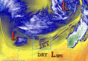
The Low from yesterday is now located over the upper mid-west, and another Low has moved in behind it (currently over Nevada) as shown in the water vapor image below. This new Low is forecast to slowly move east over the next 36-hours and is expected to bring widespread precipitation to eastern Colorado through tomorrow afternoon. With the location of the Low, there should be plenty of shortwaves rotating into the state, which will help provide some additional lift for longer duration precipitation. Furthermore, an upper-level jet streak will help expand shower coverage and duration overnight as the right entrance moves over northeast Colorado.

PW at Denver was measured at 0.36 inches with the majority of moisture located in the mid-levels. This indicates that it may take a few hours for more efficient rain rates to develop as the dry sub-layer moistens. While lower intensity hourly rainfall rates are forecast today/tonight, that will limit the flood threat, the persistent nature of the precipitation should produce meaningful accumulation during this event. However, flooding is NOT expected. Precipitation is forecast to continue into tomorrow morning, so expect wet, cloudy and cool conditions over eastern Colorado to start Wednesday.

A second area of precipitation is forecast over the Northwest Slope and Northern Mountains this afternoon into this evening. PW over Grand Junction was measured at 0.34 inches, so it’s still quite dry, which will limit the amount of rainfall that reaches the surface. With modest instability being able to build over the Northwest Slope, the high-based storms may produce some brief gusty winds as they are steered counterclockwise around the Low. Flooding is NOT expected from the widely scattered storms that develop.

Today’s Flood Threat Map

For more information on today’s flood threat, see the map below. If there is a threat, hover over the threat areas for more details, and click on burn areas to learn more about them. For Zone-Specific forecasts, scroll below the threat map.

Zone-Specific Forecasts:

Front Range, Urban Corridor, Northeast Plains, Palmer Ridge, Southeast Mountains, Raton Ridge & Southeast Plain:

Upslope flow should develop by this afternoon, and this will help to initiate storms over the Front Range. Precipitation is forecast to expand into the adjacent Urban Corridor by early afternoon and then into the Northeast Plains by this evening with help from the upper-level dynamics. During the overnight hours, precipitation should further expand to the Palmer Ridge and Southeast Plains, although more scattered coverage is forecast south.

Cooler temperatures over the mountains (less CAPE) with the snow line around ~9K feet today (dropping to ~8K tonight) should keep the flood threat close to zero at the higher elevations. A nice southwest to northeast band of precipitation, aligned with the upper-level jet, is expected to set up over the Front Range and expand into the Urban Corridor/Northeast Plains this afternoon into the overnight hours. Totals just under 2 inches may be possible under this band. Generally, expect a large area of the Front Range, northern Urban Corridor and western Northeast Plains to receive at least an inch of beneficial moisture by morning. Over the northern Palmer Ridge, totals up to 1.25 inches will be possible.

More scattered precipitation is forecast for the Southeast Mountains, Raton Ridge and Southeast Mountains. Totals by morning up to 0.60 inches (west) and 0.50 inches (east) will be possible.

Flooding is NOT expected today.

Primetime: 12PM to Ongoing

Northern Mountains, Central Mountains & Northwest Slope:

Widely scattered precipitation is forecast this afternoon and into the evening hours. At the higher elevations (above 9K feet), snow is anticipated with decreasing precipitation chances over the Central Mountains. Max 1-hour rain rates up to 0.35 inches are possible over the Northwest Slope. Faster steering flows should limit accumulation, and storms may produce some brief windy conditions. There is NO flood threat issued.

Primetime: 1PM to 9PM

Grand Valley, San Luis Valley, San Juan Mountains & Southwest Slope:

It is still quite dry over these regions, and more dry air advection throughout the day will help to keep precipitation chances close to zero. There will likely be some mixing of the stronger upper-level winds to the surface over the eastern San Juan Mountains and San Luis Valley, so paired with low relative humidity, Elevated fire danger is forecast. A Red Flag Warning has been issued for these two zones from 11AM to 9PM. Flooding is NOT expected today.

FTB 05-30-2022: Cool Memorial Day With Isolated Snow/Showers Over Northern Colorado

Issue Date: Monday, May 30th, 2022
Issue Time: 10:05AM MDT  

Flooding is NOT expected today

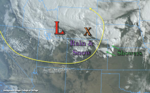
It’s a cool start to the morning statewide behind the passage of a strong cold front. Temperatures are generally between 8°F to 16°F (but up to 25°F) colder than this time yesterday. Currently, there is a rain/snow mix occurring over the northern and central high terrains along with light showers over the far Northeast Plains. The upper-level Low this morning is located just to the northwest of Colorado, and there’s a stronger band of precipitation on an axis of instability to our north (orange “X”).


The Low is forecast to move east today before quickly lifting to the northeast tonight. So, only expecting a little weak mid-level energy on its south side to slide across northern Colorado today. This first area of lift should help to increase precipitation chances over the Northeast Plains by late this morning. There is also a strong jet streak located at the base of the trough, which is currently set up over southern Colorado. This jet streak is expected to become more southwest to northeast oriented over the eastern plains by mid-day, which could also help to provide a little extra lift for storms that develop over the Northeast Plains. With it still being quite dry over southern Colorado (see lack of cloud cover in the image above), the mixing of these stronger upper-level winds down to the surface will cause another widespread Red Flag Warning to be issued.

As far as the flood threat, there is a slight decrease in PW this morning with soundings measuring 0.38 and 0.40 inches at Grand Junction and Denver, respectively. In tandem with the cooler temperatures, this will help to limit the convective and heavy rainfall potential for storms that develop today. Forecasting a couple rounds of isolated precipitation (including snow) over the northern and central high terrains with limited spillover expected in the adjacent plains. A thunderstorm or two is also likely over the Northeast Plains/eastern Palmer Ridge, but quick steering flows and limited surface moisture should produce only moderate rainfall totals over any given location. Therefore, there is NO flood threat issued.

Today’s Flood Threat Map

For more information on today’s flood threat, see the map below. If there is a threat, hover over the threat areas for more details, and click on burn areas to learn more about them. For Zone-Specific forecasts, scroll below the threat map.

Zone-Specific Forecasts:

Northern Mountains, Central Mountains, Northwest Slope, Grand Valley & Front Range:

Precipitation chances decrease when compared to yesterday. However, a couple rounds of isolated precipitation (rain/snow mix) could cause 24-hour totals to reach up to 0.60 inches over the southern Front Range and Central Mountains. With limited instability, quick steering flows and snow at the higher elevations, flooding is NOT expected from the isolated storms that develop. Expect a decrease in precipitation coverage by mid-afternoon as subsidence fills in behind the departing Low.
Primetime: Ongoing to 7PM

Palmer Ridge, Urban Corridor, Southeast Plains & Northeast Plains:

Some mid-level energy and moderate moisture should allow for a weak thunderstorm or two to develop over the eastern Palmer Ridge/Northeast Plains late this morning and into the early this afternoon. Max 1-hour rain rates up to 0.75 inches will be possible, so flooding is NOT expected. Precipitation chances decrease quickly after these storms move through, so it should be a calm evening.
Primetime: 10:30AM to 3PM

Southeast Mountains, Raton Ridge, San Luis Valley, San Juan Mountains & Southwest Slope:

Although cooler temperatures are forecast, low relative humidity and strong winds with the jet streak over these regions will cause another day of widespread Red Flag Warnings to be issued. As the jet moves into eastern Colorado with the Low by mid-afternoon, the fire weather threat should begin to decrease over western Colorado. Outside of isolated rain/snow over the northern San Juan Mountains, it will be too dry and windy for measurable precipitation. Flooding is NOT expected.