Issue Date: Tuesday, May 31st, 2022
Issue Time: 10:20AM MDT
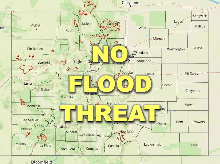
— Flooding is NOT expected today
— Fire-Burn Forecast Summary: 1 burn area is under LOW threat; click HERE for more info
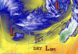
The Low from yesterday is now located over the upper mid-west, and another Low has moved in behind it (currently over Nevada) as shown in the water vapor image below. This new Low is forecast to slowly move east over the next 36-hours and is expected to bring widespread precipitation to eastern Colorado through tomorrow afternoon. With the location of the Low, there should be plenty of shortwaves rotating into the state, which will help provide some additional lift for longer duration precipitation. Furthermore, an upper-level jet streak will help expand shower coverage and duration overnight as the right entrance moves over northeast Colorado.
PW at Denver was measured at 0.36 inches with the majority of moisture located in the mid-levels. This indicates that it may take a few hours for more efficient rain rates to develop as the dry sub-layer moistens. While lower intensity hourly rainfall rates are forecast today/tonight, that will limit the flood threat, the persistent nature of the precipitation should produce meaningful accumulation during this event. However, flooding is NOT expected. Precipitation is forecast to continue into tomorrow morning, so expect wet, cloudy and cool conditions over eastern Colorado to start Wednesday.
A second area of precipitation is forecast over the Northwest Slope and Northern Mountains this afternoon into this evening. PW over Grand Junction was measured at 0.34 inches, so it’s still quite dry, which will limit the amount of rainfall that reaches the surface. With modest instability being able to build over the Northwest Slope, the high-based storms may produce some brief gusty winds as they are steered counterclockwise around the Low. Flooding is NOT expected from the widely scattered storms that develop.
Today’s Flood Threat Map
For more information on today’s flood threat, see the map below. If there is a threat, hover over the threat areas for more details, and click on burn areas to learn more about them. For Zone-Specific forecasts, scroll below the threat map.

Zone-Specific Forecasts:
Front Range, Urban Corridor, Northeast Plains, Palmer Ridge, Southeast Mountains, Raton Ridge & Southeast Plain:
Upslope flow should develop by this afternoon, and this will help to initiate storms over the Front Range. Precipitation is forecast to expand into the adjacent Urban Corridor by early afternoon and then into the Northeast Plains by this evening with help from the upper-level dynamics. During the overnight hours, precipitation should further expand to the Palmer Ridge and Southeast Plains, although more scattered coverage is forecast south.
Cooler temperatures over the mountains (less CAPE) with the snow line around ~9K feet today (dropping to ~8K tonight) should keep the flood threat close to zero at the higher elevations. A nice southwest to northeast band of precipitation, aligned with the upper-level jet, is expected to set up over the Front Range and expand into the Urban Corridor/Northeast Plains this afternoon into the overnight hours. Totals just under 2 inches may be possible under this band. Generally, expect a large area of the Front Range, northern Urban Corridor and western Northeast Plains to receive at least an inch of beneficial moisture by morning. Over the northern Palmer Ridge, totals up to 1.25 inches will be possible.
More scattered precipitation is forecast for the Southeast Mountains, Raton Ridge and Southeast Mountains. Totals by morning up to 0.60 inches (west) and 0.50 inches (east) will be possible.
Flooding is NOT expected today.
Primetime: 12PM to Ongoing
Northern Mountains, Central Mountains & Northwest Slope:
Widely scattered precipitation is forecast this afternoon and into the evening hours. At the higher elevations (above 9K feet), snow is anticipated with decreasing precipitation chances over the Central Mountains. Max 1-hour rain rates up to 0.35 inches are possible over the Northwest Slope. Faster steering flows should limit accumulation, and storms may produce some brief windy conditions. There is NO flood threat issued.
Primetime: 1PM to 9PM
Grand Valley, San Luis Valley, San Juan Mountains & Southwest Slope:
It is still quite dry over these regions, and more dry air advection throughout the day will help to keep precipitation chances close to zero. There will likely be some mixing of the stronger upper-level winds to the surface over the eastern San Juan Mountains and San Luis Valley, so paired with low relative humidity, Elevated fire danger is forecast. A Red Flag Warning has been issued for these two zones from 11AM to 9PM. Flooding is NOT expected today.
