Issue Date: Monday, May 30th, 2022
Issue Time: 10:05AM MDT
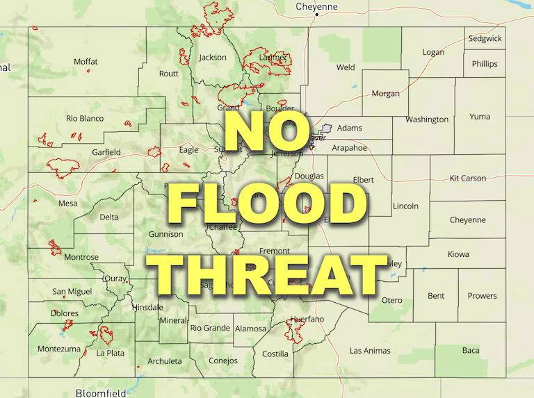
— Flooding is NOT expected today
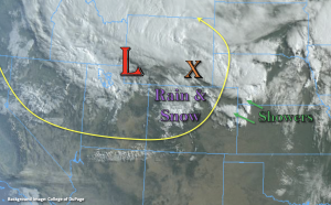
It’s a cool start to the morning statewide behind the passage of a strong cold front. Temperatures are generally between 8°F to 16°F (but up to 25°F) colder than this time yesterday. Currently, there is a rain/snow mix occurring over the northern and central high terrains along with light showers over the far Northeast Plains. The upper-level Low this morning is located just to the northwest of Colorado, and there’s a stronger band of precipitation on an axis of instability to our north (orange “X”).
The Low is forecast to move east today before quickly lifting to the northeast tonight. So, only expecting a little weak mid-level energy on its south side to slide across northern Colorado today. This first area of lift should help to increase precipitation chances over the Northeast Plains by late this morning. There is also a strong jet streak located at the base of the trough, which is currently set up over southern Colorado. This jet streak is expected to become more southwest to northeast oriented over the eastern plains by mid-day, which could also help to provide a little extra lift for storms that develop over the Northeast Plains. With it still being quite dry over southern Colorado (see lack of cloud cover in the image above), the mixing of these stronger upper-level winds down to the surface will cause another widespread Red Flag Warning to be issued.
As far as the flood threat, there is a slight decrease in PW this morning with soundings measuring 0.38 and 0.40 inches at Grand Junction and Denver, respectively. In tandem with the cooler temperatures, this will help to limit the convective and heavy rainfall potential for storms that develop today. Forecasting a couple rounds of isolated precipitation (including snow) over the northern and central high terrains with limited spillover expected in the adjacent plains. A thunderstorm or two is also likely over the Northeast Plains/eastern Palmer Ridge, but quick steering flows and limited surface moisture should produce only moderate rainfall totals over any given location. Therefore, there is NO flood threat issued.
Today’s Flood Threat Map
For more information on today’s flood threat, see the map below. If there is a threat, hover over the threat areas for more details, and click on burn areas to learn more about them. For Zone-Specific forecasts, scroll below the threat map.

Zone-Specific Forecasts:
Northern Mountains, Central Mountains, Northwest Slope, Grand Valley & Front Range:
Precipitation chances decrease when compared to yesterday. However, a couple rounds of isolated precipitation (rain/snow mix) could cause 24-hour totals to reach up to 0.60 inches over the southern Front Range and Central Mountains. With limited instability, quick steering flows and snow at the higher elevations, flooding is NOT expected from the isolated storms that develop. Expect a decrease in precipitation coverage by mid-afternoon as subsidence fills in behind the departing Low.
Primetime: Ongoing to 7PM
Palmer Ridge, Urban Corridor, Southeast Plains & Northeast Plains:
Some mid-level energy and moderate moisture should allow for a weak thunderstorm or two to develop over the eastern Palmer Ridge/Northeast Plains late this morning and into the early this afternoon. Max 1-hour rain rates up to 0.75 inches will be possible, so flooding is NOT expected. Precipitation chances decrease quickly after these storms move through, so it should be a calm evening.
Primetime: 10:30AM to 3PM
Southeast Mountains, Raton Ridge, San Luis Valley, San Juan Mountains & Southwest Slope:
Although cooler temperatures are forecast, low relative humidity and strong winds with the jet streak over these regions will cause another day of widespread Red Flag Warnings to be issued. As the jet moves into eastern Colorado with the Low by mid-afternoon, the fire weather threat should begin to decrease over western Colorado. Outside of isolated rain/snow over the northern San Juan Mountains, it will be too dry and windy for measurable precipitation. Flooding is NOT expected.
