Issue Date: 5/11/2015
Issue Time: 10:10 AM
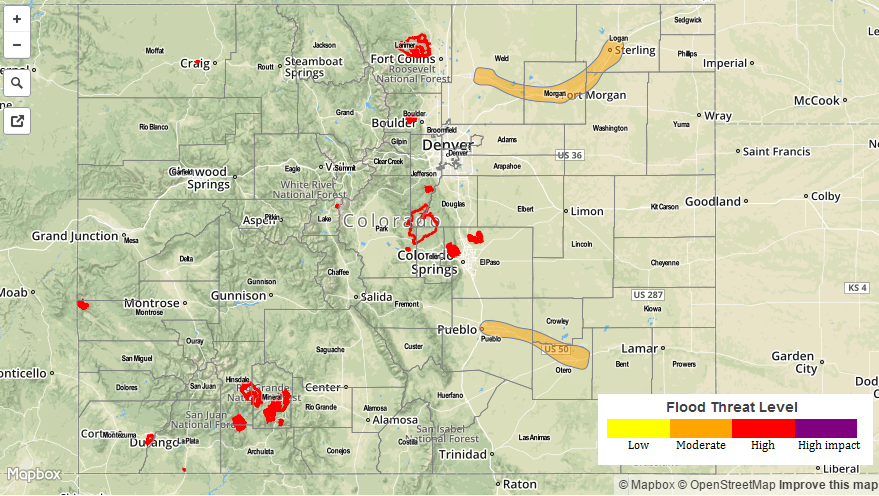
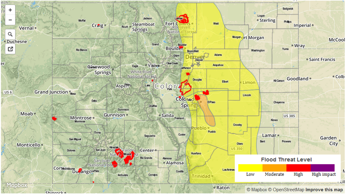
A MODERATE FLOOD THREAT HAS BEEN ISSUED FOR THE CACHE LA POUDRE/SOUTH PLATTE RIVER FROM GREELEY THROUGH STERLING, AND FOR THE ARKANSAS RIVER FROM PUEBLO THROUGH LA JUNTA.
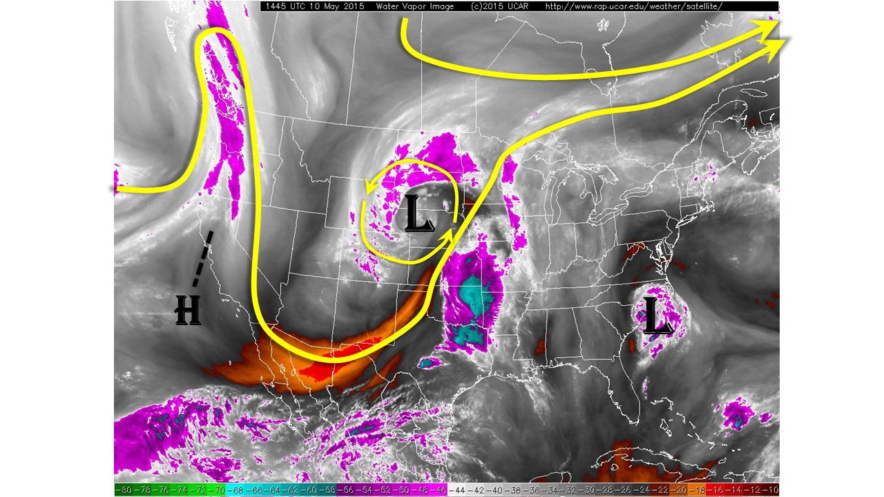
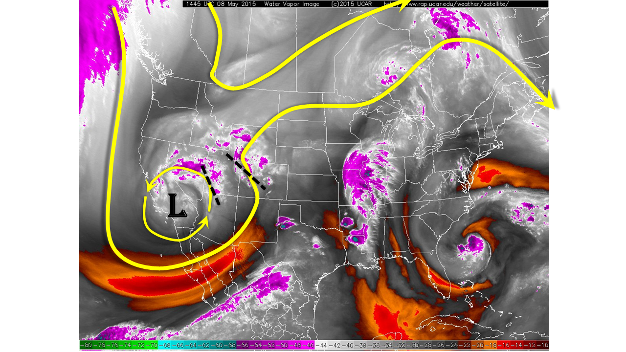
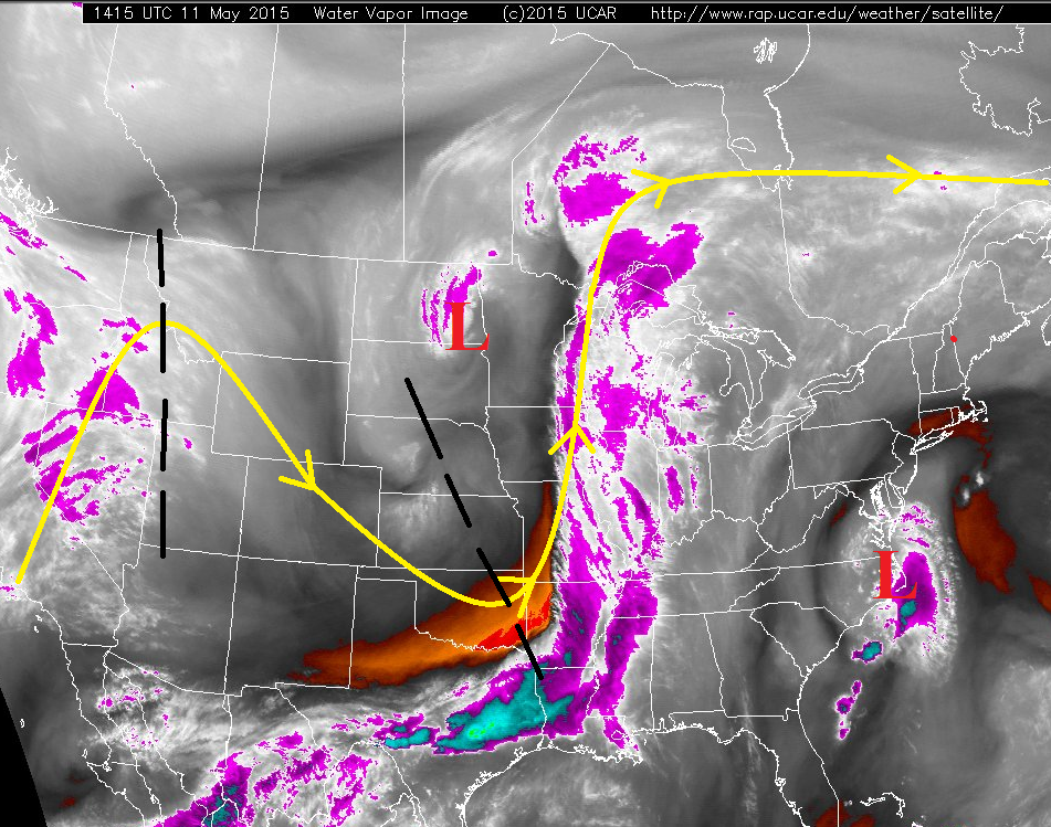
After the last 10 days of rain, it feels good to say that today will be cool and dry with mostly sunny skies as high pressure builds over the region. Aside from continued flooding along the South Platte River and Arkansas River outlined above, swollen streams will recede and standing water will dry up as the sun and westerly winds do their part. The water vapor image below really tells the whole story today; Colorado is positioned in a region of drier air and subsidence between the upstream ridge and downstream trough. This means that on the large-scale, conditions are very favorable for sunny skies. At the surface, high pressure continues to build across the state, with very little moisture left behind as dewpoints are in the 20s and 30s. The only exception to all of the sunshine and dry conditions will be a few light showers possible across the highest terrain, owing to the mountains natural ability to force weak vertical motion today. All precipitation totals should be less than 0.1 inch. Otherwise, mostly sunny skies are in store for Colorado.
Today’s Flood Threat Map
For more information on today’s flood threat, see the map below (hover over threat areas for more details). For Zone-Specific forecasts, jump below the map.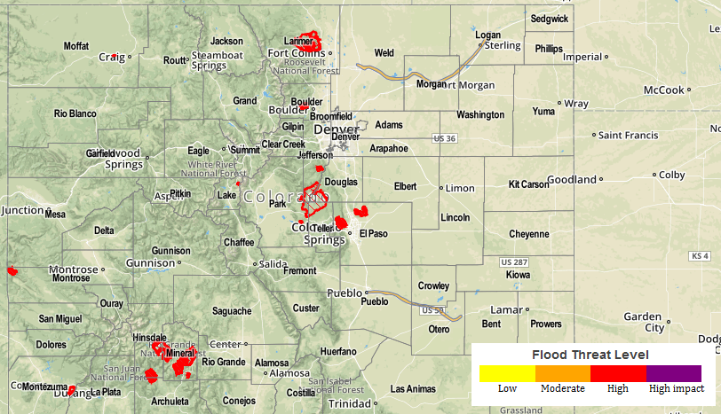
Zone-Specific Forecasts
Urban Corridor, Palmer Ridge, Northeast Plains, and Southeast Plains:
Mostly sunny and cool, with highs ranging from the mid-50s to low 60s across the Plains, to the low-to-mid 50s across the Palmer Ridge and Urban Corridor.
Front Range, Northern Mountains, Central Mountains, Northwest Slope, San Juan Mountains, and Southwest Slope:
Partly sunny, with a few showers this afternoon and evening over the highest terrain. Expect any showers to produce less than 0.1 inch of rainfall. High temperatures will range from the 30s over the highest terrain to the upper 40s for the valleys.
Southeast Mountains and Raton Ridge:
Mostly sunny, with one or two showers this afternoon and evening over the mountains. Rainfall totals will be less than 0.1 inch. High temperatures will be in the upper 50s/low 60s for the lowest elevations, and in the upper 30s/low 40s for the mountains.
Grand Valley and San Luis Valley:
Mostly sunny, with high temperatures warming into the 60s. Slightly higher elevations will see highs in the upper 40s and low 50s.