Issue Date: 5/15/2015
Issue Time: 10:22 AM
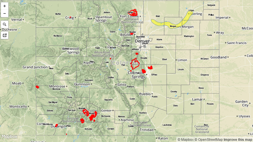
A LOW FLOOD THREAT HAS BEEN ISSUED FOR THE CACHE LA POUDRE/SOUTH PLATTE RIVER FROM GREELEY THROUGH JULESBURG.
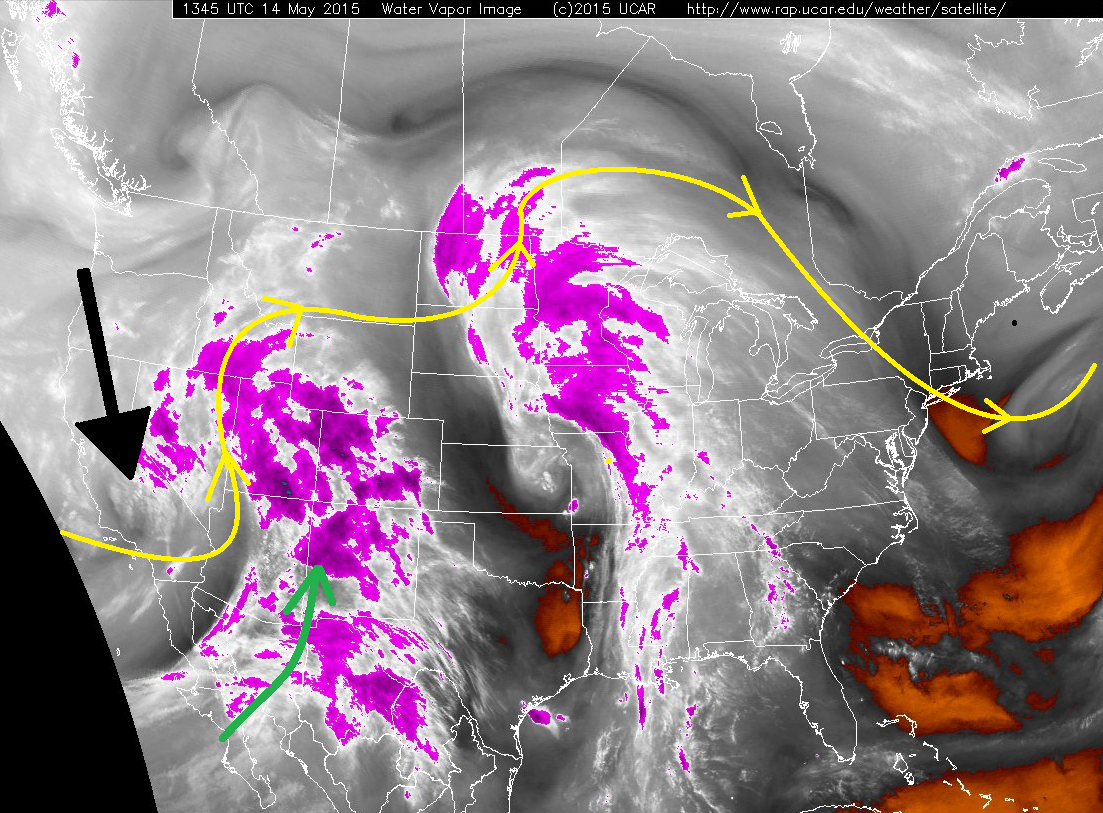
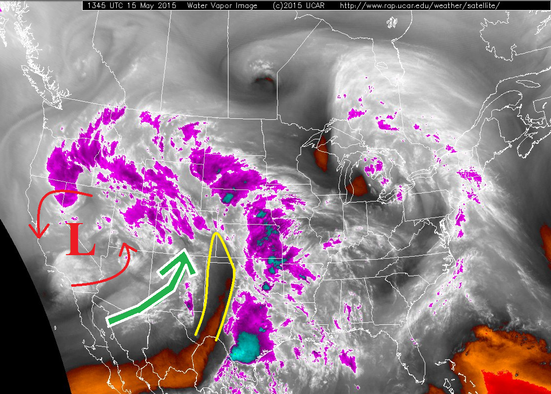
The upper-level low/digging trough that was mentioned in yesterday’s FTB is still hanging around near the West coast, but today it is on the move. It will slowly slide to the east-northeast, becoming centered over Utah by tomorrow morning. As it does this, a few things will happen…
- Broad-scale lift and mid-/upper-level moisture will continue to overspread the state, as shown by the green arrow on the water vapor image below
- The “dry slot” (marked by the yellow lines) will move over the top of much of the eastern plains
- Cooler air will move in from the west, bringing snow levels along and west of the Continental Divide down to about 8500-9000 feet.
- Surface low pressure will deepen/strengthen on the eastern plains, which will reinforce low-level moisture across the Northeastern Plains, while mixing out moisture/drying the low-levels elsewhere across the Urban Corridor, Palmer Ridge, and Southeastern Plains.
All of these ingredients together equal quite the variety of weather over Colorado, which is pretty typical for this time of year. West of the Continental Divide, snow will occur above 8500-9000 feet, with scattered showers and thunderstorms for lower elevations. The Front Range and Southeast Mountains will experience isolated-to-scattered showers and thunderstorms. The Urban Corridor (south of Castle Rock), Palmer Ridge and Southeast Plains will only see a few isolated thunderstorms, as low-level moisture gets eroded quickly by the developing surface low pressure. The Urban Corridor (north of Castle Rock) and Northeastern Plains will see isolated-to-scattered thunderstorms, with a few becoming strong-to-severe. The greatest risk for severe thunderstorms, including an isolated tornado, large hail, and wind gusts up to 65 mph will be north of a line from Cheyenne (WY) to Greeley to Fort Morgan to Wray.
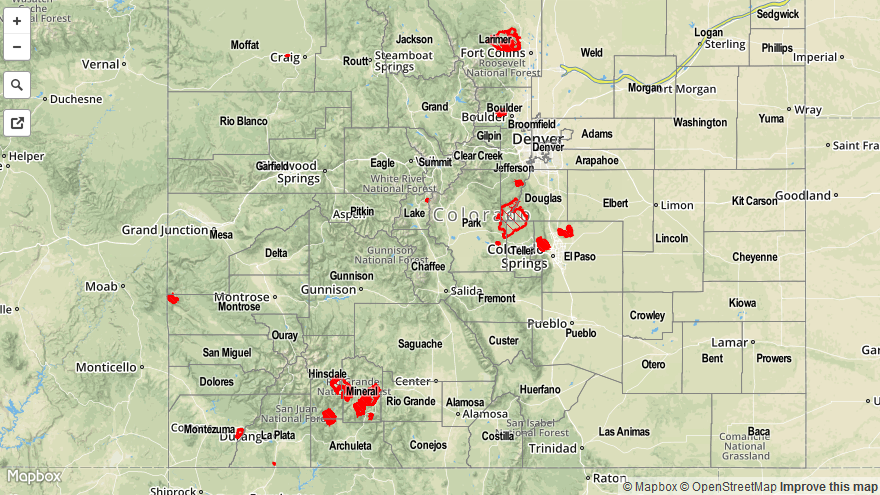
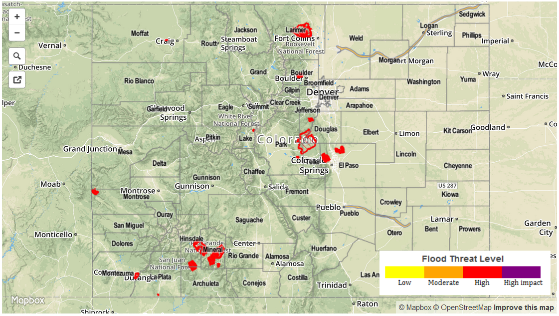
Today’s Flood Threat Map
For more information on today’s flood threat, see the map below (hover over threat areas for more details). For Zone-Specific forecasts, jump below the map.

Zone-Specific Forecasts
Urban Corridor (north of Castle Rock) and Northeast Plains:
Isolated-to-scattered thunderstorms will develop early this afternoon, with a few becoming strong-to-severe. As stated above, the greatest risk for severe thunderstorms will be north of a line from Cheyenne (WY) to Greeley to Fort Morgan to Wray.
Storms will begin to develop between Noon and 1 PM, racing quickly to the northeast at 15-30 mph. The main threats from storms will be heavy rain, hail, and lightning, with isolated tornadoes, large hail, and wind gusts up to 65 mph north of the line mentioned above. Heavy rain is not expected to cause flash flooding due to the quick storm motions. Showers and thunderstorms will diminish over the area between 8-10 PM, with a few showers continuing until midnight.
Urban Corridor (south of Castle Rock), Palmer Ridge, Raton Ridge and Southeast Plains:
A few isolated thunderstorms, mainly high-based, will work across the area this afternoon and evening. Due to a lack of moisture in the low-levels, and the previously mentioned “dry slot,” there won’t be much fuel for storms. Expect rain rates to stay in the 0.1-0.3 inch/hour range, with storms producing more wind and lightning than rain.
Timing: Noon – Midnight.
Front Range and Southeast Mountains:
Isolated-to-scattered showers and thunderstorms, with the Front Range holding the better chance of the two regions. The strongest storms over the Front Range will produce brief, heavy rain, but quick storm motions will eliminate any flash flood threat.
Timing: 11 AM – 6 PM, with a few remaining showers through 6 am tomorrow.
Northern Mountains, Central Mountains, San Juan Mountains, Northwest Slope, Southwest Slope, Grand Valley, and San Luis Valley:
Snow above 8500-9000 feet, rain below. 5-9 inches of snow will accumulate over the high elevations of the San Juan Mountains, with 3-5 inches over high elevations elsewhere. Below 8500 feet, expect scattered showers and a few thunderstorms throughout today and overnight tonight. Max rain rates will be in the 0.25-0.5 inch/hour range.
Timing: 11 AM – 11 AM tomorrow