Issue Date: 5/14/2015
Issue Time: 10:14 AM
A LOW FLOOD THREAT HAS BEEN ISSUED FOR THE CACHE LA POUDRE/SOUTH PLATTE RIVER FROM GREELEY THROUGH JULESBURG.
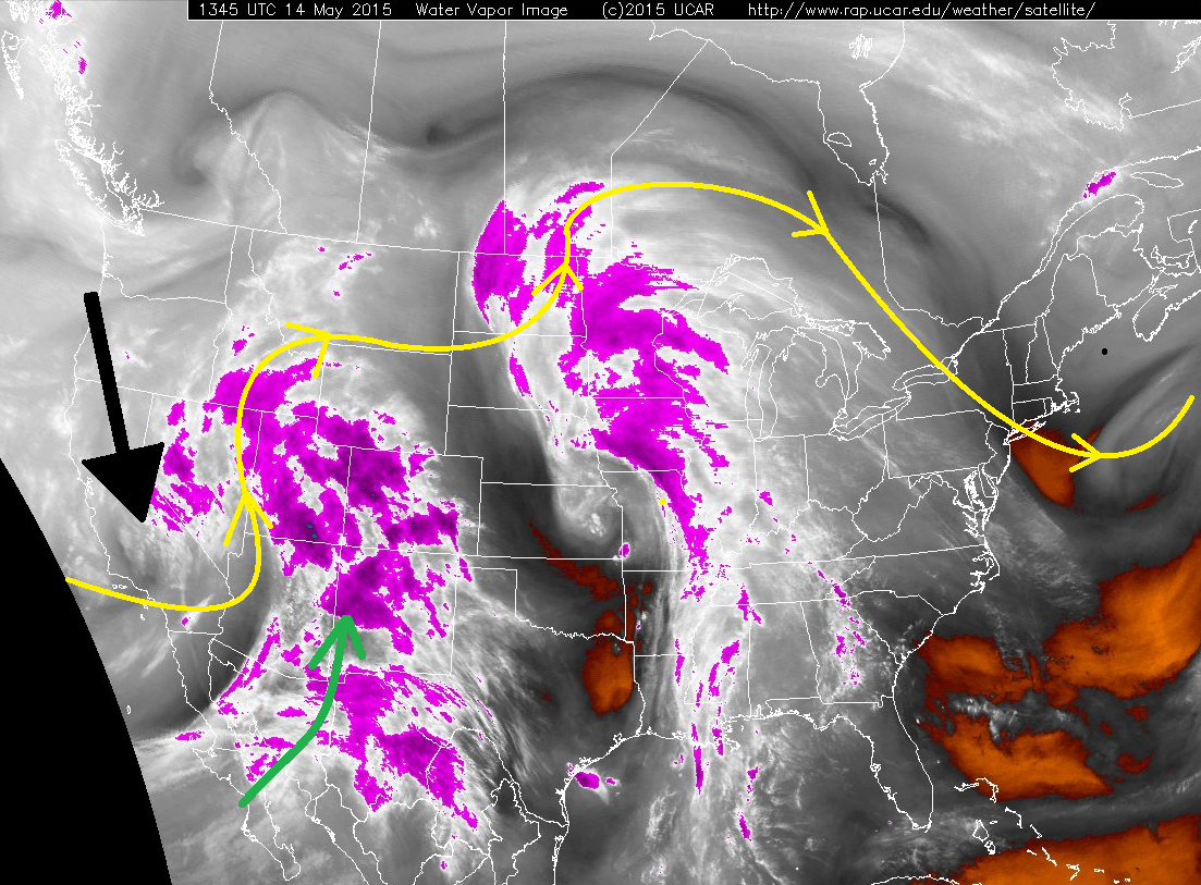
Today’s weather is fairly well-outlined in the water vapor image below; the black arrow represents the digging trough over the West Coast and the green arrow represents the Pacific moisture feed. These two features are working hand-in-hand to send another wave of showers and thunderstorms to Colorado, while simultaneously working to diminish the risk of heavy rain from those thunderstorms. Also working against the threat of heavy rain? A relative lack of low-level moisture.
The broad-scale lift that is associated with the digging trough over the west coast will spread mostly cloudy skies across Colorado; this will limit instability. Limiting instability is always a good bet to limit maximum rain rates, but combine that with the fact that moisture will be lacking near the surface, and you have a recipe for showers and thunderstorms that produce more wind than rain. Additionally, limited instability means that the plains will see much less coverage of showers and thunderstorms than the mountains. For more details, jump down to the zone-specific forecasts below the threat map.
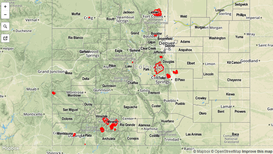
Today’s Flood Threat Map
For more information on today’s flood threat, see the map below (hover over threat areas for more details). For Zone-Specific forecasts, jump below the map.

Zone-Specific Forecasts
Urban Corridor, Palmer Ridge, Northeast Plains, and Southeast Plains:
Mostly sunny skies early will give way to partly sunny skies this afternoon as the broad-scale lift and mid-level moisture overspreads the area, limiting instability. Isolated showers and weak thunderstorms will begin to move off of the mountains and over the area between 1 and 2 PM, with isolated activity developing over the plains between 2 and 3 PM. Most showers/thunderstorms will end just after sunset, with a few lingering until 10-11 PM. Rain rates will generally be in the 0.3-0.6 inches/hour range, with the strongest storms (near the CO/KS border) producing rain in the 0.8-1.0 inch/hour range.
Front Range, Southeast Mountains, San Luis Valley, and Raton Ridge:
Isolated-to-scattered showers and thunderstorms expected, first forming over the higher terrain and then spreading over the valleys. Rain rates will generally be in the 0.25-0.5 inch/hour range, with storms producing more wind than rain (gusts up to 40 mph).
Timing: 11 AM – 10 PM, with a few showers lingering after midnight over the higher elevations of the Front Range and Southeast Mountains.
Northern Mountains, Northwest Slope, Grand Valley, Central Mountains, San Juan Mountains, and Southwest Slope:
These will be the regions that see the most activity today, with scattered showers and thunderstorms expected. A few showers are currently ongoing across southwestern Colorado, as a weak boundary lifts across the area. Cloud cover that is expanding across these regions will hold back stronger thunderstorm activity from developing until around lunchtime. Most showers and thunderstorms will produce rainfall in the 0.25-0.6 inches/hour range, with the strongest storms this afternoon producing rain rates of 0.7-0.9 inches/hour. The most likely regions for stronger thunderstorms to develop will be over the Northwest Slope, higher elevations of Grand Valley, and Southwest Slope. These storms will have the potential to produce wind gusts of 45-60 MPH.
Timing: 11 AM – Midnight, with a few scattered showers and thunderstorms continuing through the morning tomorrow.