Issue Date: 5/13/2015
Issue Time: 10:18 AM
— LOW flood threat for the South Platte River between Greeley and Sterling
Today’s weather pattern is crowded with players. Of those, one interesting player that has persisted for the greater part of two weeks now is the subtropical jet. Today, it is seen just south of the U.S. and Mexico border, by California and Arizona. And what an impressive jet it is. In the heart of the subtropical jet, the maximum wind speeds about 30,000 feet above the ground are a whopping 150 mph. This is a very high value in any jet stream, but is especially impressive given that it is May and the jet stream is supposed to fade at this time of year. This jet stream appears to be a signature of a potentially potent El Nino that may continue to strengthen through the course of the summer. But, since this is the Flood Threat Bulletin, we will simply mention to readers to check out our Flood Threat Outlook for more information about this and the longer range implications.
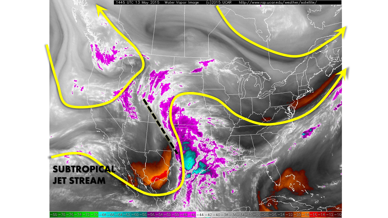
So one may ask how is the subtropical jet relevant to our weather? To answer this, let’s focus again on the water vapor image. At the eastern extent of the subtropical jet, disturbances often form and can then propagate farther “downstream” or in this case, northeastward. This morning, a pronounced disturbance is situated across Colorado and is clearly visible on water vapor imagery and the visible satellite. Light rainfall, with pockets of moderate rainfall, is already noted mainly across eastern Colorado. As this disturbance continues to trek northeastward, the shower activity will move with it. Rainfall rates will be generally light, in the 0.2 to 0.5 inch per hour range. However, during the afternoon, the heating of the day will cause weak instability, and enough to produce thunderstorm activity. Since the timing of thunderstorm formation will not favorably coincide with the disturbance dynamics, we expect more bark than bite from these storms. Nonetheless, once storms form this afternoon across the Front Range, Palmer Divide and Southeast Plains, isolated rainfall amounts of 1 inch per hour cannot be ruled out. This is supported by precipitable water values ranging from 0.6 to 0.8 inches this morning. However, with the heavier rainfall being confined to mainly east of the mountains, these amounts are not expected to cause flooding, even with the saturated soils. In the disturbance’s wake, expect more sun the clouds to emerge over southwest Colorado and spread slowly north and eastward throughout the day.
With an absence of additional rainfall, river levels continue to recede from the past storm. Today, we remove the flood threat over the Arkansas River, and downgrade the flood threat over the South Platte river to a LOW status.
Finally, as our Flood Threat Outlook suggested on Monday, there is no end to the active weather in sight as another impressive disturbance begins to encroach upon Colorado on Thursday.
Please see below for area-specific flood threat and forecasts (click on “About the FTB” link above to view Colorado region names).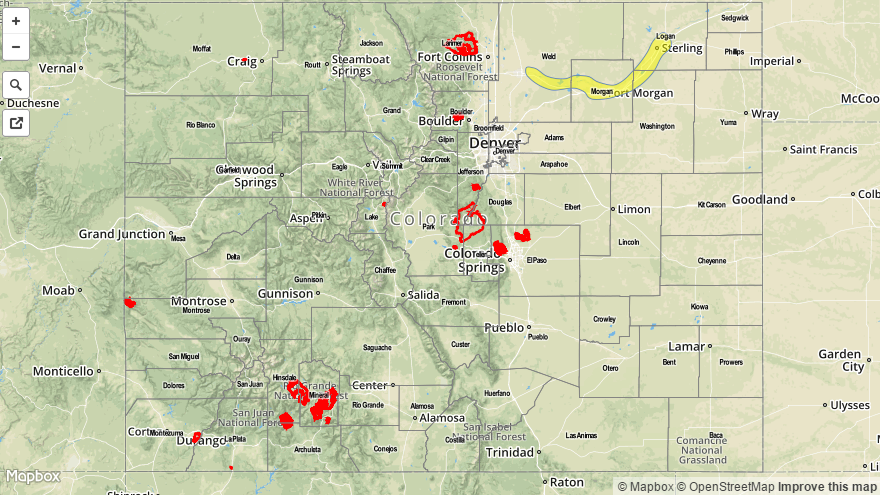

Zone-Specific Forecasts
Urban Corridor, Front Range, Northeast Plains, Palmer Ridge, Raton Ridge and Southeast Plains:
Scattered showers this morning with scattered thunderstorms developing in the afternoon. Rainfall rates will generally be in the 0.2-0.5 inch per hour range, but an isolated storm capable of producing 1 inch per hour rainfall cannot be ruled out. Gusty winds to 50 mph and small hail may accompany the stronger cells. Flooding from rainfall is not expected, but a LOW flood threat has been posted for the South Platte River.
Primetime for thunderstorms is between 2PM and 7PM.
Central Mountains, San Juan Mountains, Southeast Mountains and Northern Mountains:
Partly cloudy with scattered showers this morning gradually clearing by afternoon. A stray thundershower cannot be ruled out, but little if any rain will result from it. No flood threat is expected.
Southwest Slope, Northwest Slope, Grand Valley and San Luis Valley:
Partly cloudy this morning with isolated sprinkles and flurries. Clearing out this afternoon as a disturbances moves away from the area. No flood threat is expected.