Issue Date: Thursday, September 22nd, 2022
Issue Time: 10:10AM MDT
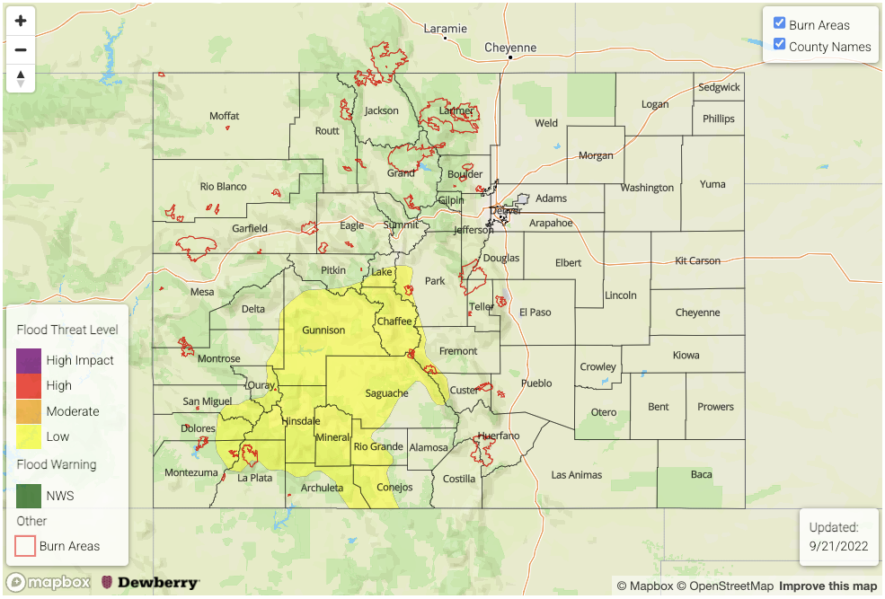
— A LOW flood threat has been posted for parts of the San Juan Mountains and Southeast Mountains
— Fire-Burn Forecast Summary: 4 burn areas under LOW threat; click HERE for more info
A very impressive, but rapidly shrinking plume of monsoonal moisture continues to hang overhead Colorado today. Morning PW at Grand Junction came in steady at 0.93 inches, with though some mid and upper-level drying noted. Socked under a thick cloud deck, Platteville’s PW came in at 0.90 inches, also steady since yesterday. Model analysis suggests a pocket of very high PW of up to 1.2 inches located over southwest Colorado this morning. If true, this would be near record values for late September. In addition to impressive total column moisture measured by PW, boundary layer moisture is equally, if not more impressive. For example, the current dewpoint at Cortez of 57F is close to a record for late September.
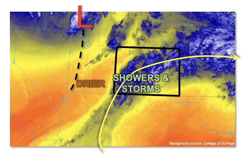
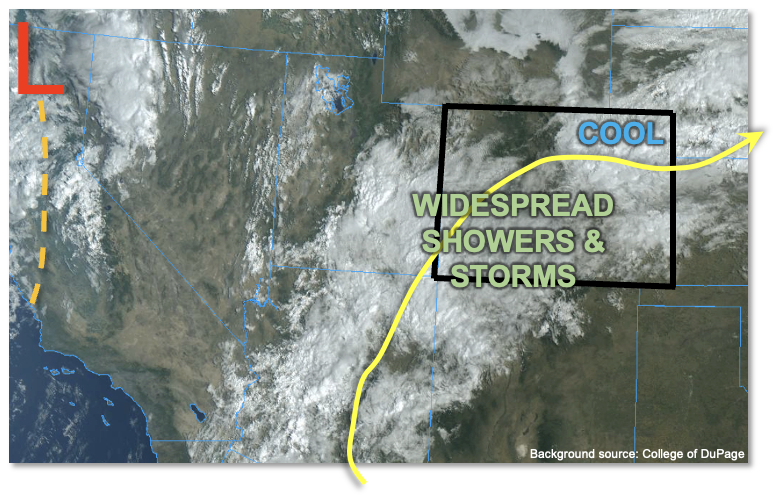
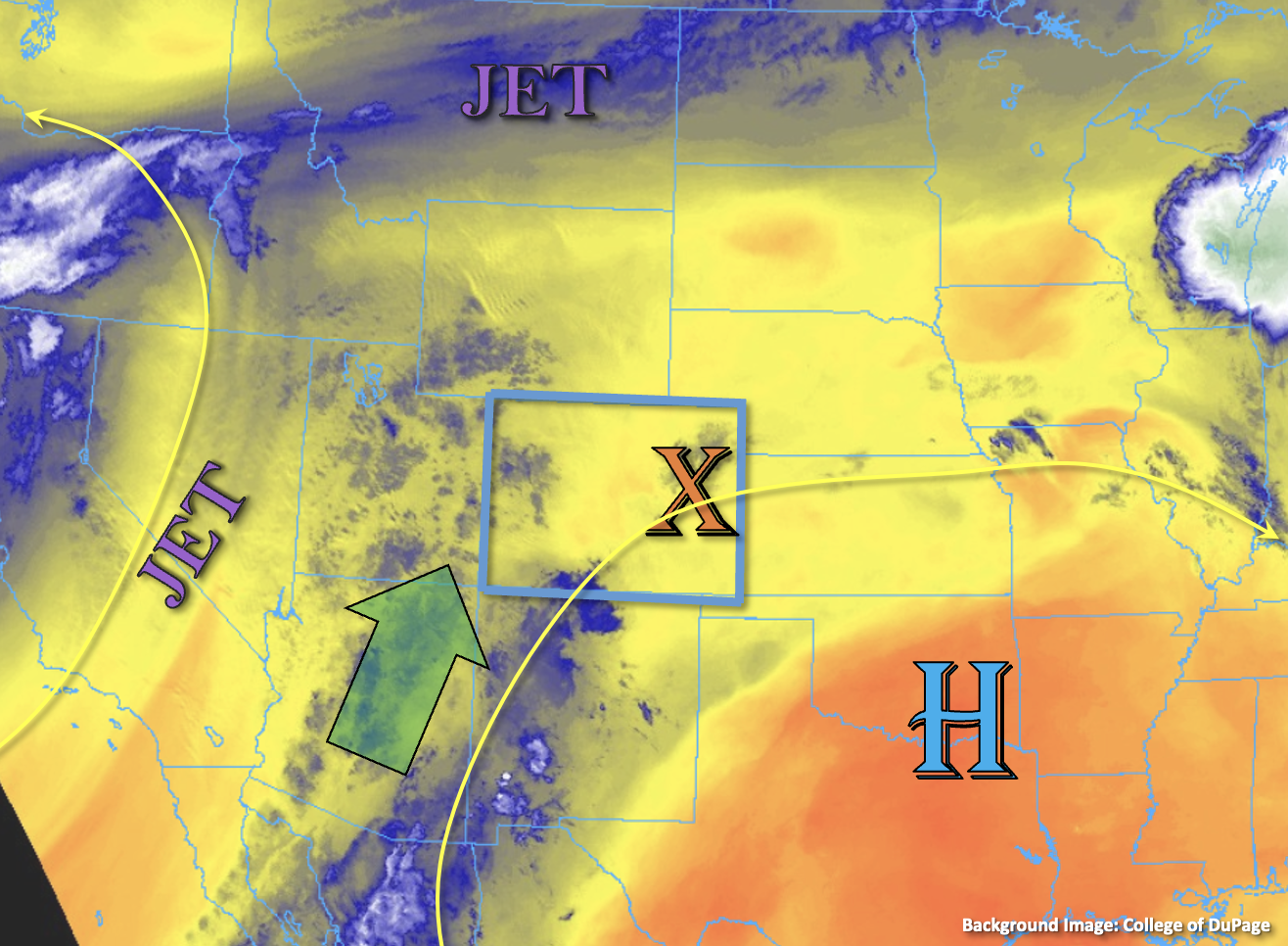
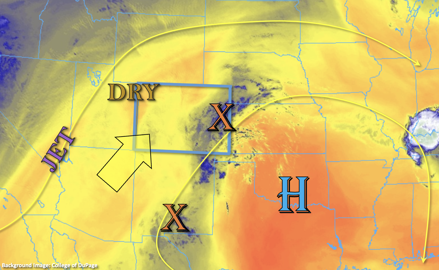
There are a couple of significant changes in today’s atmosphere, in relation to the heavy rainfall threat. First, notable drying was observed upstream in AZ/UT. The drying will be generated from the upper-levels downward, and may take a while to get into Colorado. But, by late afternoon, we do expect significant boundary layer drying especially north of I-70. This will limit heavy rainfall potential over the northern third of our state. Second, the quick steering flows have only increased since yesterday with storm motion expected to be in the 30-40 mph range today! This is due to the approach of a very strong upper-level trough, currently centered over the northern Great Basin (see water vapor image, above). Although instability will be higher today compared to yesterday (perhaps reaching 700-1,000 J/kg CAPE especially over the southern/central high terrain), there will simply be too much wind shear to sustain heavy rainfall beyond 15-30 minutes. The one exception to this will be over the far southern high terrain. There, the combination of higher instability, weaker steering flow and retention of higher moisture could allow for some terrain anchoring effects. Collectively, this will allow for heavy rainfall potential this afternoon for primarily the 1-2 hour duration. Thus, a LOW flood threat has been posted for this limited area, especially given the steeper terrain.
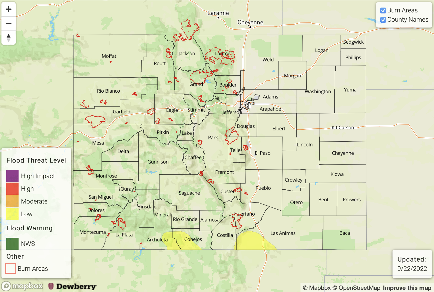
Today’s Flood Threat Map
For more information on today’s flood threat, see the map below. If there is a threat, hover over the threat areas for more details, and click on burn areas to learn more about them. For Zone-Specific forecasts, scroll below the threat map.
Zone-Specific Forecasts:
Southeast Plains, San Juan Mountains, Southeast Mountains & Raton Ridge:
Mostly cloudy and a bit warmer with scattered to numerous showers and storms re-developing this afternoon. Most locations will see only brief moderate to heavy rainfall of up to 0.5 inches in 30-minutes. However, isolated locations of the San Juan Mountains and Southeast Mountains (along the NM border) could see max 1-hour/2-hr rain rates up to 1.2/1.8 inches. Thus, a LOW flood threat has been posted for these areas. Gusty winds could accompany most storms, along with small hail.
Primetime: 12PM to 8PM, with more isolated activity possible into the early overnight hours
Northern Mountains, Front Range, Palmer Ridge, Central Mountains, Grand Valley, Southwest Slope, San Luis Valley & Northwest Slope:
Partly to mostly cloudy and breezy with scattered to numerous showers and weaker storms redeveloping this afternoon. Max 30-min rain rates up to 0.5 inches possible, along with very gusty winds and small hail. Flooding is NOT expected today.
Primetime: 10AM through 7PM
Northeast Plains & Urban Corridor:
Overcast early with some breaks in the clouds possible by later this afternoon. Continued cool with the chance of isolated to widely scattered showers and perhaps a weak embedded storm (closer to the foothills). Max 30-min rain rates up to 0.4 inches possible. Flooding is NOT expected today.
Primetime: 12PM through 7PM