Issue Date: Monday, September 19th, 2022
Issue Time: 9:05AM MDT
— Flooding is NOT expected today
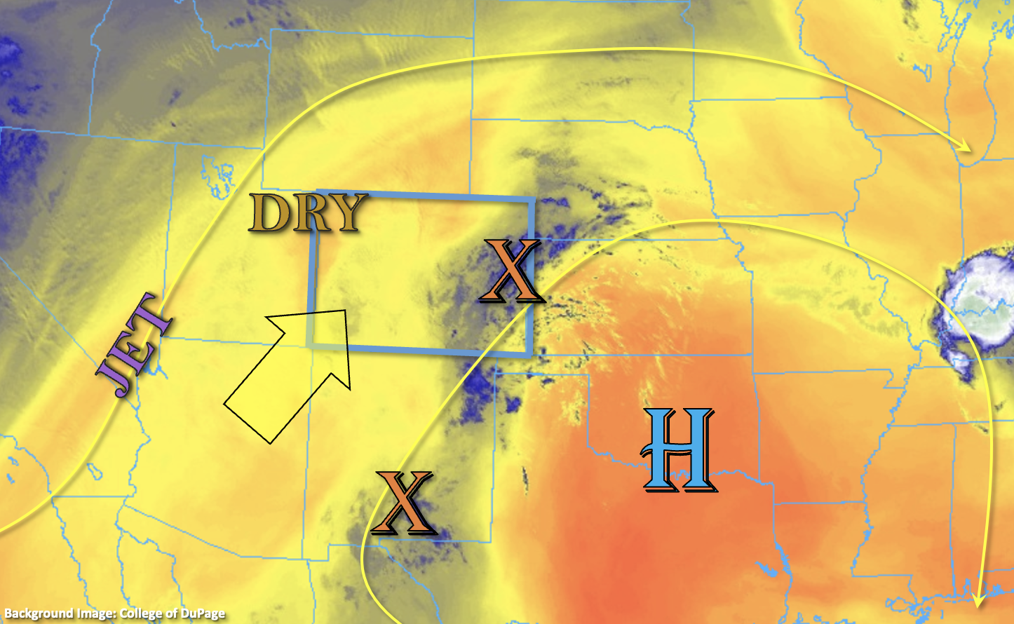
With a Low off the coast of California and a High centered over the southern Great Plains, southwesterly flow continues across the state. It’s still quite a dry air mass over the northwest portion of the state as shown by the orange shade in the water vapor imagery below, and PW at Grand Junction coming in at 0.49 inches this morning. Outside of a couple possible sprinkles over the high terrain near the Continental Divide, the drier air should help to keep precipitation chances close to zero over the northern and central portions of the state.
Also circulating around the High are a couple disturbances and a bit better moisture (orange X’s and blue shades). This moisture and lift are combining to produce cloud cover and fog over eastern Colorado this morning with perhaps a couple isolated, light showers across the southern border. To a much lesser extent, there is also some morning cloud cover over the San Juan Mountains, which indicates some mid-level moisture in the area. PW at Albuquerque was measured just under 1 inch, so as clockwise flow around the High continues today, it’s likely this weak influx of mid-level moisture across the southern border will continue. This may help to produce isolated storms over the southern mountains and adjacent Raton Ridge. However, surface moisture over the area should remain quite limited, which means that the storms that develop will likely have high bases causing more virga and wind than meaningful rainfall accumulation. Therefore, flooding is NOT expected.
Today’s Flood Threat Map
For more information on today’s flood threat, see the map below. If there is a threat, hover over the threat areas for more details, and click on burn areas to learn more about them. For Zone-Specific forecasts, scroll below the threat map.

Zone-Specific Forecasts:
Central Mountains, San Juan Mountains, San Luis Valley, Southeast Mountains, Raton Ridge, Southeast Plains & Southwest Slope:
Best chance for isolated storms today will be over the southern mountains and adjacent Raton Ridge area with the highest accumulations anticipated east. Max 30-minute rain rates up to 0.1 inches (west) and 0.5 inches (east) will be possible. Many storms are likely to only produce virga or sprinkles, and a stronger storm or two may produce brief outflow winds. Flooding is NOT expected. A much stronger moisture plume is expected to make its way northward early tomorrow morning into Tuesday, so expect a more active rainfall day tomorrow.
Primetime: 1:30PM to 8:30PM
Northwest Slope, Grand Valley, Northern Mountains, Front Range, Urban Corridor, Northeast Plains & Palmer Ridge:
Some stronger upper level winds are likely to mix down to the surface this afternoon causing breezy conditions over the northwest quadrant of the state. Gusts up to 40mph may be possible over the high peaks. Outside of the possibility for isolated sprinkles along the Continental Divide, it should remain dry. High temperatures are expected to continue to run above normal with another 90°F day anticipated for elevations under 5,500 feet.