Issue Date: Sunday, June 14th, 2015
Issue Time: 10:20 AM
— Moderate flood threat for Urban Corridor for early evening through 3AM
— Low flood threat for the Front Range, Northeast Plains, Palmer Ridge, Southeast Plains, Southeast Mountains, Raton Ridge, San Juans and parts of Central Mountains
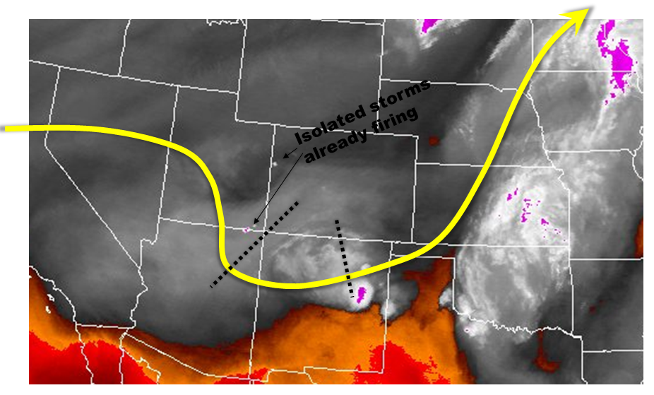
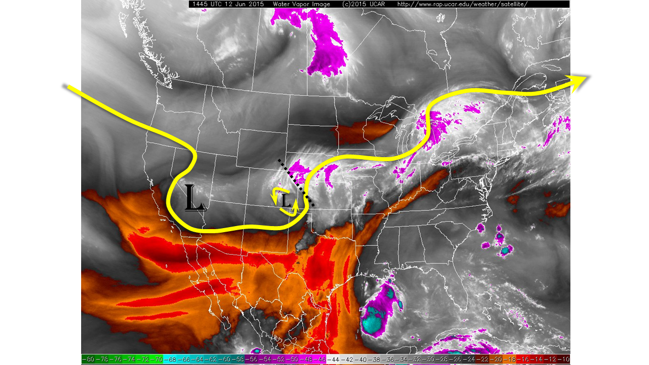
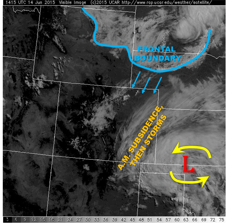
A potentially volatile weather situation is at hand today. The setup for today is shown by the visible satellite imagery below. During most of the day, we expect the weather to evolve in a similar fashion to yesterday. Scattered thunderstorms will develop across the higher terrain, mainly along and east of the Continental Divide and then spread east across the Plains. A few of these cells will have the potential to dump very heavy rainfall, warranting a widespread Low threat area. However, things may turn interesting later in the evening as high-resolution model guidance suggests a very moist airmass will quickly push into the Northeast Plains (see satellite image below). It appears that there will be a window of time, from around sunset through 1AM where at least scattered thunderstorm activity will be likely in the Northeast Plains and Urban Corridor region. Looking at the heavy rainfall checklist suggests one hour rain rates up to 2.5 inches will be possible. A Moderate flood threat has been issued for this area for the late evening and nighttime hours. The storms are expected to subside before sunrise Monday.
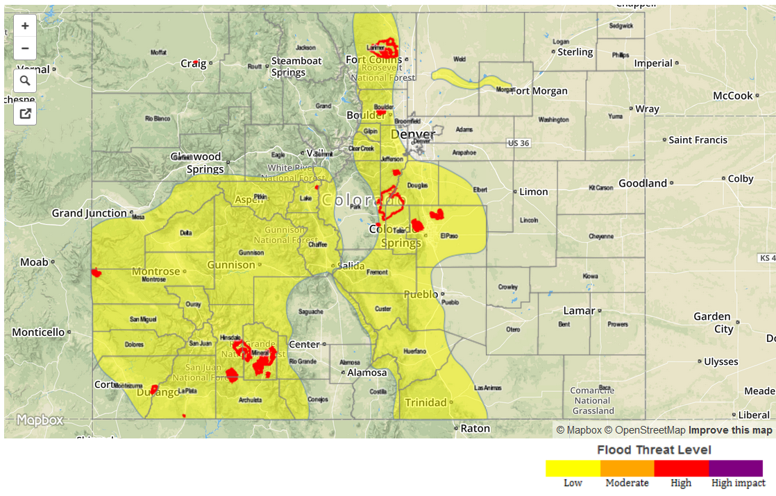
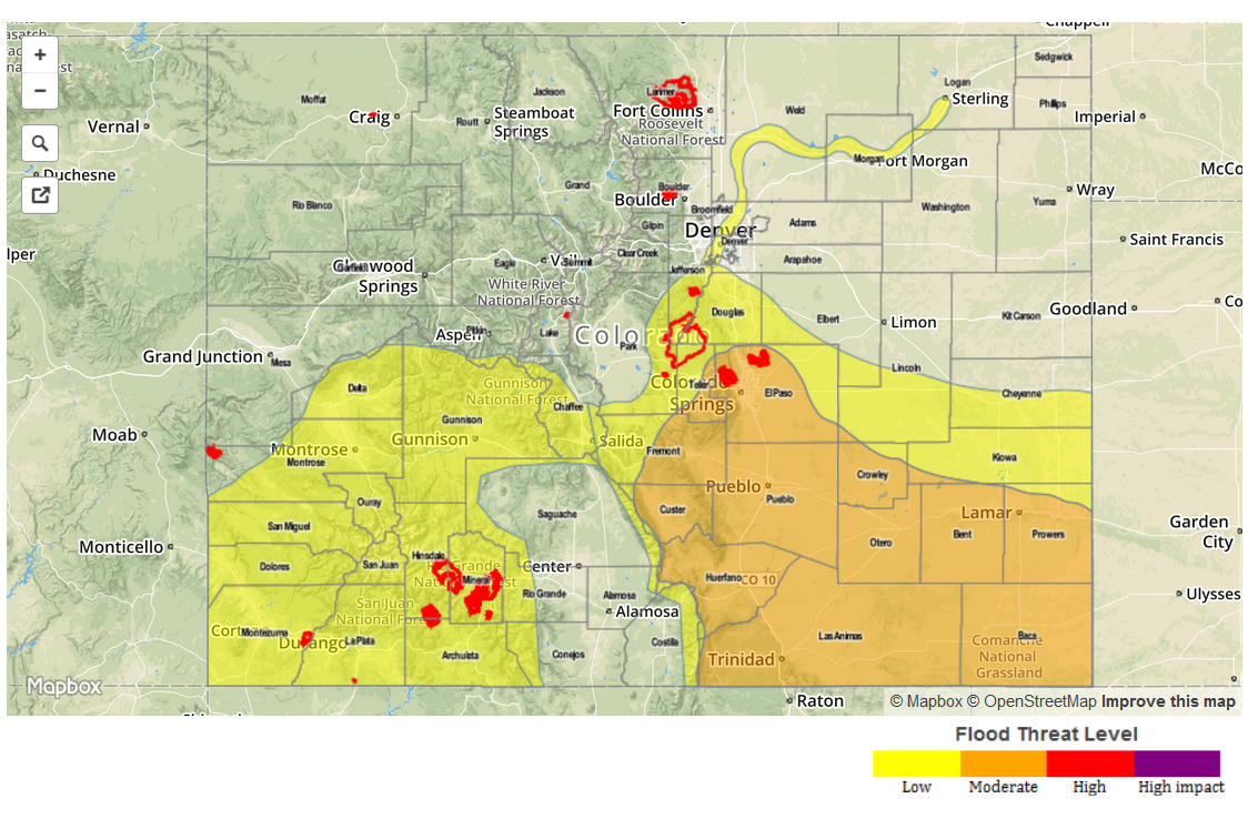
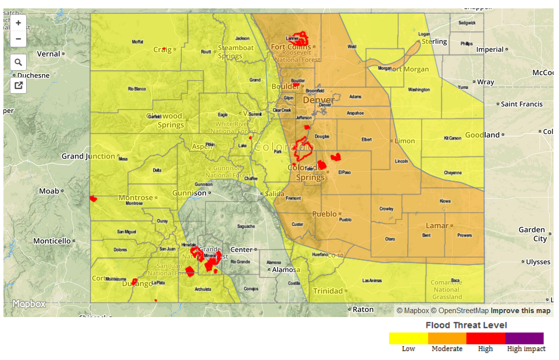
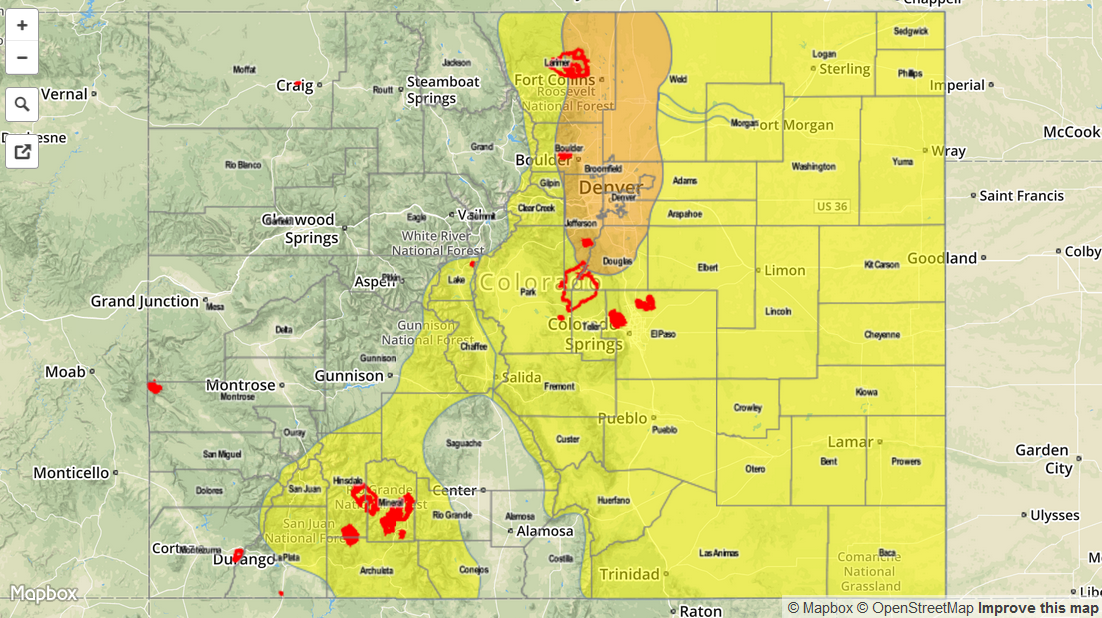
Today’s Flood Threat Map
For more information on today’s flood threat, see the map below (hover over threat areas for more details). For Zone-Specific forecasts, jump below the map.

Zone-Specific Forecasts
Grand Valley, San Juan Mountains, Northwest Slope, Southwest Slope, Northern Mountains, Central Mountains and San Luis Valley:
Isolated to scattered thunderstorms developing by early afternoon. Most storms will be weak and will not bring much rainfall. However, a few storms will produce rain rates up to 0.8 inches per hour, warranting a Low flood threat across southern portions of the region. In general, storm coverage and intensity will be higher in the south. Fire burn areas are especially vulnerable.
Prime time: 1pm through 8pm
Front Range, Urban Corridor, Northeast Plains, Palmer Ridge:
Mostly sunny this morning, with high elevation thunderstorms quickly forming by noon. Coverage will be isolated to scattered during the day. Most storms will yield 0.5 inches of rainfall or less, but a few stronger storms will be capable of very heavy rainfall, up to 2.2 inches per hour. In the evening, a moist airmass will come in from the east and allow a 4-6 hour window of very heavy rainfall potential, up to 2.8 inches per hour. Street flooding will be likely, as well as stream flooding given high flows to begin with. A Moderate flood threat has been posted for the Urban Corridor, while a Low flood threat is in effect elsewhere.
Primetime: 1PM through 3AM for the Low threat, 8PM through 3AM for the Moderate threat
Southeast Plains, Southeast Mountains and Raton Ridge:
Sunny early, with isolated to scattered storms forming by early afternoon. Most cells will be light rainfall producers, but a few isolated cells will be capable of up to 2.2 inches per hour. A Low flood threat is in effect.
Primetime: 1PM through 9PM