Issue Date: June 13th, 2015
Issue Time: 10:00 AM
— Low flood threat for San Juan Mountains, Front Range, Palmer Ridge, Southeast Mountains and Raton Ridge
— Low flood threat for the South Platte River from Greeley through Fort Morgan
Several days ago, the forecast for Saturday looked mostly dry. But alas, summer weather in Colorado can quickly change on a day-to-day basis. The last piece of the disturbance that has given the state active weather since Wednesday remains positioned over the state this morning, as shown by the water vapor imagery below. Low-level moisture remains high statewide, with dewpoints in the 40s west of the Divide, and 40s/50s east of the Divide. Precipitable water has fallen to 0.6 to 0.8 inches, implying most of the drying in the past day has been in the mid and upper atmosphere.
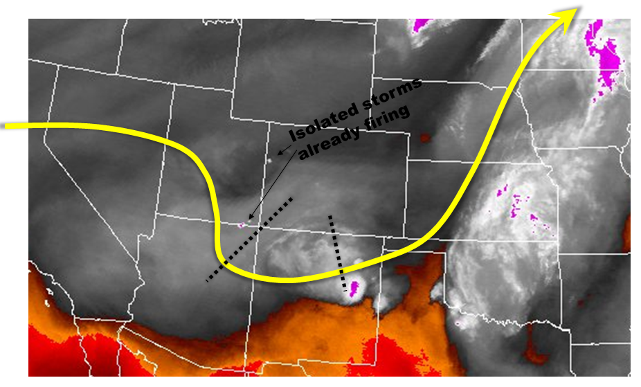
For today, we expect the mostly clear skies this morning to quickly fill with puffy cumulus clouds. Over the higher terrain, these clouds will quickly lead to thunderstorms shortly afternoon noon. In fact, there are already several isolated thunderstorms seen on radar and satellite data this morning, a testament to the primed state of the atmosphere. We do not expect very high storm coverage today, but there will likely be a storm, or even several, that will be capable of producing very heavy short-duration rainfall. For this reason, combined with the expectation of many hikers headed to the higher elevations, a Low flood threat has been posted for the Front Range down through the Southeast Mountains, as well as the San Juans. Hikers: if you see lightning, head down to lower elevations immediately! A summertime storm can go from an innocent cumulus cloud to a flash flood producer in 30 minutes.
Otherwise, the South Platte River remains under a Low flood threat, but we have trimmed the threat area to the stretch from Greeley through Fort Morgan.
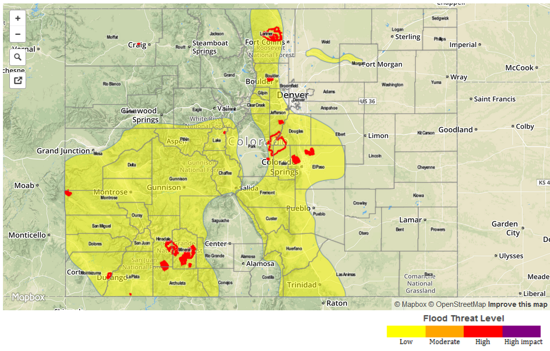
Today’s Flood Threat Map
For more information on today’s flood threat, see the map below (hover over threat areas for more details). For Zone-Specific forecasts, jump below the map.
 Zone-Specific Forecasts
Grand Valley, San Juan Mountains, Northwest Slope, Southwest Slope, Northern Mountains, Central Mountains and San Luis Valley:
Mostly sunny early, with isolated to scattered thunderstorms developing by noon. Most storms will be weak and may not even yield any rainfall. However, some storms will produce rain rates up to 0.8 inches per hour, warranting a Low flood threat across southern portions of the region. In general, storm coverage and intensity will be higher in the south. Fire burn areas are especially vulnerable.
Prime time: 12pm through 8pm
Front Range, Urban Corridor, Northeast Plains, Palmer Ridge, Southeast Plains, Southeast Mountains and Raton Ridge:
Mostly sunny this morning, with high elevation thunderstorms quickly forming by noon. Coverage will be isolated to scattered, and most storms will be light rainfall producers. However, several isolated cells will be capable of very heavy rainfall, up to 0.7 inches in 30 minutes and 1 inch per hour. A Low flood threat has been posted over the higher terrain and adjacent foothills.
Primetime: 1pm through 9pm