The disturbance responsible for three days of active weather across Colorado has now split into two, as shown by the water vapor image below. Although as a whole the system is weakening, it will give us at least one, if not two, more days of active weather. However, the good news is that the coverage of heavy rainfall is expected to decrease noticeably today. Nonetheless, abundant moisture content, with dewpoints still in the 50s and precipitable water around 1 inch, will support heavy rainfall mainly over southeast Colorado.
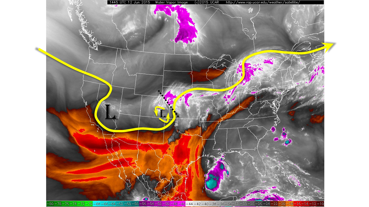
For today, we expect the ongoing rainfall over the Palmer Ridge to rapidly lighten and decrease in coverage as the supporting disturbance leaves the state. However, as shown by the water vapor imagery, a low-level circulation remains intact over southeast Colorado. This disturbance will allow for the early development of thunderstorms. Adequate instability and slow, erratic storm motion will once again result in short-term very heavy rain rates. A Moderate flood threat has been posted for the Southeast Plains with a Low flood threat over the San Juans. All activity is expected to diminish shortly after sunset.
Yesterday’s heavy rainfall has once again elevated the South Platte and Arkansas Rivers into Minor flood stage. We anticipate it will take at least several days before the rivers begin to lower.
Today’s Flood Threat Map
For more information on today’s flood threat, see the map below (hover over threat areas for more details). For Zone-Specific forecasts, jump below the map.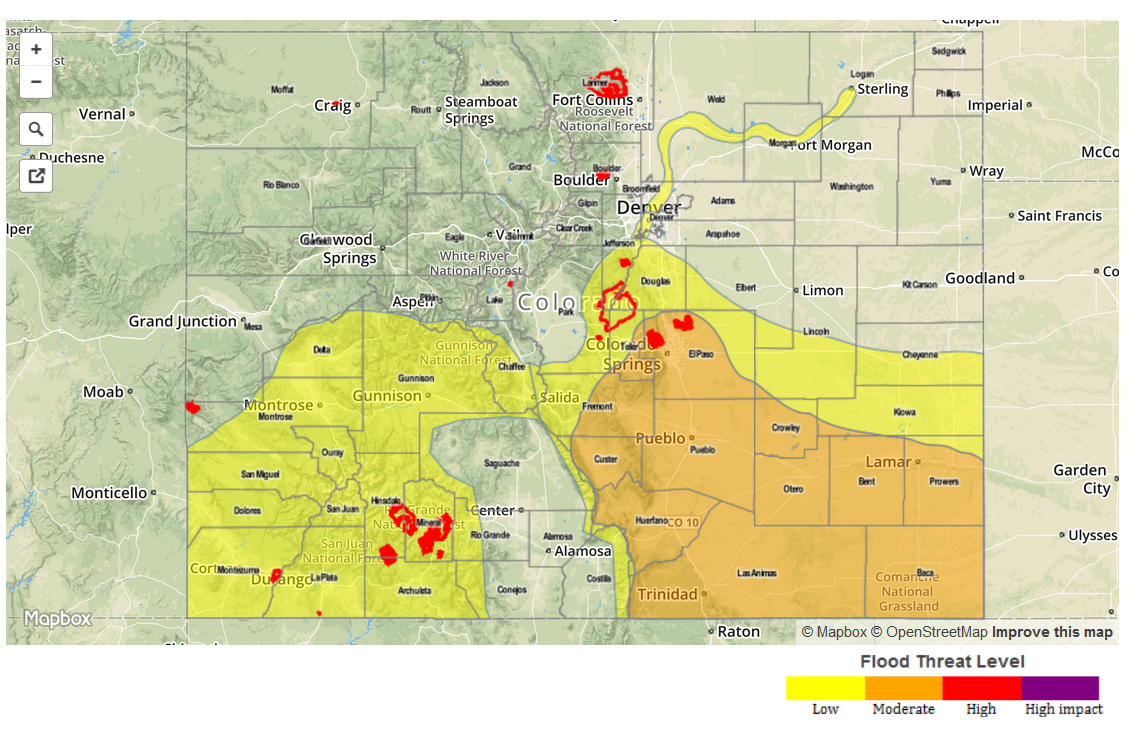
Zone Specific Forecasts
Front Range, Urban Corridor, Northeast Plains, Northern Mountains, Northwest Slope:
Variable cloudiness and cool with showers ending by early afternoon. Additional shower activity and a weak thunderstorm cannot be ruled out, but rain rates are expected to remain below 0.8 inches per hour. No flooding is expected. Many streams and rivers are bankfull, so please monitor NWS forecasts for local hydrologic information.
Palmer Ridge, Southeast Plains, Southeast Mountains, Raton Ridge:
Partly cloudy early, with thunderstorms developing by early afternoon and lasting into the early evening. Short-term very heavy rainfall is likely, with 30 minute rain rates up to 1.7 inches, 1-hr: 2.25 inches and 3-hr: 3 inches. Flash flooding will be likely with the strongest cells, as are debris slides and mud flows. A Moderate flood threat is in place.
Primetime: 1pm through 9pm
Grand Valley, San Juan Mountains, Southwest Slope, Central Mountains and San Luis Valley:
Partly cloudy early, with scattered showers and thunderstorms developing by early afternoon. Coverage and intensity will highest in the south. One hour rain rates up to 0.9 inches possible, leading to isolated flash flooding. Fire burn areas are particularly vulnerable. A Low flood threat is in place for parts of the area.
Primetime: 1pm through 8pm