Issue Date: 7/8/2015
Issue Time: 9:45AM
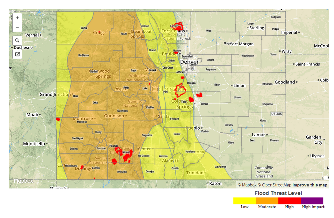
— Moderate flood threat for Palmer Ridge and Southeast Plains
— Low flood threat for Grand Valley, Northwest Slope, Northern Mountains, Front Range, Urban Corridor and parts of Northeast Plains
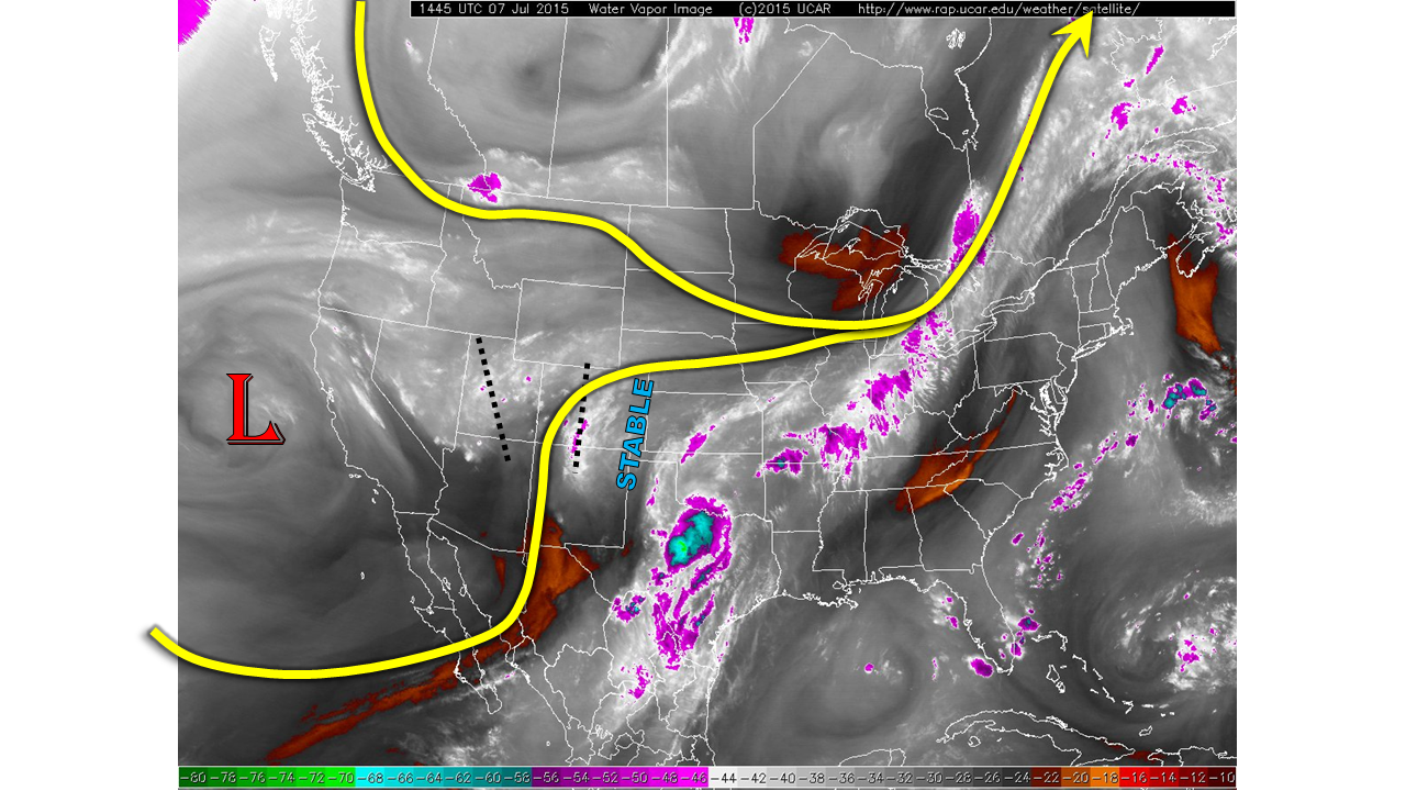
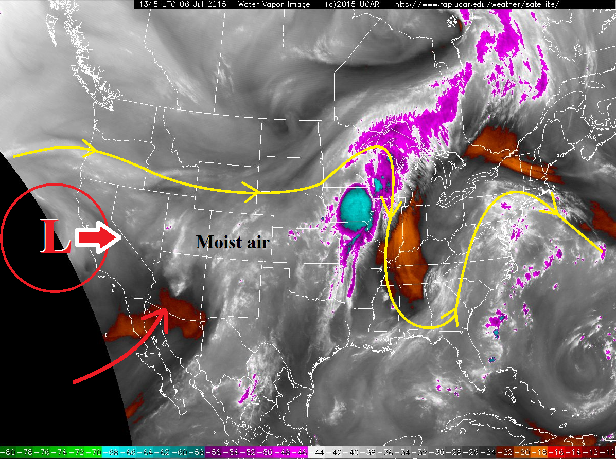
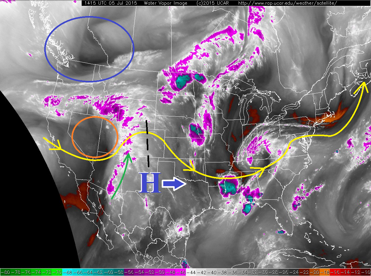
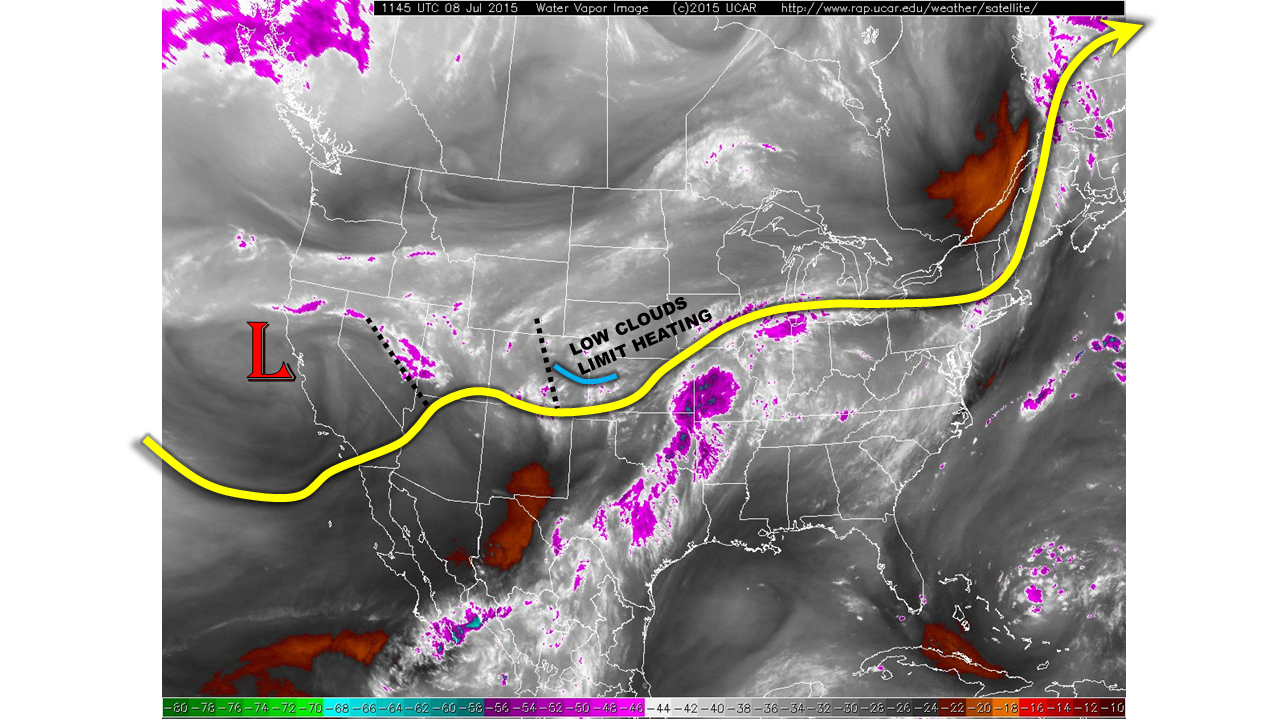
A disturbance will trek across Colorado today, sparking more thunderstorm activity. This disturbance is a “child” of the parent low-pressure system that continues to rotate off the California coast, as shown by the water vapor imagery below. Another disturbance is noted on the UT/NV border that may influence northwestern Colorado later this afternoon. With the favorable dynamics described above, we now look at today’s moisture content. As in past days, it is quite high with dewpoint temperatures in the 40s and 50s across the state. Precipitable water values remain at or above an inch almost statewide, further supporting the heavy rain threat.
As the disturbance currently over the state treks slowly eastward, heating of the day will cause plenty of instability to fuel thunderstorm activity. The highest threat today will be over the Palmer Ridge and extending towards the Kansas border. A Moderate flood threat has been posted for the area. Low cloud activity and a stable atmosphere will continue to limit rainfall chances in the Northeast Plains for the second day in a row. In northwest Colorado, a Low flood threat is in place for short-term heavy downpours that may cause brief flash flooding, mud flows and debris slides. West of the Divide, activity will subside around sunset. East of the Divide, storms may persist through midnight.
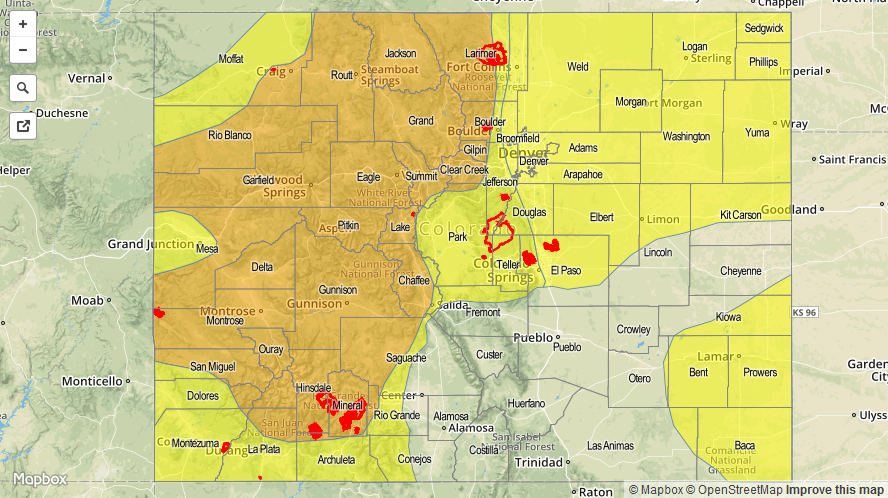
Today’s Flood Threat Map
For more information on today’s flood threat, see the map below (hover over threat areas for more details). For Zone-Specific forecasts, jump below the map.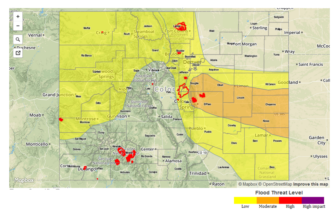
Zone-Specific Forecasts
Front Range, Urban Corridor, Northeast Plains, Palmer Ridge, Southeast Plains:
Thunderstorms will develop by early afternoon over the higher terrain and spread east and south through the day. Over the higher terrain, 1-hr rain rates up to 1.5 inches are possible, increasing to as high as 2.4 inches over the Palmer Divide. Over the Palmer Divide and Southeast Plains, 3-hr rain rates up to 3.5 inches will be possible. A Moderate flood threat is in place for part of the region, with a Low flood threat elsewhere except for the far northeast corner of the state. Activity will subside by early evening closest to the mountains, but may persist through midnight towards the Kansas border.
Primetime: 12pm to midnight
Northwest Slope, Grand Valley, Northern Mountains:
Ongoing thunderstorms growing in coverage and intensifying by early afternoon. One hour rain rates up to 1.2 inches will be possible. A Low flood threat is in effect for isolated flash flooding, mud flows and debris slides. Soils remain rather wet and several mud slides have been reports across the Grand Valley during the past few days. Activity will subside by sunset.
Primetime: 11am to 8pm
Raton Ridge, Southeast Mountains, San Luis Valley, Central Mountains, Southwest Slope, San Juans:
Partly cloudy with isolated to scattered thunderstorms developing by early afternoon. One hour rain rates up to 0.8 inches will be possible, but flooding is not expected. Activity will subside shortly after sunset.