Issue Date: 7/7/2015
Issue Time: 10:45AM
— Moderate flood threat for Northwest Slope, Grand Valley, Southwest Slope, San Juan Mountains, Central Mountains and Northern Mountains
— Low flood threat for Front Range, San Luis Valley, Southeast Mountains and Raton Ridge
The incredibly moist spring has transitioned into an equally moist summer across our state with many Colorado residents waking up to dewpoints exceeding 50F on a near-daily basis. Today is no exception. In addition to the plentiful surface moisture, the atmosphere is moist throughout its entire column (roughly up to 40,000 feet). The best measure of this is precipitable water (PW), which was 1.0-1.2 inches across all four sites that we regularly monitor: Pueblo, Colorado Springs, Boulder and Grand Junction. We expect PWs to stay in the 1.0-1.4 inch range throughout the course of the day. In short, these values are about as high as we see here in Colorado, so it is clear that a heavy rainfall threat exists today.
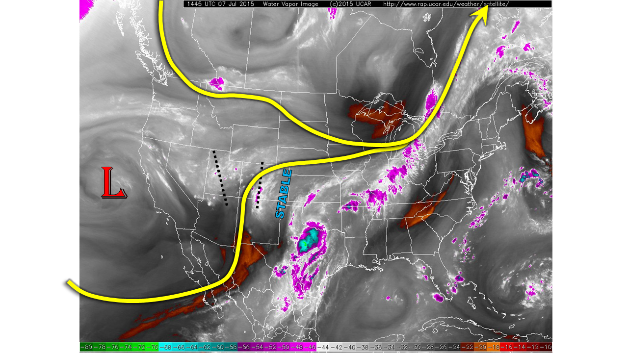
Coupled with the high moisture content today, atmospheric dynamics are also conducive for heavy rainfall. The water vapor image below shows that a deep upper-level low is positioned west of California. However, its influence extends into Colorado with several shortwaves noted across western CO and over UT. As these features propagate eastward, they will spark numerous rounds of shower and thunderstorm activity from late this morning into the late evening hours. Most of the higher terrain will once again be in a Moderate flood threat today. In the lower elevations east of the Divide, atmospheric instability is limited so no flood threat is anticipated today.
For more information on today’s flood threat, see the map below (hover over threat areas for more details). For Zone-Specific forecasts, jump below the map.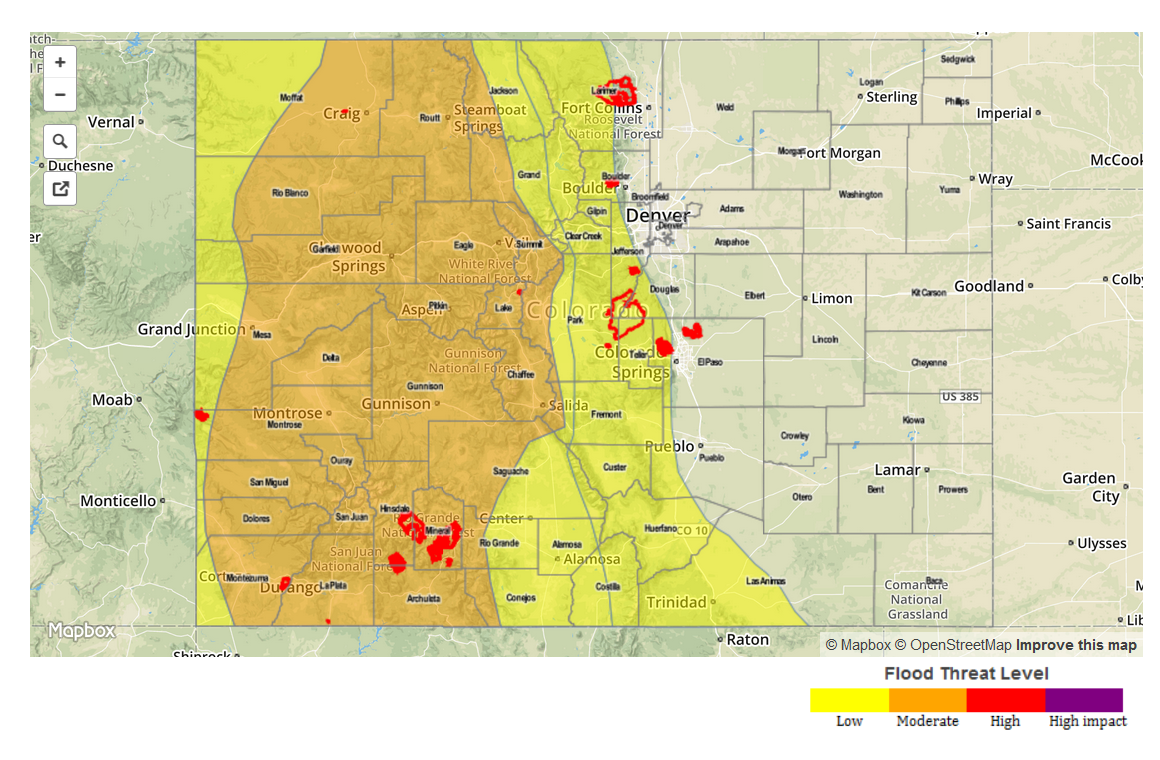
Zone Specific Forecasts
Northwest Slope, Grand Valley, Southwest Slope, San Juans, Central Mountains, Northern Mountains, San Luis Valley:
Mostly cloudy this morning with ongoing thunderstorm activity intensifying and growing in coverage. Maximum 1-hour rain rates will be 1.25 inches. Multiple storms crossing one area will result in maximum 6-hour rain rates up to 2 inches. Heavy rainfall will bring a threat of flash flooding, debris slides and mud flows. A Moderate flood threat is in place over most of the region with a Low threat elsewhere. Hail up to 0.75 inches may accompany the strongest storms. Please stay tuned to National Weather Service warnings for specific local information.
Primetime: 11am to 11pm
Front Range, Palmer Ridge, Southeast Plains, Raton Ridge, Southeast Mountains:
Overcast this morning with some sunshine by early afternoon, leading to thunderstorms. Isolated to scattered activity will be likely across the higher terrain. One hour rain rates up to 2 inches will be possible, resulting in isolated flash flooding, debris slides and mud flows. Street flooding will be possible as well.
Primetime: 2pm to 10pm
Urban Corridor, Northeast Plains:
Overcast and cool conditions with some breaks in the cloud cover possible by late afternoon. An isolated thunderstorm cannot be ruled out along the I-25 corridor in the late afternoon. The strongest storm will be capable of rainfall up to 1 inch per hour. No flooding is expected due to isolated storm coverage and limited runoff.
Primetime: 2pm to 9pm