Issue Date: 7/24/2015
Issue Time: 10:00 AM
NO FLOOD THREAT IS FORECAST.
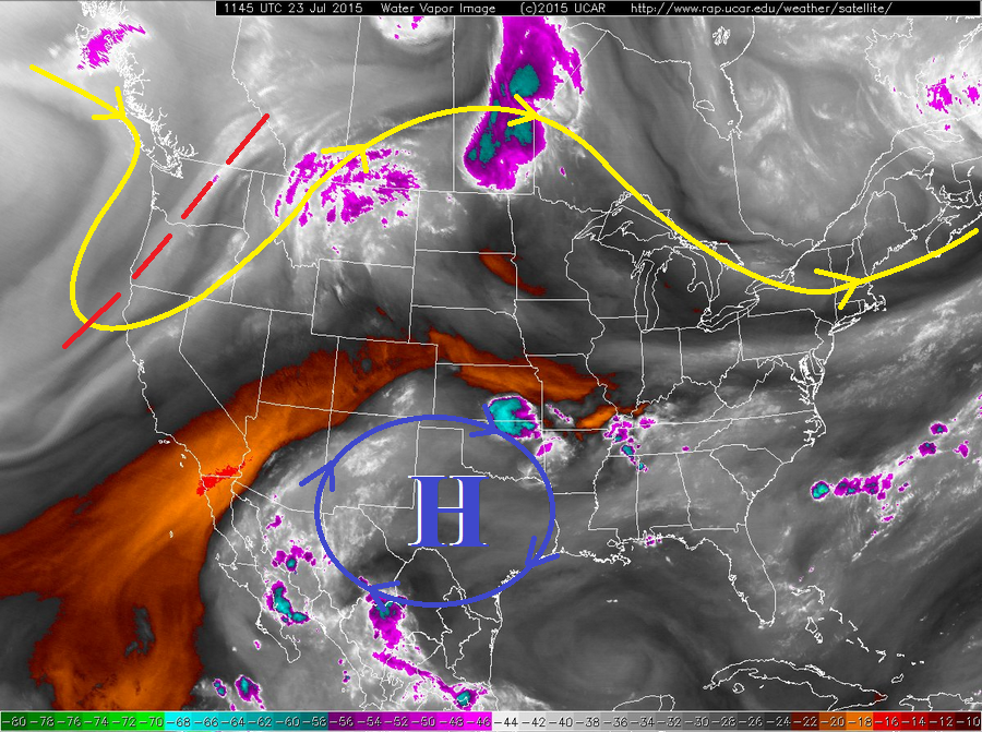
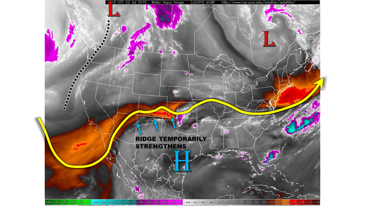
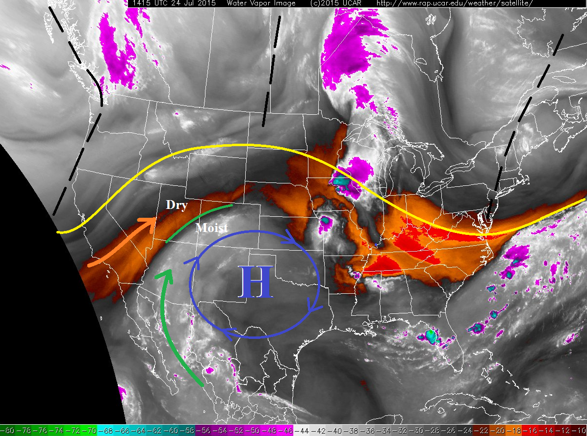
Not much has changed since yesterday, as upper-level high pressure remains the big player in our weather today. Mid-/upper-level disturbances continue to track across the northern US (black dashed lines), but remain unable to break into that strong high pressure ridge sitting across Colorado.
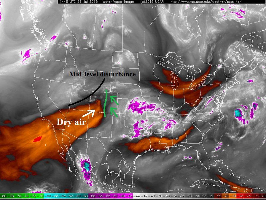
Southwest flow aloft will continue through today, bringing an increase in mid- and upper-level moisture to much of the state, while the Northwest Slope and Northern Mountains regions remain under drier flow aloft. This is denoted well in the water vapor image below; the green line separates the dry air from more moist air, and the green and orange arrows show the separate feeds supporting the resultant conditions. This has led to an increase in cloud cover this morning for areas under the moist flow, which will have limiting effects on the strength of potential thunderstorms this afternoon.
Scattered thunderstorms are expected across the High Country today and tonight, with the best coverage across the San Juan Mountains, Central Mountains, and Southeast Mountains (where the best mid-level moisture resides). The Northwest Slope will stay dry, while the Northern Mountains and Grand Valley will hold a slight chance for an isolated thunderstorm or two this afternoon/evening. The Front Range will see a couple isolated thunderstorms, mainly south of I-70.
As far as eastern Colorado is concerned, most locations will stay dry today, but isolated-to-scattered thunderstorms are expected across the Northeast Plains, Palmer Ridge, Southeast Plains, and Raton Ridge. A surface convergence zone will lay approximately along a line from Sterling to Limon to Trinidad, and this will help aid thunderstorm development. Any thunderstorms that develop will produce rainfall fairly efficiently compared to yesterday, but dry air in the lowest 10,000 feet will evaporate a fair amount of the precipitation before reaching the surface. The main threats from these storms will be gusty outflow winds, lightning, and hail. Storm motions will generally be to the east/northeast with the mean flow.
The Urban Corridor will see an isolated thunderstorm or two move off of the Front Range, but the main threat will be gusty winds and lightning – dry air near the surface will really cut into the heavy rain potential.
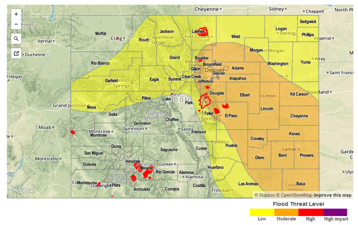
Today’s Flood Threat Map
For more information on today’s flood threat, see the map below (hover over threat areas for more details). For Zone-Specific forecasts, jump below the map.

Zone-Specific Forecasts
Urban Corridor, Raton Ridge, Palmer Ridge, Southeast Plains, and Northeast Plains:
Isolated-to-scattered thunderstorms expected this afternoon and evening, with the biggest threats being strong outflow winds and dangerous lightning. Large hail will be possible along and east of the surface convergence zone mentioned above. Maximum rain rates will vary, so they are as follows:
Urban Corridor: 0.4-0.7 inches/hour
Raton Ridge: 0.7-1.0 inches/hour
Palmer Ridge, Northeast Plains, and Southeast Plains: 1.0-1.5 inches/hour.
Timing: 1 PM – 9 PM, with a few isolated thunderstorms continuing until around midnight across far eastern Colorado
Front Range, Central Mountains, Southeast Mountains, Northern Mountains, Northwest Slope, San Luis Valley, San Juan Mountains, Southwest Slope, and Grand Valley:
Isolated-to-scattered thunderstorms expected today and tonight, with the best coverage occurring across the higher terrain of the Central Mountains, San Juan Mountains, and Southeast Mountains. The Northwest Slope will stay dry, and the Grand Valley/Northern Mountains regions will be mainly dry with only a couple isolated storms over the higher terrain. The Front Range will see isolated thunderstorms mainly south of I-70. Storms will generally move to the northeast, so lower elevations downstream will likely see thunderstorms move overhead. Rain rates will not be particularly high, as the moisture is mainly confined above 550 mb; maximum rates will be 0.4-0.6 inches/hour.
Timing: 11 AM – 8 PM, with a couple showers/weak thunderstorms lingering until about midnight across southern areas.