Issue Date: 7/22/2015
Issue Time: 9:55AM
No Flood Threat Today
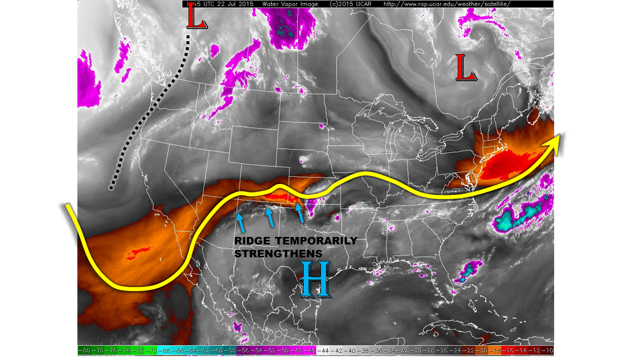
Due to the wavy nature of the atmosphere, the day after a disturbance passage is often times accompanied by drier weather as subsidence takes hold. Such is the case today. As shown in the water vapor image, below, yesterday’s disturbance is now a gradually weakening mass of clouds currently over central Kansas. Much drier conditions are noted over Colorado, although interestingly this is not yet reflected by surface dewpoints. Morning dewpoints range from the in the 40s to as high as low 60s statewide. However, this moisture is shallow, with Precipitable Water (PW) values in the 0.6 to 0.8 range. Yesterday’s incredibly “juicy” PWs have fallen by 30-40% into a more typical range for Colorado in mid-July.
For today, we anticipate mostly sunny skies this morning to fill in with puffy cumulus clouds by early afternoon. Scattered high-elevation thunderstorms will once again dot the landscape, mostly north of I-70. By later in the afternoon, a few isolated to widely scattered storms will be possible in the Northeast Plains as well. However, due to the strengthening ridge to the south, increasing subsidence will cap rainfall rates at around 0.4 inches over the higher terrain and around 0.7 inches in the far eastern Plains. Thus, no flooding is expected today.
Today’s Flood Threat Map
For more information on today’s flood threat, see the map below (hover over threat areas for more details). For Zone-Specific forecasts, jump below the map.

Zone-Specific Forecasts
Southeast Plains, Northeast Plains, Palmer Ridge, Front Range, Urban Corridor, Raton Ridge, Southeast Mountains:
Sunny early with a few cumulus clouds developing by early afternoon. Scattered high-elevation storms will occur over, mainly north of I-70 from the early afternoon through early evening hours. Max 1-hr rainfall will be 0.4 inches. Isolated storms will also be possible over the Northeast Plains, with max 1-hr rain rates up to 0.7 inches. No flooding is expected today.
Southwest Slope, San Juans, Grand Valley, San Luis Valley, Northwest Slope, Northern Mountains, Central Mountains:
Sunny to partly cloudy early with scattered afternoon storms possible across the higher elevations, mainly north of I-70. Max 1-hr rain rates will be 0.4 inches so no flooding is expected today.