Issue Date: 8/5/2015
Issue Time: 8:45 AM
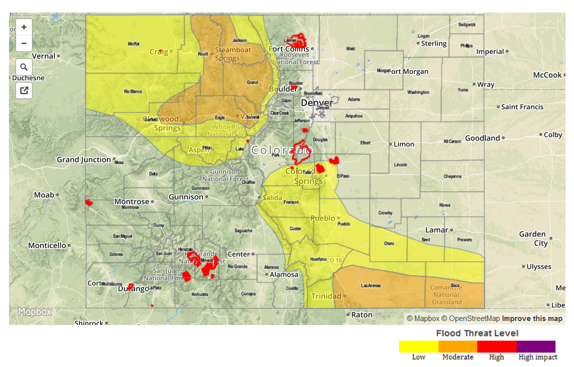
NO FLOOD THREAT IS FORECAST FOR TODAY.
Another mainly dry and seasonably hot day is in store for Colorado today, as upper-level ridging remains in control. The ridge will flatten a bit this afternoon as an upper-level low works across the northwest US, but overall, the flow will remain west-southwesterly aloft. This flow pattern will allow for a plume of modest mid-/high-level moisture to enter the state from the west, but fairly dry low-levels will limit the impact of the increase in moisture aloft. All in all, isolated-to-widely scattered showers/thunderstorms across the higher terrain will be possible, mainly along the Continental Divide and Front Range. The main impacts from this activity will be light rain and gusty outflow winds, as well as lightning. A couple of isolated thunderstorms will move off of the higher terrain and over the Urban Corridor, and western portions of the Northeast Plains/Southeast Plains/Raton Ridge/Palmer Ridge. Not expecting much more than brief light rain and gusty winds from such activity.
The only concern for isolated stronger thunderstorms this afternoon/evening will be near the CO/KS border, where a bit more moisture/instability will be present along and east of a weak surface boundary. If the low-level moisture can hang around sufficiently, and surface convergence can be enough, an isolated thunderstorm or two will develop; but if the moisture mixes out or surface convergence is too weak, thunderstorm chances will diminish rapidly. Brief bouts with heavy rain will attend these potential storms, as well as strong winds and small hail. No flash flooding is expected, as rain rates will be too low with the expected storm motions (15-20 mph) to cause issues.
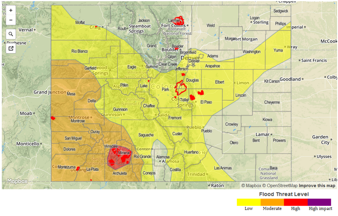
Today’s Flood Threat Map
For more information on today’s flood threat, see the map below (hover over threat areas for more details). For Zone-Specific forecasts, jump below the map.

Zone-Specific Forecasts
Urban Corridor, Northeast Plains, Raton Ridge, Palmer Ridge, and Southeast Plains:
Mostly sunny and hot for most, with high temperatures near seasonal average. A couple of isolated thunderstorms are possible, as described above. Maximum rain rates along and near the higher terrain will be 0.2-0.4 inches/hour, and 0.9-1.3 inches/hour near the CO/KS border.
Timing: 2 PM – 10 PM
Northern Mountains, Front Range, Central Mountains, Southeast Mountains, San Juan Mountains, Northwest Slope, Southwest Slope, San Luis Valley, and Grand Valley:
Mostly sunny and hot for most areas today, with isolated-to-widely scattered thunderstorms developing over the higher terrain. The best relative chances for thunderstorms are across the Northern Mountains, Central Mountains, Front Range, and Southeast Mountains regions, with lower chances elsewhere. Maximum rain rates will be 0.15-0.3 inches/hour.
A Red Flag Warning has been issued for portions of Moffat, Rio Blanco, Garfield, and Mesa Counties, so be sure to check in with the local National Weather Service Office for more details.
Timing: Noon – 9 PM