Issue Date: 8/9/2015
Issue Time: 9:55AM
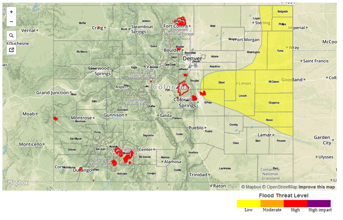
— LOW flood threat for the Palmer Ridge and parts of Southeast Plains
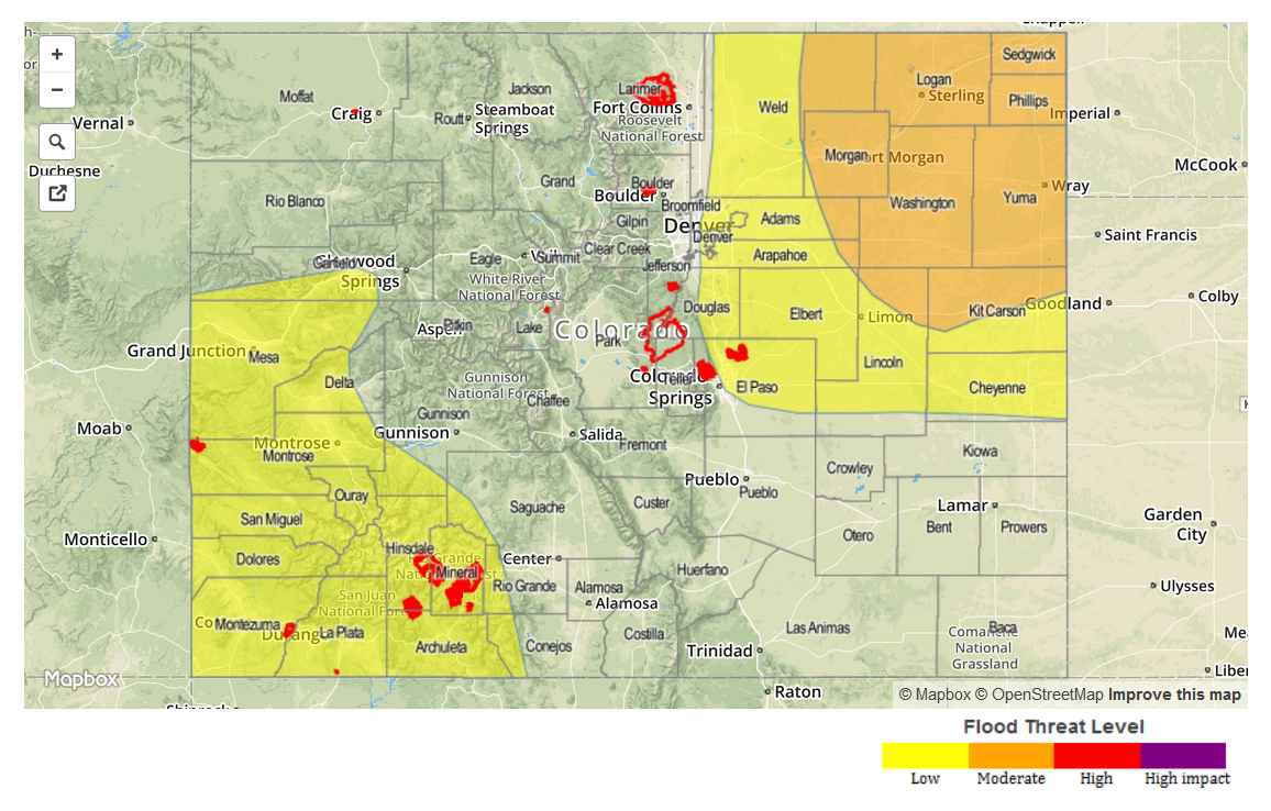
— An elevated flood threat is likely tomorrow east of the Continental Divide
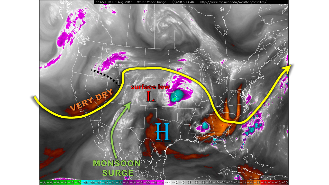
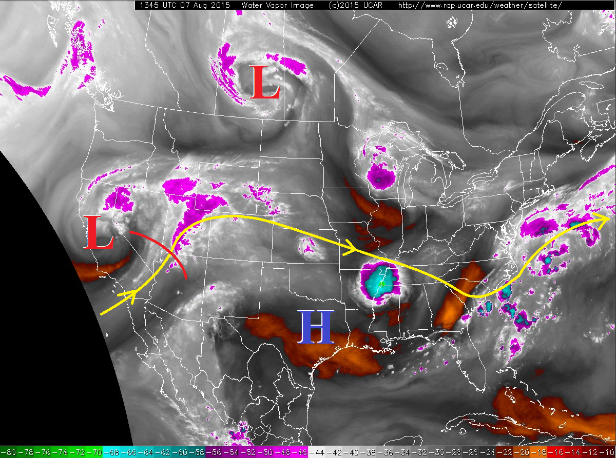
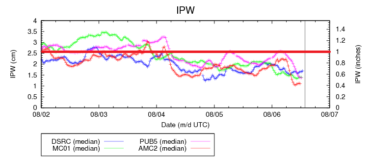
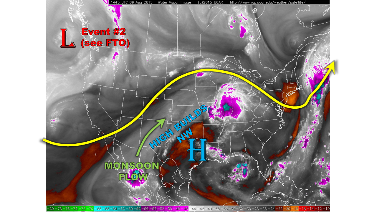
Today’s weather map (see water vapor image below) shows most of the same players as yesterday. Monsoonal flow around the subtropical high continues to stream northeastward. Today the trajectory of that flow implies that only southeast Colorado will be meaningfully impacted. This is also well captured by morning precipitable water values (PWs). For most of the state, PWs are in the 0.6 to 0.85 range, but Pueblo sits at 1.2 inches. As the high pressure ridge will build to the northwest today, we expect some further lowering of PWs. However, the southeast quadrant of the state will likely maintain the critical 1.0 inch PW threshold that we use as a rough proxy for the heavy rainfall threat. At the surface, dewpoint temperatures are in the 40s to mid-50s, except in the southeast where low 60s are found. Meanwhile, also note a strong low pressure seen off the west coast. This will become a player in our weather over the next few days (see our Flood Threat Outlook).
This morning, most of Colorado sits under clear skies. Cumulus clouds will quickly develop and then build into thunderstorms by early afternoon. Highest storm coverage will be from the San Juans eastward through the south face of the Palmer Ridge. But even in these areas, we expect isolated to scattered coverage. The expected surface circulation will favor drying/downsloping flow north of the Palmer Ridge. To the south, however, a weak upslope component to the flow combined with high moisture will support a Low flood threat. In this small region, 1-hr rain rates up to 1.9 inches will be possible. Elsewhere, storms are not expected to amount to much rainfall. That will change tomorrow.
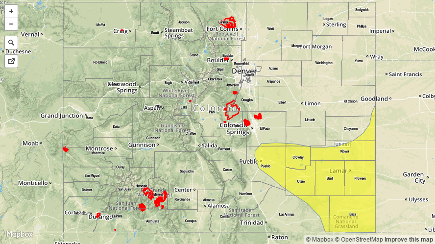
Today’s Flood Threat Map
For more information on today’s flood threat, see the map below (hover over threat areas for more details). For Zone-Specific forecasts, jump below the map.

Zone Specific Forecasts
Palmer Ridge, Southeast Plains:
Sunny early, then partly to mostly cloudy with isolated to scattered thunderstorms developing by early afternoon. Max 1-hr rain rates up to 1.9 inch will be possible, causing isolated flash flooding and street flooding. Gusty winds up to 45 mph may accompany the strongest storms. Storm coverage will likely be highest from mid-afternoon through around sunset. However, the flood threat will persist through the early morning hours due to anticipated upslope moving outflow boundary.
Primetime: 1pm to 1AM
Northeast Plains, Urban Corridor, Front Range, Southeast Mountains, Raton Ridge, San Juans:
Partly cloudy early, then isolated to scattered showers and thunderstorms forming around noon and lasting through early evening. Max 1-hour rain rates up to 0.6 inches will be possible. No flooding is expected. Gusty winds up to 45 mph could accompany the strongest storms. East of the Divide, an isolated storm or two may pop up in the late evening and early morning hours.
Northwest Slope, Northern Mountains, Central Mountains, Grand Valley, Southwest Slope, San Luis Valley:
Mostly sunny early, then partly cloudy with isolated to showers and a weak thunderstorm possible from early afternoon through early evening. Max 1-hr rain rates up to 0.3 will be possible, thus, flooding is not expected.