Issue Date: 8/8/2015
Issue Time: 9:45AM
— LOW flood threat for the Palmer Ridge and parts of the Northeast and Southeast Plains
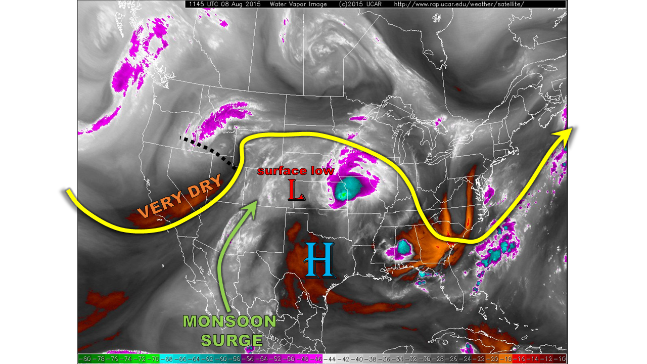
Yesterday’s disturbance has raced all the way across Kansas overnight. However, as shown in the water vapor image below, another much weaker disturbance is seen this morning over northern Utah. This disturbance will progress east/northeastward within the flow. As it is also transporting in some very dry air from the west, heavy rainfall will effectively be prevented west of the Divide today. Case in point: in Grand Junction’s morning atmospheric sounding, the relative humidity values between 10,000 and 14,000 feet ranged between 2 and 5%. Meanwhile, east of the Divide, a surface low circulation was noted on the CO/KS border. This will help to maintain a weak surface front roughly along the Palmer Divide. A monsoon surge continues to send pulses of moisture northeast, supporting a rainfall threat across eastern Colorado today. However, coverage and intensity should be much weaker/lower than Friday. Finally, the morning moisture check reveals dewpoints in the 50s and low 60s east of the Divide and precipitable water values near 1 inch. These readings are certainly conducive for at least isolated heavy rainfall.
 For today, we expect the cloud deck over central and northeast Colorado to thin out a bit by afternoon. Thunderstorms are expected to develop over the San Juans stretching east/northeast across the Palmer Ridge. West of the Divide, rain rates will be low enough to ease any flooding concerns. East of the Divide, rain rates could approach 2.2 inches an hour over the Palmer Ridge and Northeast Plains. A Low flood threat is warranted here. However, storm motion will be fast enough to prevent a prolonged heavy rain threat. Due to the dry air impinging from the west, there will likely only be one round of thunderstorms today (unlike yesterday). Hail and gusty winds will once again be a threat, but we do not expect hail over 1.5 inches.
Today’s Flood Threat Map
For more information on today’s flood threat, see the map below (hover over threat areas for more details). For Zone-Specific forecasts, jump below the map.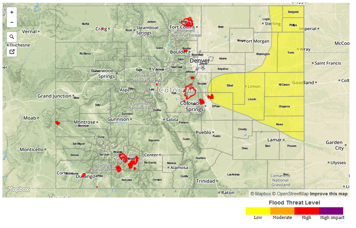
Zone Specific Forecasts
Northeast Plains, Palmer Ridge, Southeast Plains:
Partly cloudy early with scattered thunderstorms developing shortly after noon. Coverage will be highest over the Palmer Ridge as well as far northeast Colorado. Max 1-hour rain rates up to 2.2 inches can be expected. A Low flood threat is in place for isolated flash flooding, and street flooding. Wind shear in the lowest 6-km will vary between 30-35 knots, supporting hail up to 1.5 inches in the strongest storms. However, atmospheric instability will be limited (and decrease by late afternoon), tempering this threat. Gusty winds up to 55 mph will be possible with the strongest storms. Most activity will cease around sunset, but an isolated storm or two could persist through midnight.
Primetime: 1pm to midnight
Urban Corridor, Front Range, Southeast Mountains, Raton Ridge, San Juans:
Partly cloudy early, then isolated to scattered showers and thunderstorms forming around noon and lasting through early evening. Max 1-hour rain rates up to 0.8 inches will be possible. No flooding is expected. Gusty winds up to 45 mph could accompany the strongest storms.
Northwest Slope, Northern Mountains, Central Mountains, Grand Valley, Southwest Slope, San Luis Valley:
Mostly sunny early, then partly cloudy with isolated to scattered showers and weak thunderstorms possible from early afternoon through early evening. Max 1-hr rain rates up to 0.5 will be possible, thus, flooding is not expected.