Issue Date: 8/13/2015
Issue Time: 9:21 AM
A LOW FLOOD THREAT IS ISSUED FOR PORTIONS OF THE SOUTHEAST PLAINS, PALMER RIDGE, AND URBAN CORRIDOR.
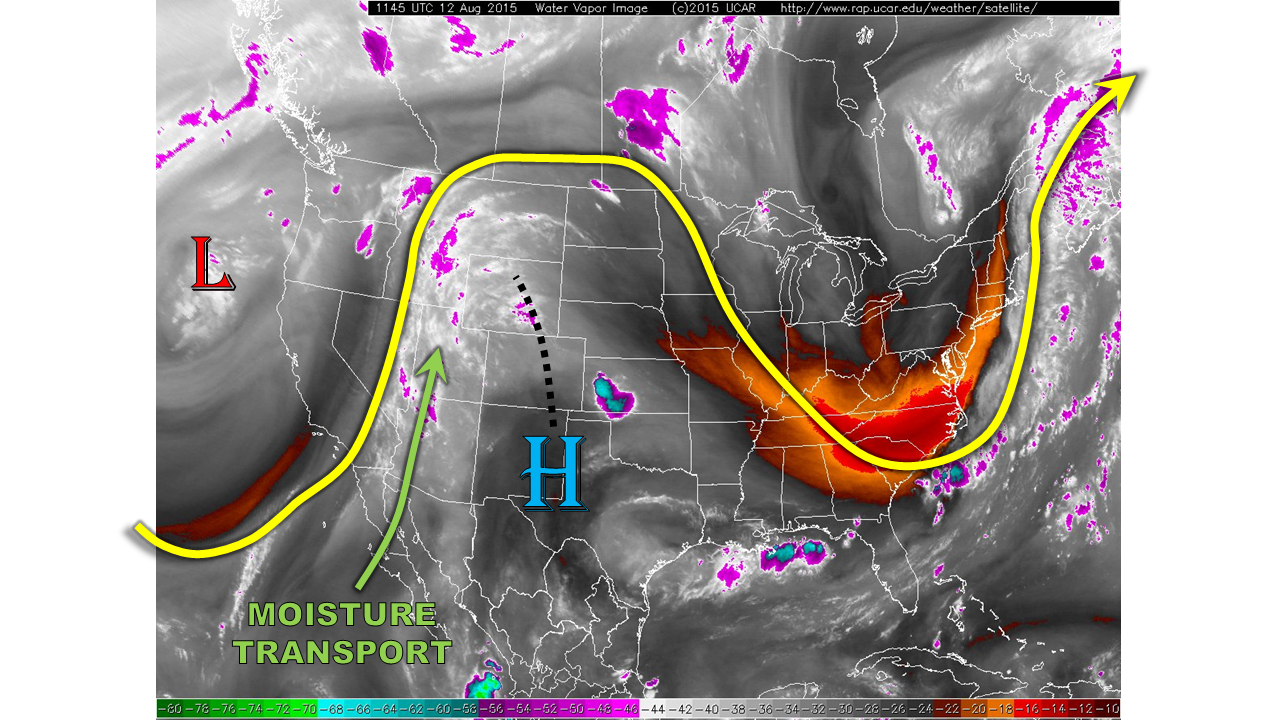
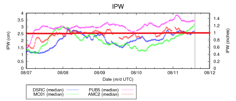
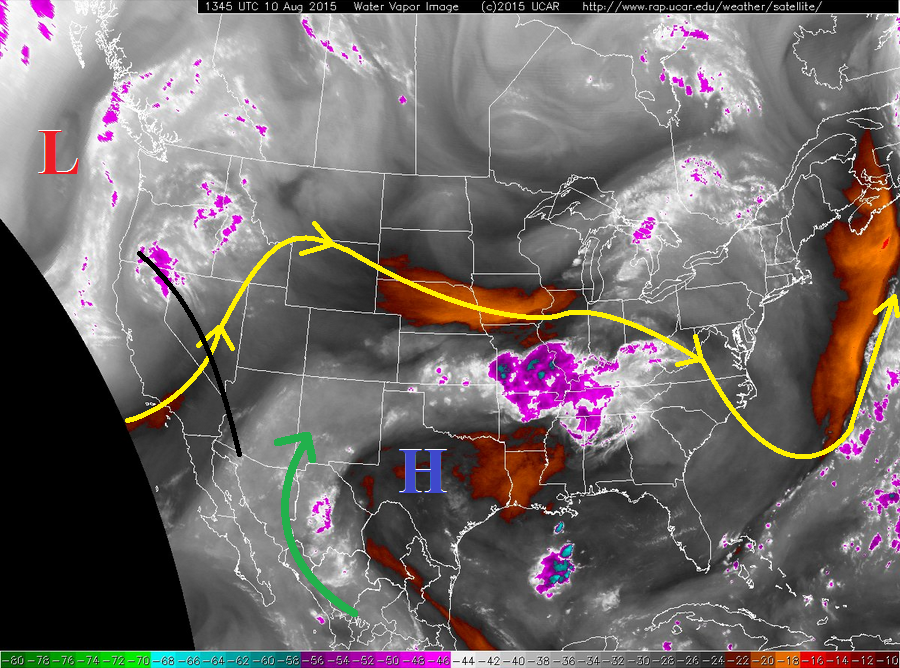
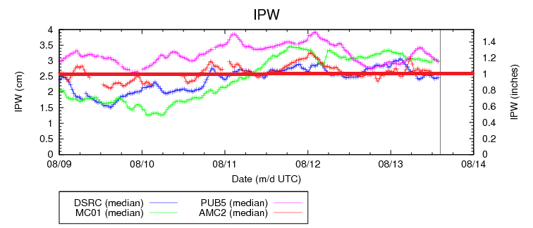
Persistent moisture is still hanging out under the upper-level ridge aloft, leaving precipitable water values above average for this date. As you can see in the IPW trace below, Shriever AFB and Boulder have fallen to near, or just below, 1 inch IPW, while Grand Junction and Pueblo remain above 1.15 inches (as of 8:30 AM). This depth of moisture still suggests that heavy rain is possible with thunderstorms, but the environment overall is fairly unsupportive to that occurring. The exception to this will be over Eastern Colorado, but we will get to that point in just a moment.
Over the higher terrain, isolated-to-widely scattered showers/thunderstorms are expected to increase through the afternoon and evening hours due to daytime heating/orographic effects making use of the residual moisture. The Northern Mountains, Front Range, Central Mountains, and San Juan Mountains will be the most active higher terrain regions, relatively speaking. Brief moderate-to-heavy rainfall will be possible, but probabilities of occurrence are low enough that no flood threat is warranted.
For the lower elevation east of the mountains, a weak shortwave trough will round the upper-level ridge and bring a bit of upper-level support to the environment. This will allow for isolated-to-scattered thunderstorms to develop this afternoon and evening, accompanied with a threat of brief moderate-to-heavy rainfall. A couple will become strong/marginally severe over the Northeast Plains, Southeast Plains, and Palmer Ridge regions where good instability will be in place. Strong winds, large hail, and lightning will be the main threats. For a look at maximum rain rates and timing of storms, jump down to the zone-specific discussions below.
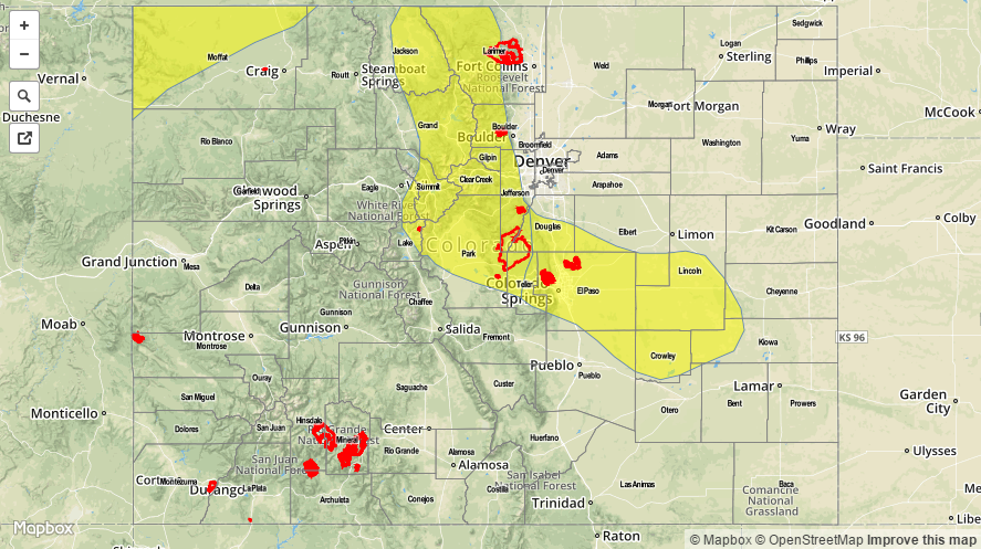
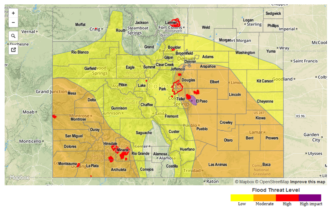
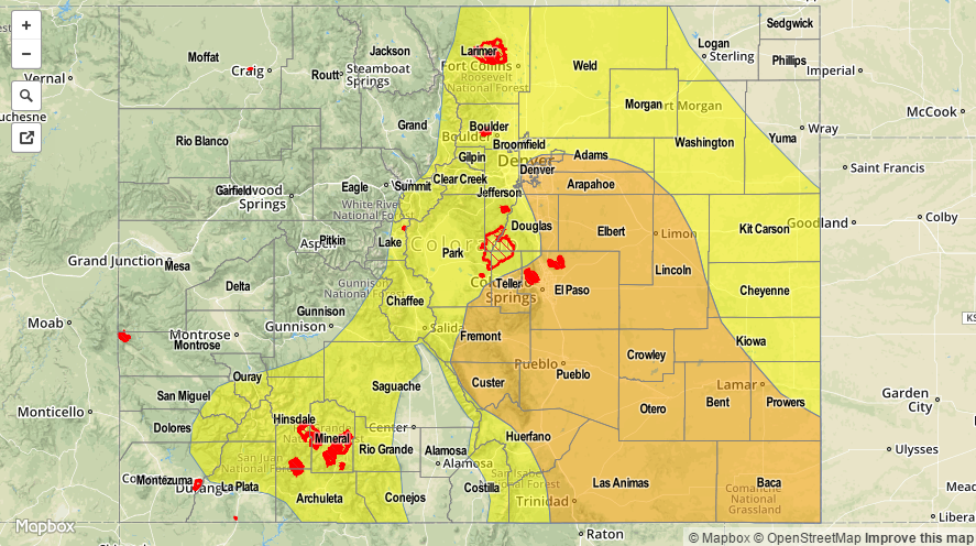
Today’s Flood Threat Map
For more information on today’s flood threat, see the map below (hover over threat areas for more details). For Zone-Specific forecasts, jump below the map.

Zone-Specific Forecasts
Urban Corridor, Northeast Plains, Southeast Plains, Palmer Ridge, and Raton Ridge:
Isolated-to-scattered thunderstorms are expected this afternoon and evening. A couple will become strong/marginally severe over the Northeast Plains, Southeast Plains, and Palmer Ridge regions. Maximum rain rates will vary by region:
Urban Corridor: 0.6-1.2 inches/hour
Palmer Ridge, Raton Ridge, and Northeast Plains: 0.8-1.4 inches/hour
Southeast Plains: 1.2-2.0 inches/hour
Timing: 1 PM – 9 PM will be prime time, with a few lingering until midnight.
Front Range, Northern Mountains, Central Mountains, Southeast Mountains, San Juan Mountains, Grand Valley, San Luis Valley, Northwest Slope, and Southwest Slope:
Isolated-to-scattered showers and thunderstorms expected today/this evening, before diminishing after sunset with the loss of daytime heating. The main result will be light rain, gusty winds, and lightning, but brief bouts with moderate-to-heavy rainfall cannot be ruled out. With a lack of general support from the environment, storms will not be long-lived, so flooding rainfall, even if heavy for brief periods of time, is not expected.
Rain rates will generally be 0.25-0.5 inches/hour, but maximum rain rates will push 0.6-1.0 inches/hour.
Timing: 11 AM – 9 PM