Issue Date: 8/17/2015
Issue Time: 9:48 AM
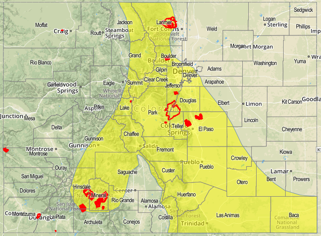
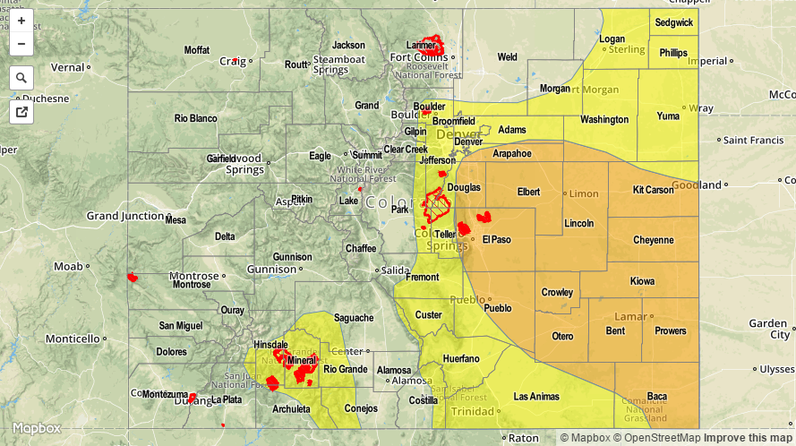
A MODERATE FLOOD THREAT IS ISSUED FOR PORTIONS OF THE NORTHEAST PLAINS, SOUTHEAST PLAINS, PALMER RIDGE, URBAN CORRIDOR, AND FRONT RANGE.
A LOW FLOOD THREAT IS ISSUED FOR PORTIONS OF THE SOUTHEAST PLAINS, PALMER RIDGE, URBAN CORRIDOR, FRONT RANGE, RATON RIDGE, SOUTHEAST MOUNTAINS, AND SAN JUAN MOUNTAINS.
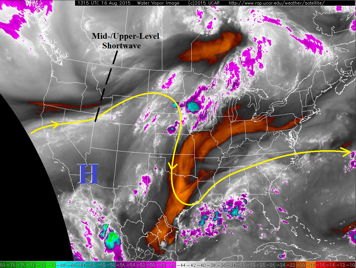
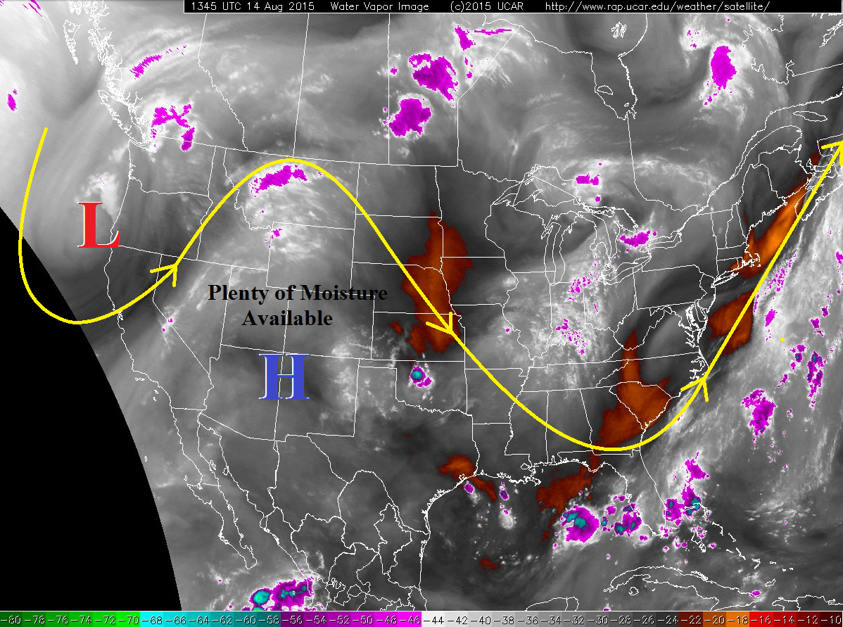
In what has been a string of fairly active weather, today/tonight will feature the grand finale for areas east of the Divide. The environment is bringing together ingredients favorable for severe weather and heavy rainfall. A seasonably strong shortwave trough will rotate across the Rockies today, pushing into the northern US plains by tomorrow morning. This shortwave is accompanied by a jet streak, and both will bring favorable broad-scale lift/deep-layer shear for strong/severe thunderstorms to eastern Colorado. Additionally, the approach of the trough will push a cool front through Colorado, providing a source of low-level convergence and wind shear, and southeasterly flow ahead of the front continues to transport in abundant low-level moisture.
The prime areas for strong/severe thunderstorms will be along and south of the I-70 corridor, from the Front Range to the CO/KS border. A few strong storms will be possible north of that line, but south is where the most action will occur. Narrowing down this further, wherever the cool front is located, that will be the best corridor for severe thunderstorms capable of large hail, damaging winds, and a couple tornadoes. At this time, that appears to be across the Palmer Ridge, southern extents of the Urban Corridor, and central/northern portions of the southeast plains, but all areas in the general area outlined in the first sentence of this paragraph will have an environment favorable for strong-to-severe storms thanks to available moisture, instability, and deep-layer shear.
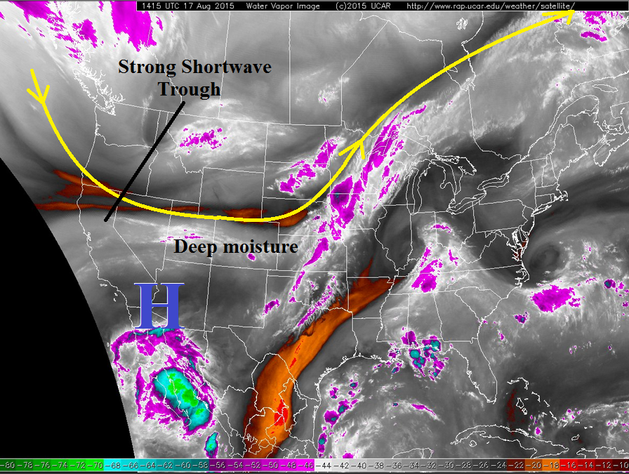
West of the Continental Divide, on the other hand, will see the downtick experienced yesterday continue through today and tonight. Isolated-to-widely scattered showers and thunderstorms are expected, developing over the higher terrain initially and drifting over valleys with time. The most active regions will be across the southern half of the area, namely in the San Juan Mountain, Central Mountain, and Southwest Slope regions. Drier air will begin working south behind the passing cool front late this afternoon/evening, effectively ending thunderstorm chances behind the front. The front will push out of the area by early Tuesday morning.
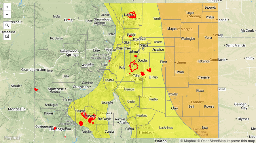
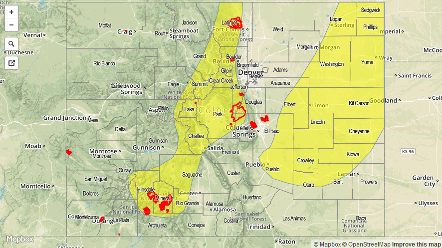
Today’s Flood Threat Map
For more information on today’s flood threat, see the map below (hover over threat areas for more details). For Zone-Specific forecasts, jump below the map.

Zone-Specific Forecasts
Front Range: Urban Corridor, Northeast Plains, Southeast Plains, Palmer Ridge, and Raton Ridge:
Scattered strong-to-severe storms are likely, especially for the areas outlined in the discussion above. With abundant moisture available, heavy rain is also likely, with maximum rain rates as follows:
Urban Corridor, Raton Ridge, and Front Range: 1.0-1.8 inches/hour
Northeast Plains: 2.0-2.5 inches/hour
Southeast Plains: 2.5-3.0 inches/hour
A thunderstorm complex is currently ongoing across the Southeast Plains/Raton Ridge. Today’s main activity timing: 2-3 PM – 11 PM, with a few thunderstorms continuing into the early morning across the plains.
Northern Mountains, Central Mountains, Southeast Mountains, San Juan Mountains, Grand Valley, San Luis Valley, Northwest Slope, and Southwest Slope:
Isolated-to-widely scattered showers and thunderstorms expected this afternoon and evening, before winding down after sunset. Locally moderate-to-heavy rainfall is possible across the San Juan Mountains, Central Mountains, and Southeast Mountains. Maximum rain rates break down like this:
Northern Mountains, Northwest Slope, Grand Valley, San Luis Valley, Central Mountains, and Southwest Slope: 0.4-0.8 inches/hour
San Juan Mountains: 0.6-1.0 inches/hour
Southeast Mountains: 0.8-1.2 inches/hour
Timing: 11 AM – 9 PM