Issue Date: 9/10/2015
Issue Time: 9:20 AM
NO FLOOD THREAT IS FORECAST.
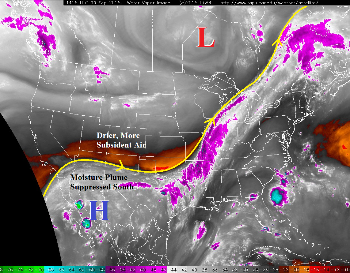
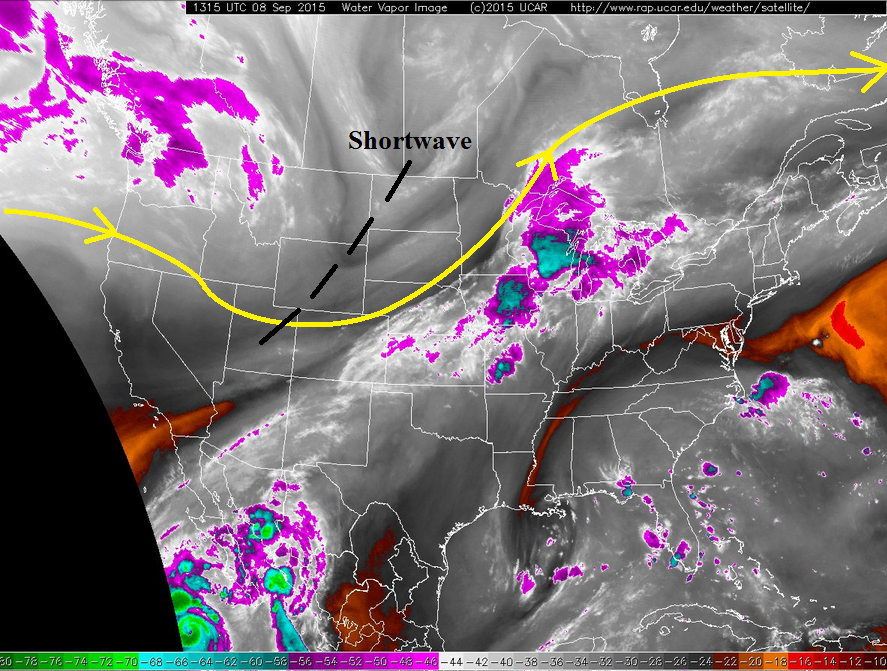
A stark contrast of two forecasts will exist across Colorado today, split down the middle along the Front Range and Southeast Mountains. Locations west of the line will see temperatures a few degrees warmer than yesterday underneath mostly sunny skies. One exception to the dry rule will be the eastern San Juan Mountains, where an isolated shower/weak thunderstorm will attempt to overcome the otherwise unfavorable environment.
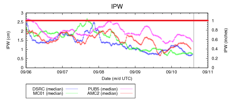
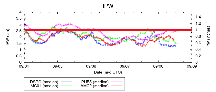
Along and east of the Front Range and Southeast Mountains, a cool front lurks and will pass through the state through this evening, entering NM by midnight. As the front pushes through, a few isolated thunderstorms will be possible across the Northeast Plains, Palmer Ridge, and Southeast Plains. Behind the front, upslope flow will develop, bringing in low clouds, showers, and a couple of weak thunderstorms, with best chances across the Urban Corridor, Palmer Ridge, and western portions of the Southeast Plains/Northeast Plains/Raton Ridge. Generally light rain will result from activity today/tonight as moisture will have to rebound from morning values in the 25th percentile at Boulder and Grand Junction (see IPW graph above). For more information on timing and rain rates, please see the zone-specific discussions below. Otherwise, the primary effect of the cool front will be high temperatures a few degrees cooler than yesterday.
Today’s Flood Threat Map
For more information on today’s flood threat, see the map below (hover over threat areas for more details). For Zone-Specific forecasts, jump below the map.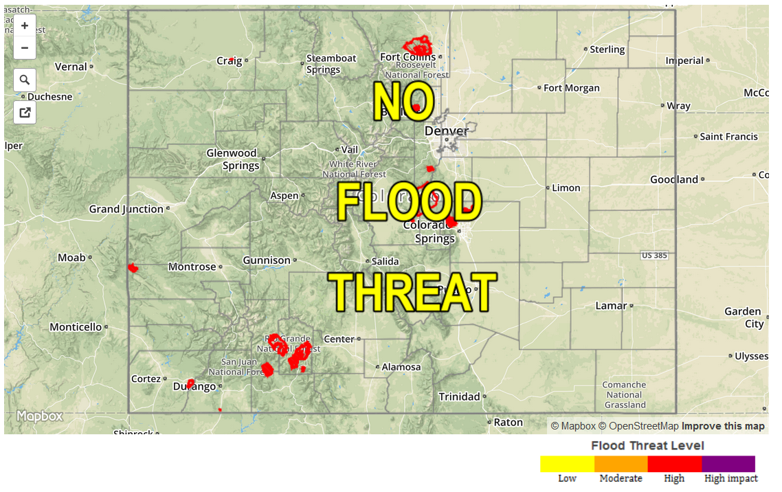
Zone-Specific Forecasts
Front Range, Urban Corridor, Northeast Plains, Raton Ridge, Palmer Ridge, Southeast Mountains, and Southeast Plains:
Mostly sunny early, with clouds increasing during the late afternoon/evening and through the overnight hours as the front moves through and upslope flow develops behind it. Isolated-to-scattered showers and weak thunderstorms are expected, beginning during the mid-afternoon and continuing through the overnight hours. No flood threat is forecast, as rain rates will be generally light, moderate at best. Max rain rates are as follows:
Front Range, Urban Corridor, Palmer Ridge, and Northeast Plains: 0.4-0.8 inches/hour
Southeast Plains and Raton Ridge: 0.5-1.0 inches/hour
Southeast Mountains: 0.5-0.9 inches/hour
Timing will vary, so check out the breakdown:
Front Range: 8 PM – 4 AM
Urban Corridor: 8 PM – 6 AM
Northeast Plains: 3 PM – 8 AM
Palmer Ridge: 6 PM – 6 AM
Raton Ridge: 2 PM – 8 PM, redeveloping from Midnight – 5 AM
Southeast Plains: 4 PM – 8 AM
Southeast Mountains: 10 PM – 5 AM
Northern Mountains, Northwest Slope, Central Mountains, San Juan Mountains, Southwest Slope, Grand Valley, and San Luis Valley:
Mostly sunny skies and warm temperatures will be the main story today, with highs climbing a few degrees above normal. Moisture associated with the cool front to the east will not be deep enough to bring an impact to these regions, and thus, dry and pleasant weather is expected. An isolated shower/weak thunderstorm will be possible, albeit a low chance, across the eastern San Juan Mountains today. Rain rates with any potential activity will be less than 0.25 inches/hour.
Timing: 1 PM – 7 PM