Issue Date: 9/9/2015
Issue Time: 10:15 AM
NO FLOOD THREAT IS FORECAST.
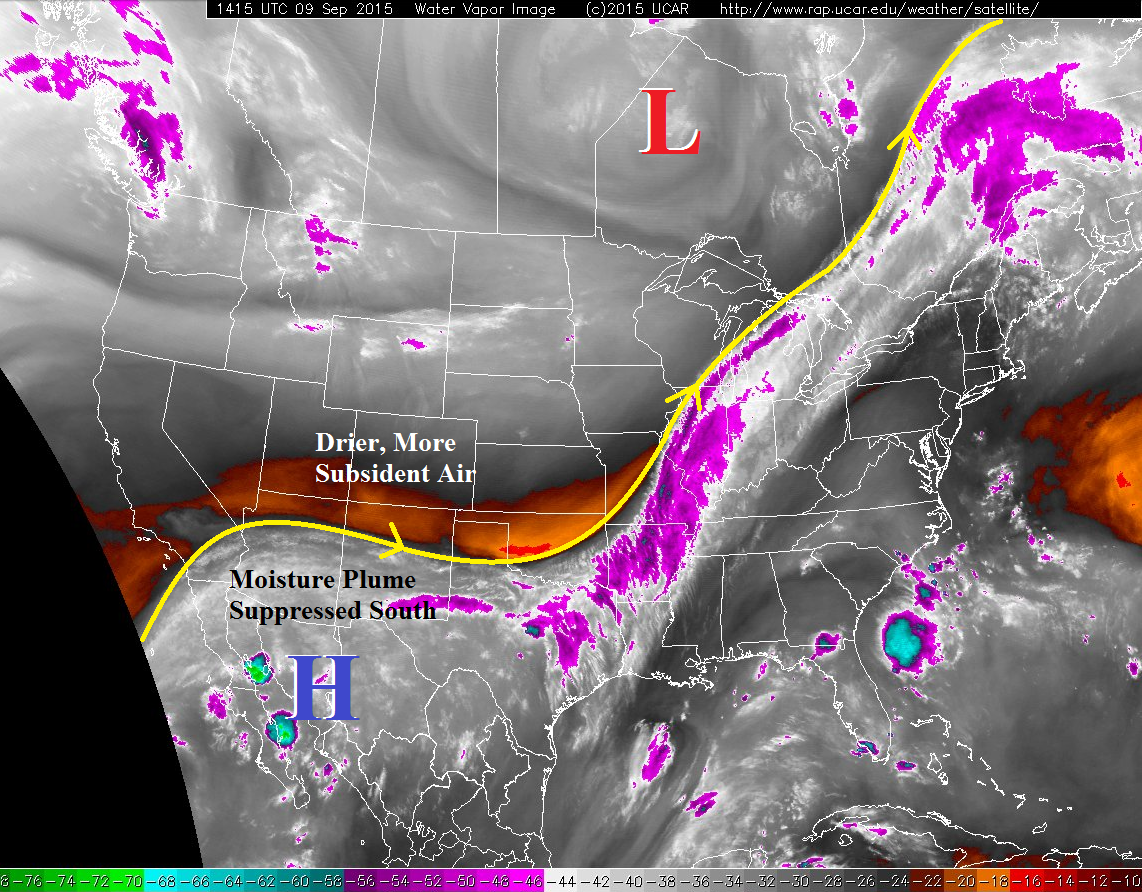
If you like sunny skies and warm temperatures today is the day for you. Stuck under northwest flow aloft, the air mass over Colorado has dried significantly, with the deep moisture plume suppressed to the south. One quick glance at the water vapor image below shows this drying clearly, with Colorado “between” the upper-low over central Canada and a building upper-level high over western Mexico. The dry air and mostly sunny skies will allow for temperatures to climb nicely through the afternoon, finishing off at, or just above, average for the date.
The only exception to the dry rule today will be over the preferred terrain of the San Juan Mountains, Southeast Mountains, and Raton Ridge. A bit of stubborn residual moisture will combine with daytime heating and orographic effects to force a couple isolated showers/weak thunderstorms. No significant activity is expected, and rain rates will be very low. Additionally, one or two isolated thunderstorms will be possible across the Southeast Plains, where a narrow corridor of instability will be present. The chances of development are low, though (15%).
Today’s Flood Threat Map
For more information on today’s flood threat, see the map below (hover over threat areas for more details). For Zone-Specific forecasts, jump below the map.

Zone-Specific Forecasts
Urban Corridor, Northeast Plains, Raton Ridge, Palmer Ridge, and Southeast Plains:
Mostly sunny and warm, with high temperatures climbing to, or just above, seasonal average. The Raton Ridge and Southeast Plains hold a slight chance for an isolated thunderstorm or two this afternoon/evening, but otherwise the regions will be quiet. Rain rates will be 0.4-0.7 inches/hour.
Timing: Noon – 8 PM
Front Range, Northern Mountains, Northwest Slope, Central Mountains, San Juan Mountains, Southwest Slope, Grand Valley, San Luis Valley and Southeast Mountains:
Mostly sunny skies with seasonal high temperatures will be the main story today for all regions, minus a few isolated showers/weak thunderstorms over the San Juan Mountains and Southeast Mountains. Rain rates will be low (0.15-0.3 inches/hour), and no significant activity is expected.
Timing: Noon – 8 PM