Issue Date: 8/8/2016
Issue Time: 9:40 AM
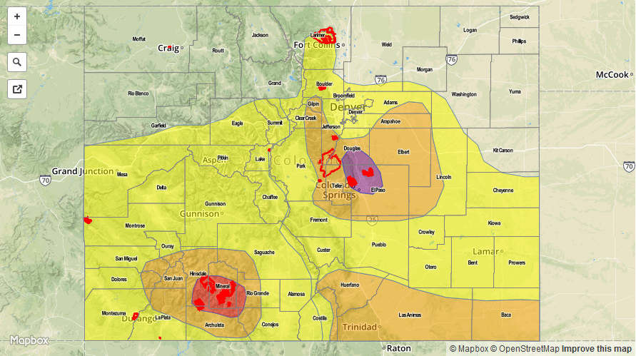
A LOW FLOOD THREAT IS FORECAST TODAY FOR PORTIONS OF THE PALMER RIDGE, URBAN CORRIDOR, SOUTHEAST PLAINS, NORTHEAST PLAINS, FRONT RANGE, AND SOUTHEAST MOUNTAINS.
A LOW FLOOD THREAT IS FORECAST TODAY FOR PORTIONS OF THE SOUTHWEST SLOPE AND SAN JUAN MOUNTAINS.
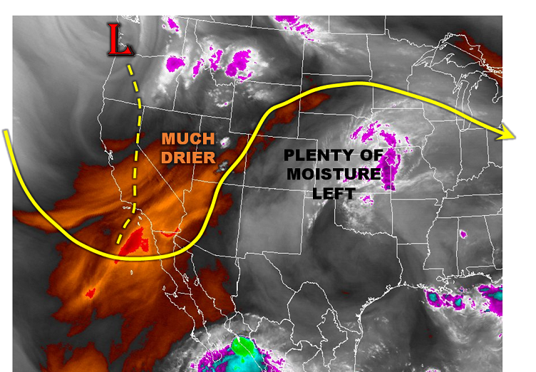
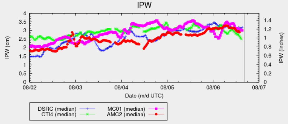
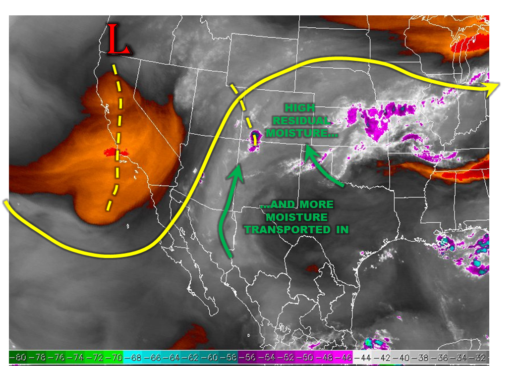
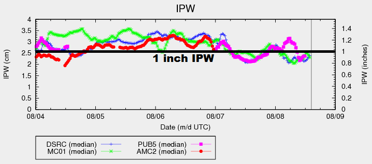
Flow aloft will turn more westerly today, thanks to the upper-level high settling over the southern Rockies. This will bring in drier air from the west, which will lessen the threat for flash flooding, especially west of the Continental Divide. From a statewide perspective, IPW values have fallen below 1 inch this morning at three of the normal reporting stations (Schriever AFB is not reporting currently). There will still be the opportunity for heavy rain east of the Continental Divide, as residual moisture and surface dewpoints in the 50s and 60s provide the fuel for efficient rainfall production. Storm motions are expected to be a bit quicker today, as well, which will also mitigate the flooding threat. The main concern areas for any flooding issues will be areas that have received heavy rainfall over the past few days, as well as burn scars like the Hayden Pass Fire, which will react quickly to any heavy rain.
A couple severe storms are possible east of the Front Range/Southeast Mountains, where ample instability will be in place this afternoon/evening. Sufficient wind shear, mainly in the mid-levels will allow for a couple organized storm clusters, with the main threats being strong winds and periods of heavy rainfall. Small hail may mix in, as well. The best opportunity for these storms will be across the Urban Corridor, Palmer Ridge, and Northeast Plains.
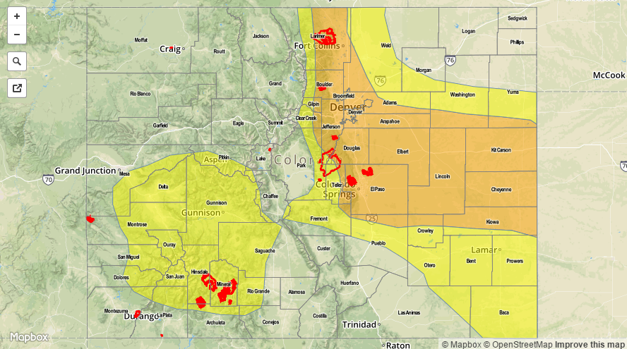
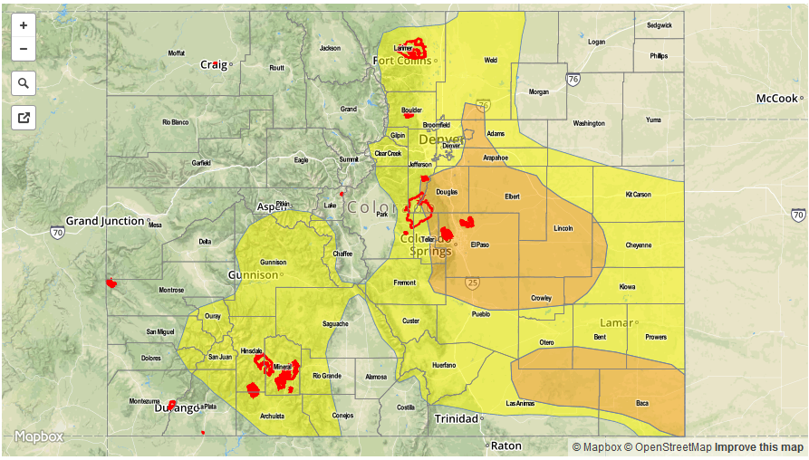
Today’s Flood Threat Map
For more information on today’s flood threat, see the map below (hover over threat areas for more details). For Zone-Specific forecasts, jump below the map.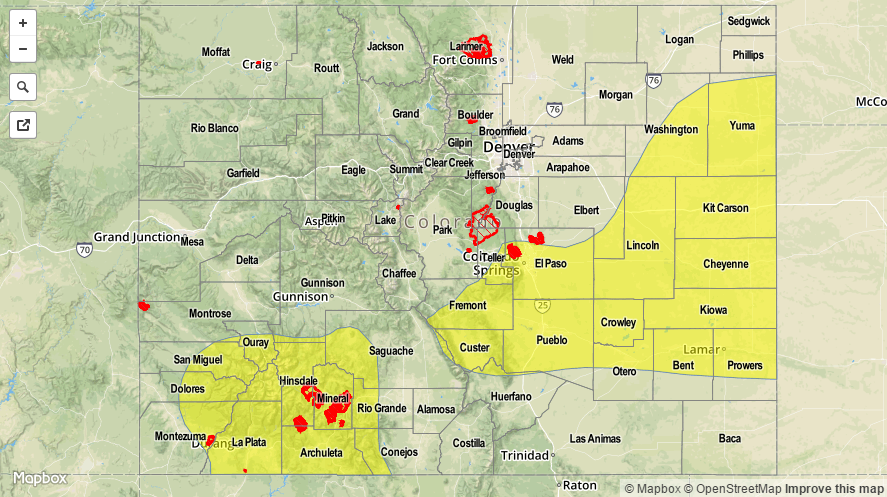

Zone-Specific Forecasts
Urban Corridor, Northeast Plains, Palmer Ridge, Southeast Plains and Raton Ridge:
Widely scattered showers and thunderstorms are expected this afternoon and evening, moving west to east with the steering flow. Most areas will see any storm activity come to an end by 8-9 PM, with only a couple lingering storms over the far eastern Plains until 11 PM-Midnight. Maximum rain rates are as follows:
Urban Corridor and Raton Ridge: 0.6-1.0 inches/hour
Palmer Ridge: 1.5-2.0 inches/hour
Northeast Plains and Southeast Plains: 2.0-2.5 inches/hour
Front Range, Northern Mountains, Southeast Mountains, Northwest Slope, San Juan Mountains, Southwest Slope, San Luis Valley, Central Mountains, and Grand Valley:
A few scattered showers/thunderstorms are ongoing this morning due to their proximity to the upper-level jet. New development of showers/thunderstorms will begin around 11 AM, with coverage increasing through the 5 PM, before decreasing again as daytime heating wanes and drier air helps choke off convection. Most of the moisture exists above 3 km, so the moisture profile is a bit “top-heavy” today. Still, dewpoints in the 40s and 50s will keep the threat of moderate-to-heavy rain in the forecast, mainly for southern zones. For this reason, the low flood threat has been issued for portions of the San Juan Mountains, Southwest Slope, Southeast Mountains, and Front Range. Maximum rain rates are as follows:
Front Range: 0.8-1.2 inches/hour
Southeast Mountains and San Juan Mountains: 0.8-1.4 inches/hour
Southwest Slope and San Luis Valley: 0.6-1.0 inches/hour
Grand Valley, Northwest Slope, Northern Mountains, and Central Mountains: 0.4-0.8 inches/hour