Issue Date: Saturday, August 20th, 2016
Issue Time: 9:10AM MDT
— Flooding is NOT expected today.
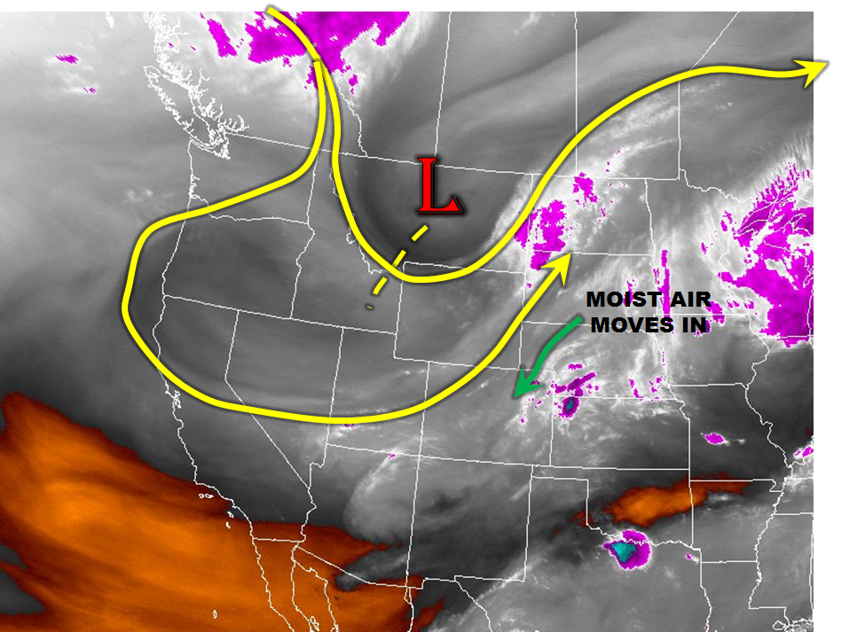
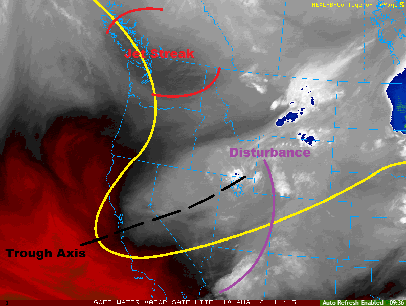
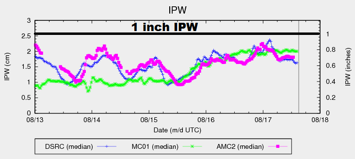
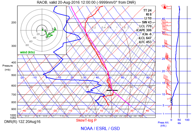
A strong disturbance and associated cool front responsible for yesterday’s active weather has largely cleared the state. Precipitable water values have fallen substantially from the 0.9 – 1.1 inch range yesterday afternoon into the 0.55 – 0.7 inch range by this morning. A 5,000 foot layer of very stable fall-like air has settled in for most areas east of the Divide (see morning sounding from Denver below), which will act to lower or even eliminate rain chances today. The one exception will be in the far southern parts of the state where the depth of the cool, stable air is very shallow. This will allow for solar heating to create enough instability for scattered thunderstorms this afternoon and evening. However, with only marginal instability and relatively fast storm motions today, heavy rainfall will be too isolated and brief to cause a flood threat. Thus, flooding is not expected today.
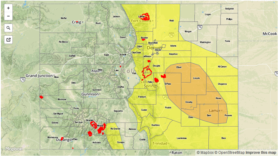
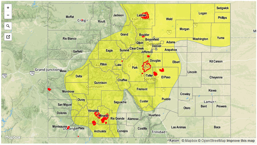
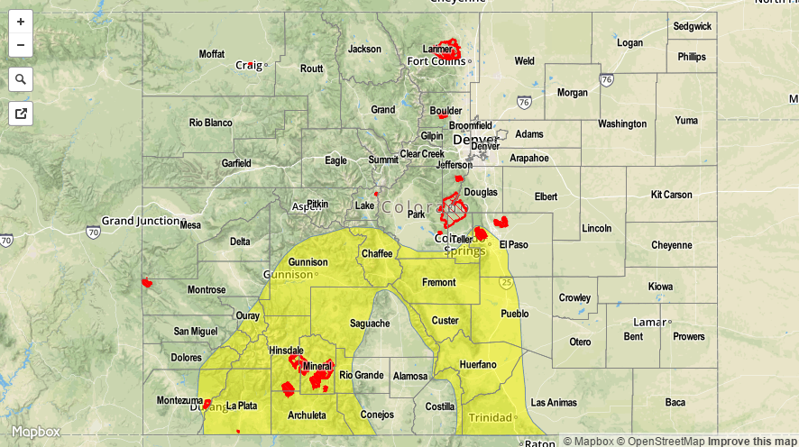
Today’s Flood Threat Map
For more information on today’s flood threat, see the map below (hover over threat areas for more details). For Zone-Specific forecasts, scroll below the map.

Zone-Specific Forecasts
Southeast Mountains, Raton Ridge, Southeast Plains:
Low-clouds early then becoming partly cloudy with scattered thunderstorms developing shortly after noon. Activity will develop first over the higher terrain then spread southeastward. However, most action will be limited to the higher terrain and foothills. Max 30-min rain rates up to 0.7 inches and 1-hour rain rates up to 1 inch are possible. However, flooding is not expected today. Small hail up to 0.5 inches and gusty winds up to 60 mph could accompany the stronger cells.
Primetime: 1PM to 7PM
Front Range, Urban Corridor, Palmer Ridge, Northeast Plains:
Partly to mostly sunny and unseasonably cool today with some fair weather cumulus clouds developing by late morning. Isolated to scattered showers and thunderstorms are possible closer to the higher terrain. Max 1-hour rain rates up to 0.4 inches are possible. Flooding is not expected today.
San Juan Mountains, Southwest Slope, Grand Valley, Central Mountains, San Luis Valley, Northwest Slope, Northern Mountains:
Mostly sunny early then partly cloudy and seasonably cool. An isolated shower or storm is possible for southern areas. Max 1-hour rain rates up to 0.2 inches. Flooding is not expected today.