Issue Date: Wednesday, August 24th, 2016
Issue Time: 10:45AM MDT
— HIGH flood threat for Hayden Pass fire burn area
— LOW flood threat for San Juans, Southeast Mountains and parts of Southeast Plains
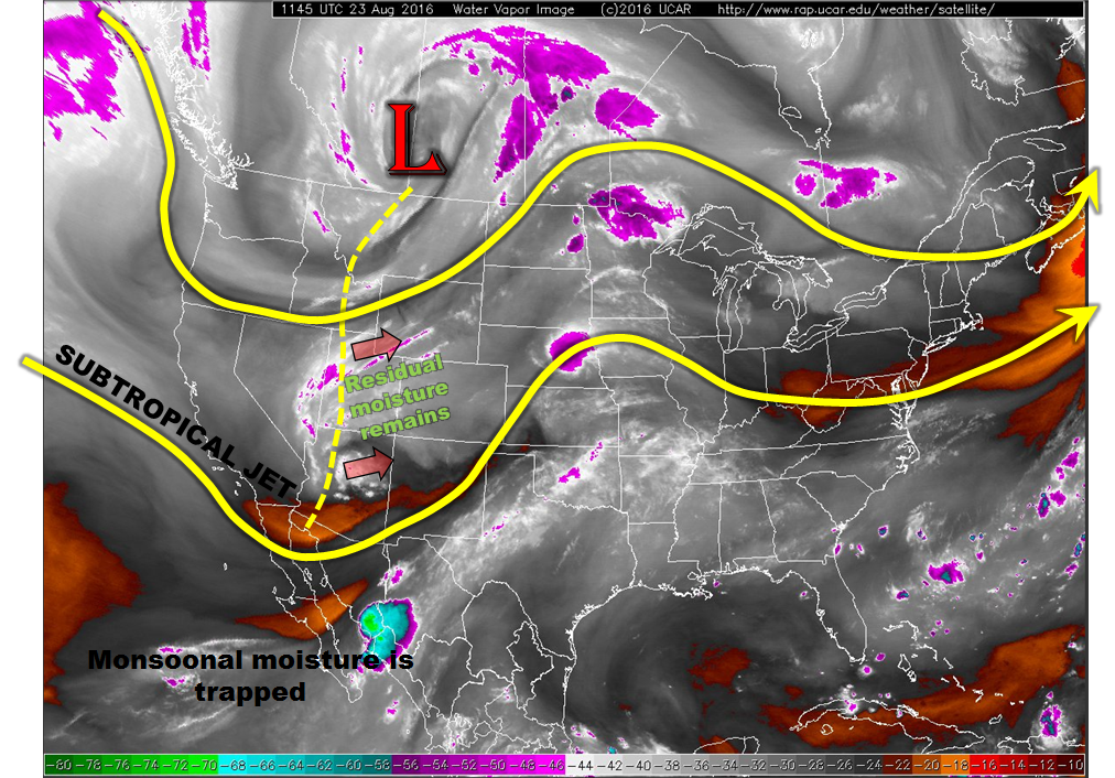
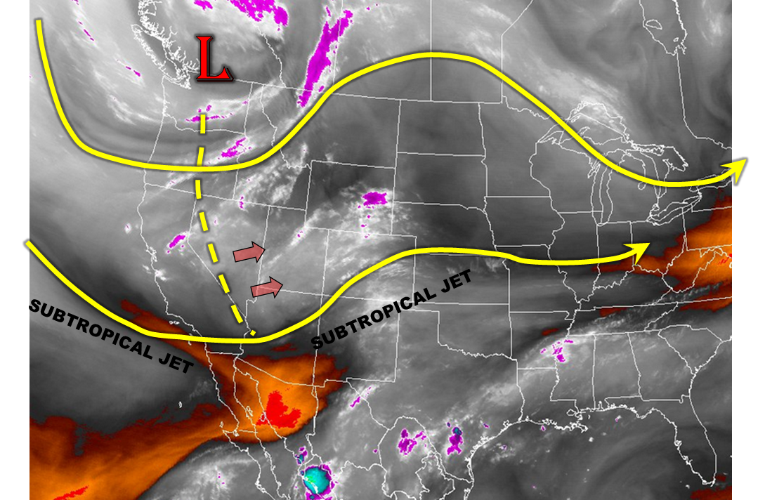
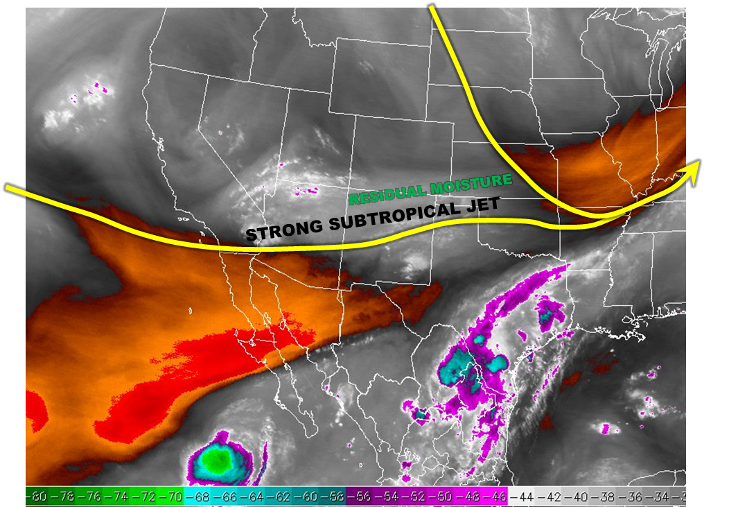
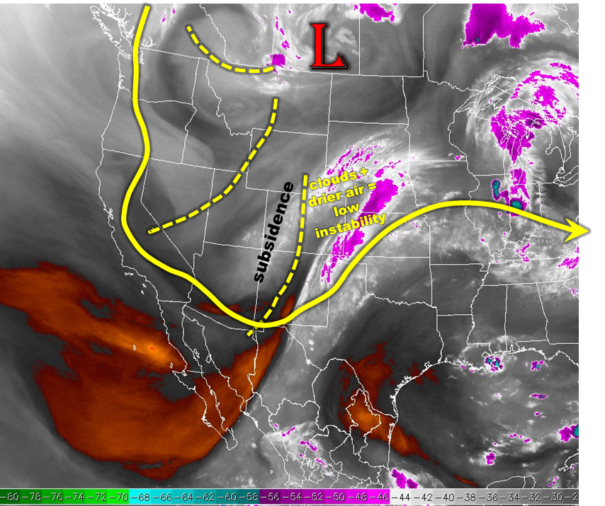
A rather complicated weather map is seen this morning, see the marked-up water vapor image below. The trough, and attendant surface low pressure, that has been at the center of attention the past few days has broadened. Just like spokes on a bicycle wheel, there are now at least three distinct disturbances that are part of the bigger trough. The far southeast one is the main focus for Colorado’s weather today. As of this morning, it was roughly oriented along the Continental Divide with upward motion to its east and subsidence to its west. Accordingly, morning visible satellite imagery showed this contrast with clear skies across the western slope but thick clouds and light to moderate shower activity to the east. Cloud cover and drier air entraining from the northeast will be a strong limiting factor on rainfall rates. However, with more sunshine a few southern areas will be the exception to this and that’s where a Low flood threat has been issued this morning. The Southeast Plains will see a threat of severe weather in addition to heavy rainfall. Additionally, the Hayden Pass burn scar has been a trouble spot for the past few days. It will continue to be an issue today with moderate rainfall rates exceeding 0.5 inches per hour likely. A High flood threat is in effect for the scar area.
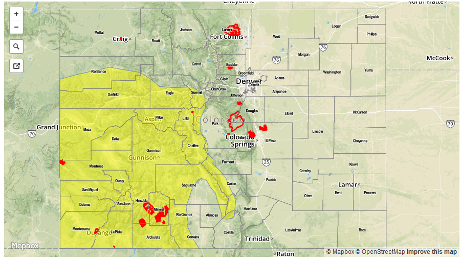
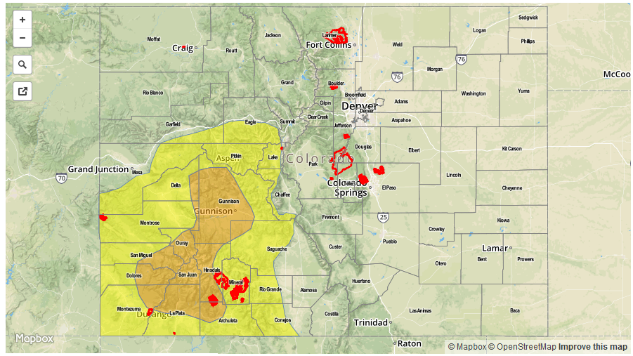
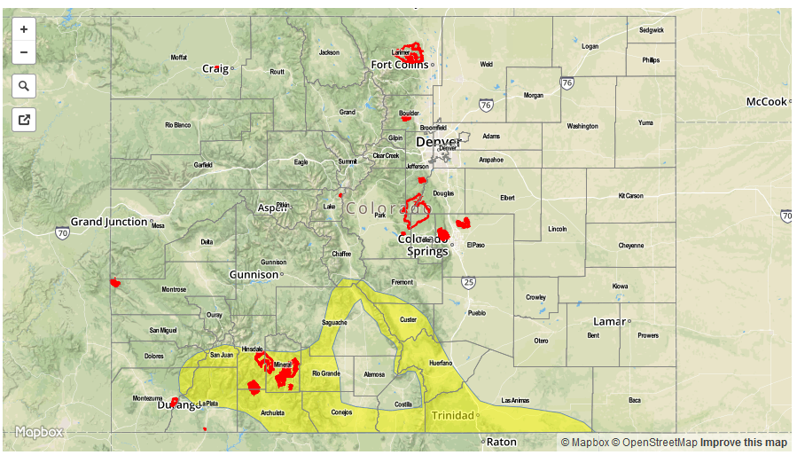
Today’s Flood Threat Map
For more information on today’s flood threat, see the map below (hover over threat areas for more details). For Zone-Specific forecasts, scroll below the map.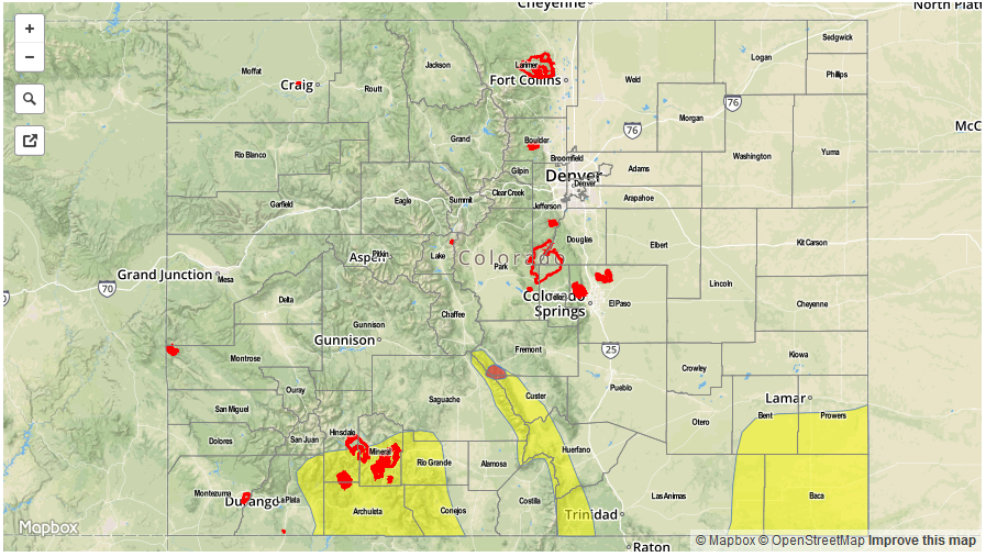

Zone-Specific Forecasts:
San Juan Mountains, Southeast Mountains, San Luis Valley, Hayden Pass fire scar:
Partly cloudy this morning then scattered to widespread showers and thunderstorms developing by early afternoon. Max 1-hr rain rates up to 1 inch possible for the San Juans with up to 1.2 inches possible for the Southeast Mountains. A Low flood threat has been issued for the region due to antecedent 48-hour rainfall that will lead to quicker runoff. A High flood threat is in effect for the Hayden Pass fire scar because rainfall rates exceeding 0.5 inches per hour are likely today leading to more runoff and potential mud flows.
Primetime: 12PM to 8PM, except through midnight for the Hayden Pass burn scar
Southeast Plains:
Partly cloudy then scattered thunderstorm and shower activity developing by mid afternoon. Maximum 1-hour rain rates up to 2.0 inches will be possible, along with hail up to 1.5 inches and wind gusts up to 75 mph. A Low flood threat has been issued for isolated flash flooding and field/roadway flooding.
Primetime: 3PM to 11PM
Northwest Slope, Northern Mountains, Central Mountains, Grand Valley, Southwest Slope:
Sunny early then isolated to scattered showers and weak thunderstorms developing by early afternoon. Maximum 1-hour rain rates up to 0.4 inches are possible, with maximum 24-hour rainfall up to 0.7 inches. Flooding is not expected today.
Primetime: 12PM to 7:30PM
Front Range, Urban Corridor, Palmer Ridge, Northeast Plains, Raton Ridge:
Overcast with scattered to widespread moderate shower activity on and off throughout the day, diminishing after sunset. Maximum 1-hr rain rates up to 0.5 inches possible. An isolated strong storm is possible for southern areas especially near the foothills where up to 0.9 inches per hour of rainfall is possible. However, flooding is not expected today.
Primetime: 2PM to 7:30PM for southern areas with higher storm chances