Issue Date: 9/17/2016
Issue Time: 9:05 AM
A LOW FLOOD THREAT IS FORECAST FOR PORTIONS OF THE SOUTHEAST PLAINS AND RATON RIDGE.
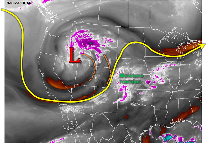
Roughly speaking, if you split the state with a southwest-to-northeast oriented line from Alamosa to Sterling, you could break down the forecast fairly well. To the west of the line, the forecast is for mainly dry conditions, aside from a few isolated showers over/near the higher terrain of the Front Range/Continental Divide/San Juan Mountains. On the other hand, along/east of the line will feature scattered strong-to-severe thunderstorms, capable of large hail, damaging winds, and even an isolated tornado or two. Specifically, this includes portions of the following regions: Northeast Plains, Palmer Ridge, Southeast Plains, Raton Ridge, and Southeast Mountains.
Even with the strong-to-severe thunderstorms expected, the flood threat remains low-end. This is due to a combination of expected storm motions and marginal moisture profiles (inverted-V). Better moisture is expected to be transported in from the southeast and into the Southeast Plains and Raton Ridge regions, thus the issuance of the low flood threat in those regions. For more details on timing and expected rain rates, please see the zone-specific forecast discussions below.
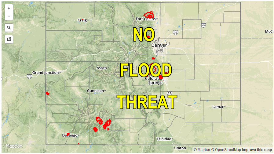
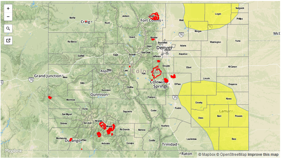
Today’s Flood Threat Map
For more information on today’s flood threat, see the map below (hover over threat areas for more details). For Zone-Specific forecasts, jump below the map.

Zone-Specific Forecasts
Northeast Plains, Urban Corridor, Palmer Ridge, Southeast Plains, and Raton Ridge:
Scattered showers/thunderstorms are expected across the Raton Ridge, Southeast Plains, Palmer Ridge, and eastern portions of the Northeast Plains. A few will be strong/severe, producing large hail, strong winds, and perhaps an isolated tornado or two. Elsewhere, including the Urban Corridor, dry conditions will prevail, minus an isolated shower or two near the higher terrain. Maximum rain rates will be as follows:
Urban Corridor: 0.1-0.2 inches/hour
Palmer Ridge: 0.2-0.5 inches/hour
Northeast Plains: 0.8-1.2 inches/hour
Southeast Plains and Raton Ridge: 1.0-1.5 inches/hour
Timing: Noon – 10 PM
Front Range and Southeast Mountains:
Isolated showers over the Front Range and isolated thunderstorms over the Southeast Mountains are expected this afternoon and evening. The best moisture will sit to the southeast of these areas, so heavy rain is not a threat. Maximum rain rates will be 0.1-0.2 inches/hour over the Front Range and 0.4-0.6 inches/hour over the Southeast Mountains. The majority of the regions will remain dry today.
Timing: Noon – 7 PM
Northern Mountains, Northwest Slope, Grand Valley, Central Mountains, San Juan Mountains, Southwest Slope, and San Luis Valley:
Mostly sunny and dry conditions will be the name of the weather game today across these regions. A few clouds will develop over the higher terrain, producing a few streaks of virga across the sky, and perhaps a light sprinkle or two along the Continental Divide and San Juan Mountains, but nothing more.