Issue Date: Thursday, September 15th, 2016
Issue Time: 9:30PM MDT
— Flooding is NOT expected today
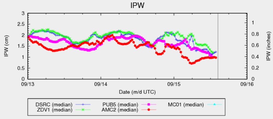
Today’s precipitable water (PW) chart, shown below for several Colorado stations, shows everything one needs to know about today’s heavy rainfall chances. PW has sharply fallen over the past 24 hours and is not expected to recover today. Thus, despite the presence of an upper-level trough to the west, the odds of heavy rainfall are slim to non-existent. Instead, we expect gusty winds and scattered showers with perhaps a thunderstorm mixed in especially over eastern areas.
Today’s Flood Threat Map
For more information on today’s flood threat, see the map below (hover over threat areas for more details). For Zone-Specific forecasts, scroll below the map.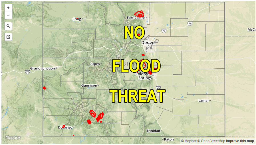

Zone-Specific Forecasts:
Southeast Plains, Northeast Plains, Palmer Ridge, Raton Ridge, Front Range, Urban Corridor, Southeast Mountains:
Mostly sunny early then partly cloudy with isolated showers and a weak thunderstorm possible from mid-afternoon to early evening. Max 1-hr rain rates up to 0.7 inches over far eastern areas, with up to 0.3 inches for everyone else. Gusty winds up to 55mph are possible even with the weak storms. Flooding is not expected today.
Primetime: 2PM to 7:30PM
San Juan Mountains, Southwest Slope, Grand Valley, Central Mountains, San Luis Valley, Northwest Slope, Northern Mountains:
Sunny early then partly cloudy with an isolated shower possible especially over the higher terrain closer to the Wyoming border. Max 1-hr rain rates up to 0.25 inches. Gusty winds will be possible over higher elevations through mid-afternoon. Flooding is not expected today.