Issue Date: Sunday, September 25th, 2016
Issue Time: 9:00AM MDT
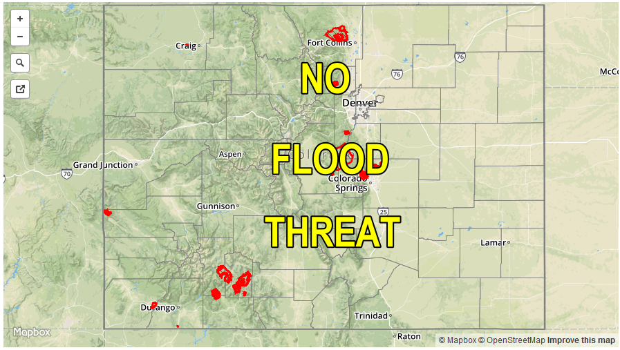
— Flooding is NOT expected today
As the water vapor image, below, shows the trough that has been in our weather discussion for about a week has moved east of Colorado. Interestingly and somewhat unexpectedly, a part of the disturbance broke off and is now spinning by itself near Baja California. This may increase subtropical moisture across the Southwest US in the coming days, but is not a factor today. Instead, Colorado will begin to be influenced by the rather strong ridge centered just west of California. This will promote downward motion and aside from a few boundary layer clouds today, it will be sunny across the state. In the low-levels, cool northerly flow will ensure at least one more day of slightly below normal temperatures. Neither precipitation nor flooding is expected today.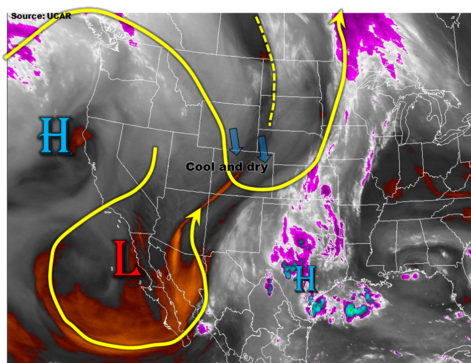
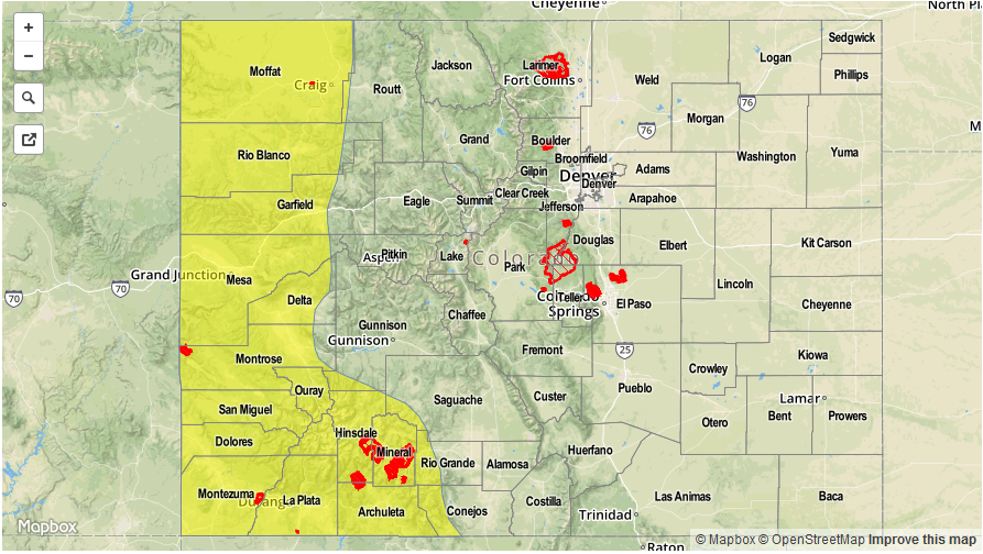
Today’s Flood Threat Map
For more information on today’s flood threat, see the map below (hover over threat areas for more details). For Zone-Specific forecasts, scroll below the map.


Zone-Specific Forecasts:
All Zones:
Mostly sunny early then partly cloudy and continued cool. High temperatures will continue to hover at or slightly below seasonal normal.