Issue Date: Saturday, September 24th, 2016
Issue Time: 8:50AM MDT
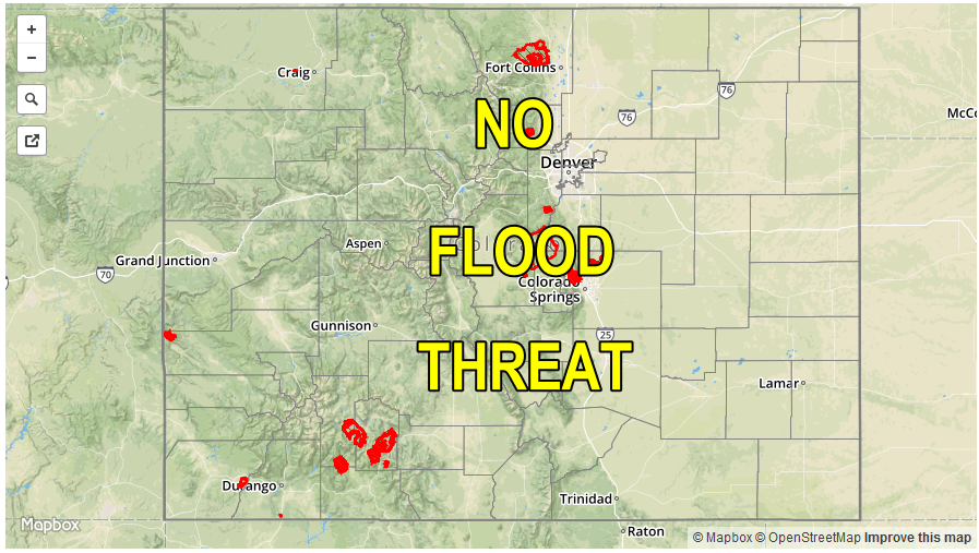
— Flooding is NOT expected today
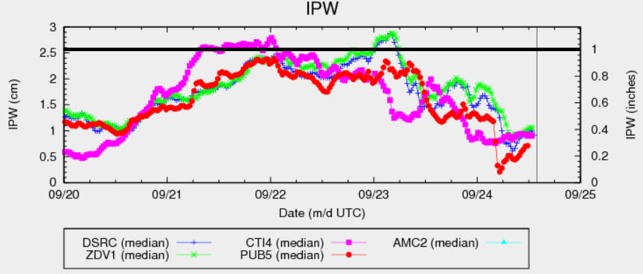
The strong upper-level trough finally entered Colorado overnight, bringing a slew of changes for many and unofficially signaling the start of fall. In terms of the today’s flood threat, this morning’s precipitable water (PW) chart, below, shows all one needs to know. Moisture, both mid and low-level, has plummeted statewide with PWs at all five stations that we typically use reading below 0.5 inches. Despite the presence of some dynamics overhead, without moisture there will be no threat of heavy rainfall today. Otherwise, expect windy conditions to slowly subside by late afternoon. Ongoing rain and high-elevation snow showers are expected to continue across the Northern Mountains, Central Mountains and Northwest Slope making it feel like winter. For every else, enjoy the first true taste of fall!
Today’s Flood Threat Map
For more information on today’s flood threat, see the map below (hover over threat areas for more details). For Zone-Specific forecasts, scroll below the map.

Zone-Specific Forecasts:
Southeast Plains, Northeast Plains, Palmer Ridge, Raton Ridge, Front Range, Urban Corridor, Southeast Mountains:
Mostly sunny and much cooler with gusty morning winds (especially over higher terrain) gradually subsiding by mid-afternoon. High temperatures will be up to 20F cooler than on Friday. A few isolated rain and snow showers will be possible in the higher elevations of the Front Range. Max 1-hr rainfall rates up to 0.15 inches.
San Juan Mountains, Southwest Slope, Grand Valley, Central Mountains, San Luis Valley, Northwest Slope, Northern Mountains:
Mostly cloudy skies with scattered rain and snow showers continuing through the day. Max 1-hr rain rates up to 0.3 inches possible, with max 24-hour precipitation totals up to 0.7 inches in favored west-facing locations of the Northern Mountains, Northwest Slope and Central Mountains. Morning snow level is around 9,000 feet and this will climb to about 10,000-10,500 feet through the day. Up to 7 inches of snowfall will be possible in the very highest elevations.