Issue Date: 5/11/2017
Issue Time: 10:05 AM
A MODERATE FLOOD THREAT IS FORECAST TODAY FOR PORTIONS OF THE SOUTHEAST PLAINS DUE TO RECENT RAINFALL.
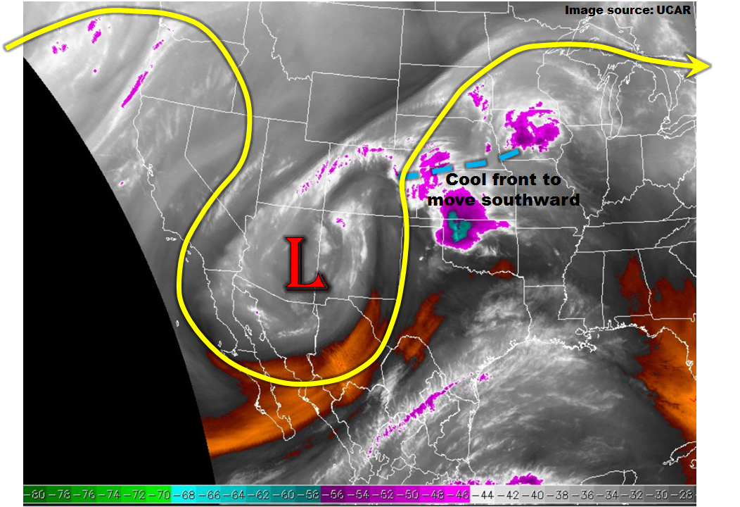
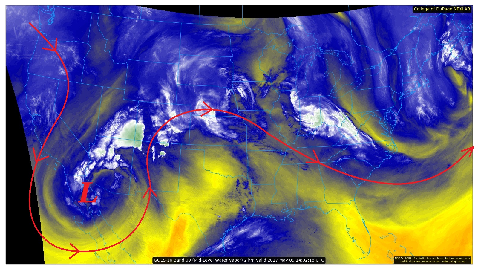
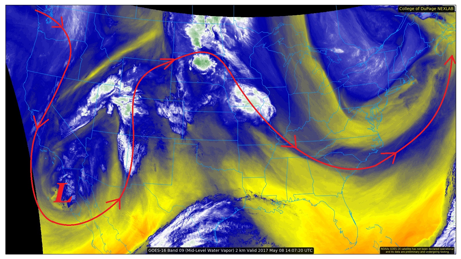
The upper-level low that has brought about an extended wet period to Colorado will finally exit to the east today. The corresponding surface low (denoted in the visible satellite image below) is already centered over western OK, with wrap-around precipitation remaining only over southeastern Colorado. The extensive cloud shield associated with this low will exit as the morning turns to afternoon, leaving behind mostly sunny skies for much of the state by this evening. The showers currently ongoing across southeastern Colorado are light, and are not expected to produce any additional flooding issues. Ongoing flooding issues across portions of the Southeast Plains will continue through the period, and are outlined on the flood threat map below.
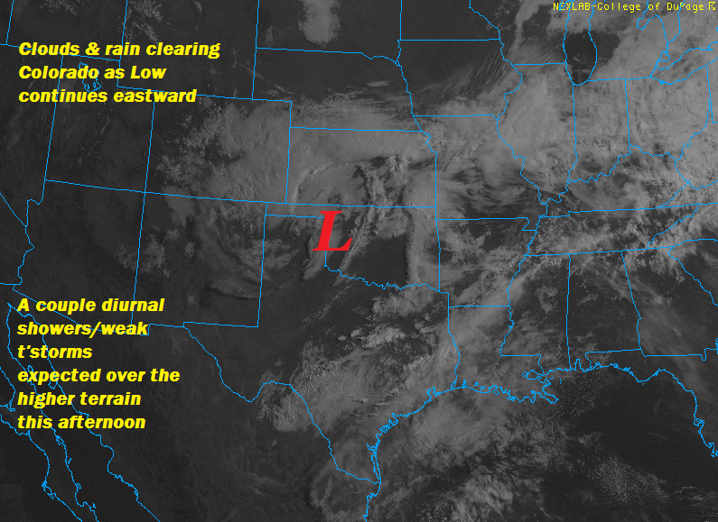
A few showers, and a weak thunderstorm or two, are expected across the High Country today, focused mainly south of I-70, as daytime heating plays on residual moisture. Generally speaking, this activity will be sporadic and garden-variety, with light rain and gusty winds the main threats. For more information on timing and rain rates, please see the zone-specific forecast discussions below.
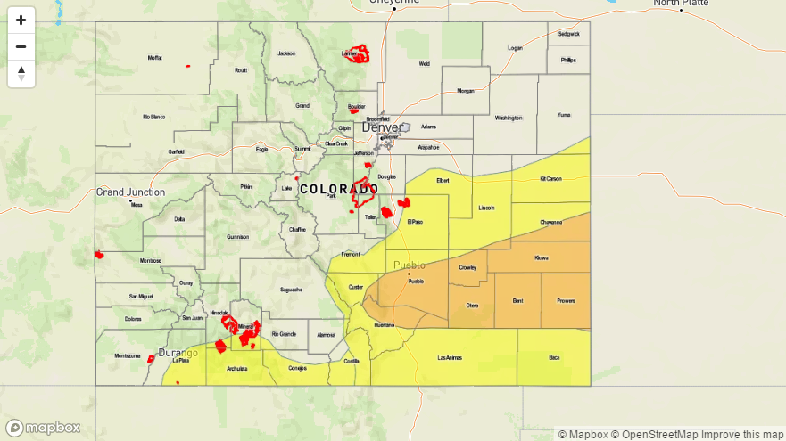
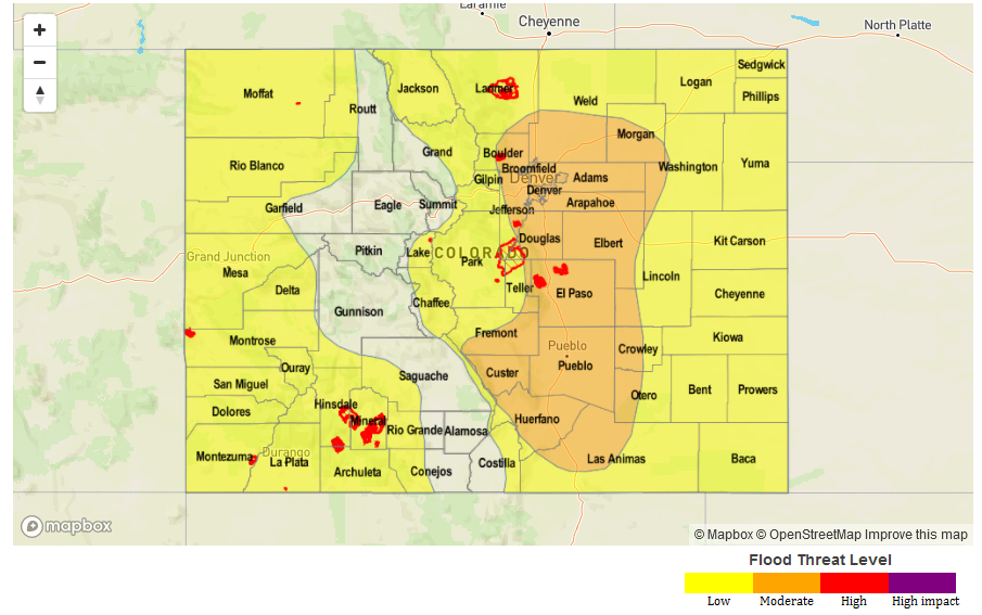
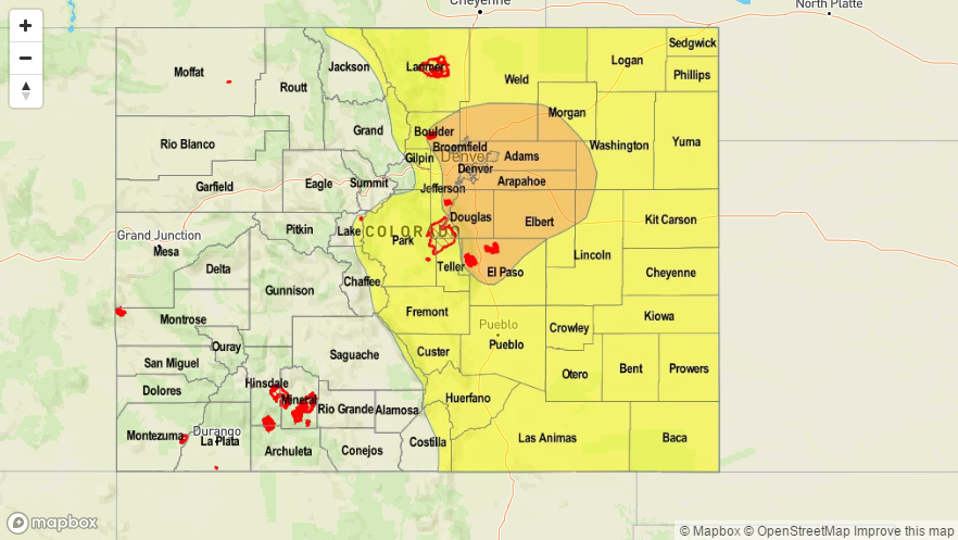
Today’s Flood Threat Map
For more information on today’s flood threat, see the map below (hover over threat areas for more details). For Zone-Specific forecasts, jump below the map.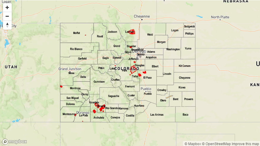

Zone-Specific Forecasts
Urban Corridor, Palmer Ridge, Northeast Plains, Southeast Plains, and Raton Ridge:
Clouds and precipitation will clear from the area with time, eventually resulting in partly cloudy-to-mostly sunny skies and dry conditions by later this afternoon/evening. The skies will clear from north to south, so the Raton Ridge and Southeast Plains will hold onto the cloud cover the longest. The light showers ongoing across the Southeast Plains will exit the state by around lunchtime (or soon after). Near the mountains, a sprinkle or two may be felt this afternoon as showers pop up over the higher terrain.
Front Range, Northern Mountains, Northwest Slope, Central Mountains, Southeast Mountains, San Juan Mountains, San Luis Valley, Southwest Slope, and Grand Valley:
A few sporadic showers/weak thunderstorms are expected to develop this afternoon/evening across the higher terrain as daytime heating plays on residual moisture. No significant precipitation is expected, and no flood threat is warranted. Maximum rain rates will be 0.05-0.15 inches/hour.
Timing: 1 PM – 9 PM