Issue Date: 5/9/2017
Issue Time: 9:40 AM
A MODERATE FLOOD THREAT IS FORECAST TODAY FOR PORTIONS OF THE RATON RIDGE, SOUTHEAST MOUNTAINS, FRONT RANGE, URBAN CORRIDOR, PALMER RIDGE, SOUTHEAST PLAINS, AND NORTHEAST PLAINS.
A LOW FLOOD THREAT IS FORECAST TODAY FOR SURROUNDING AREAS, INCLUDING PORTIONS OF THE NORTHERN MOUNTAINS, AND CENTRAL MOUNTAINS.
A LOW FLOOD THREAT IS ALSO FORECAST FOR PORTIONS OF THE NORTHWEST SLOPE, GRAND VALLEY, SOUTHWEST SLOPE, AND SAN JUAN MOUNTAINS.
The upper-level low will continue to linger to the southwest of Colorado, becoming centered over southeastern AZ by tonight. This will allow the anomalous influx of moisture into Colorado to continue, resulting in a second-consecutive day of a moderate flood threat. According to this morning’s soundings from Denver and Grand Junction, precipitable water is in the 90th and 75th percentiles, respectively, for the date. This moisture, combined with large-scale support and sufficient instability/wind shear, will result in scattered showers and thunderstorms, where a few will be strong-to-severe.
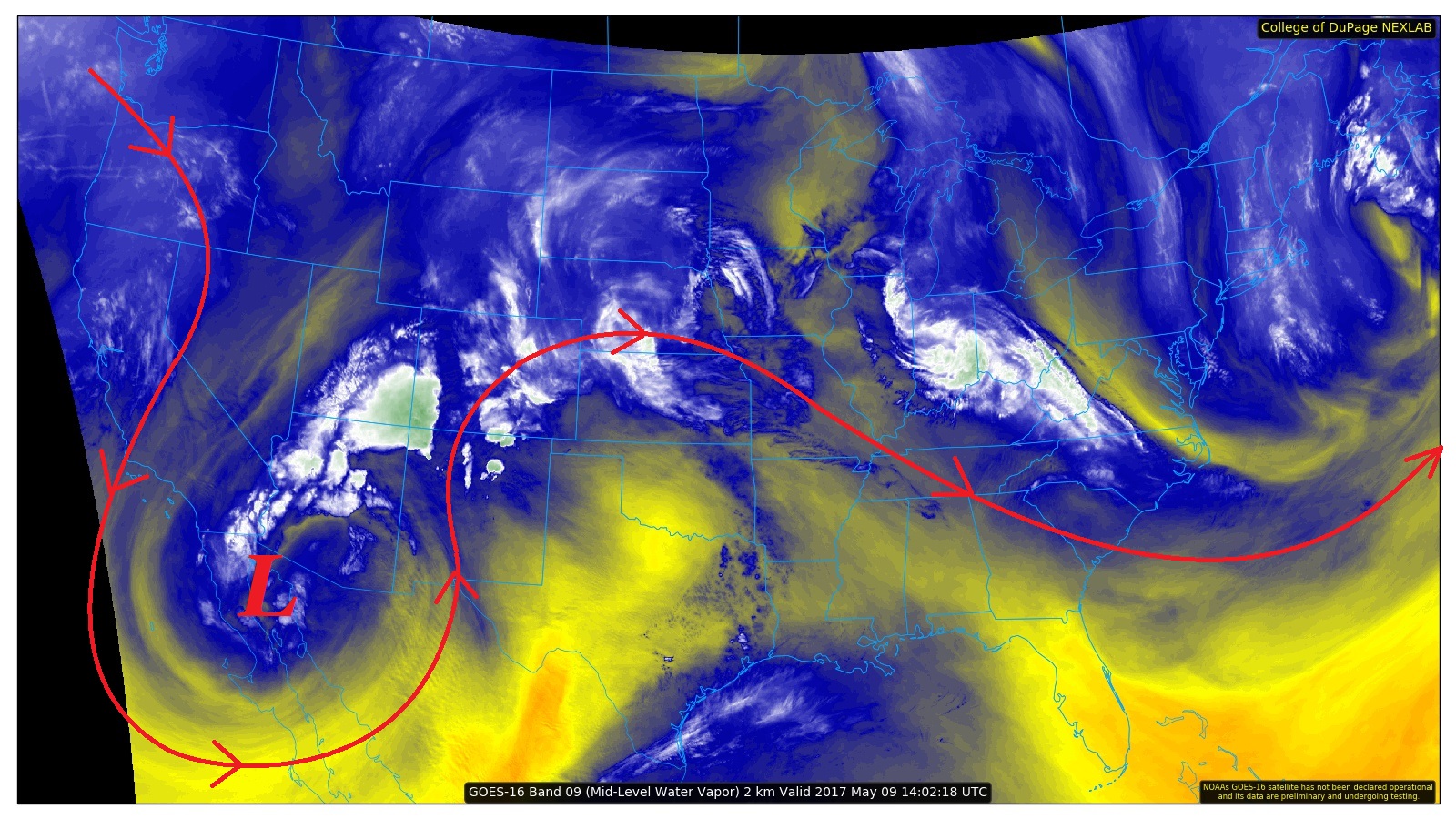
Much of the state is expected to get in on the action today, with the strongest storms expected east of the Continental Divide. Severe thunderstorms will be capable of heavy rain, strong winds, hail up to 1.5 inches in diameter, and a couple tornadoes. West of the Continental Divide, the main focus will be on periods of lingering moderate rainfall that may result in minor flooding issues. For more details, please see the region-specific forecast discussions below.
Today’s Flood Threat Map
For more information on today’s flood threat, see the map below (hover over threat areas for more details). For Zone-Specific forecasts, jump below the map.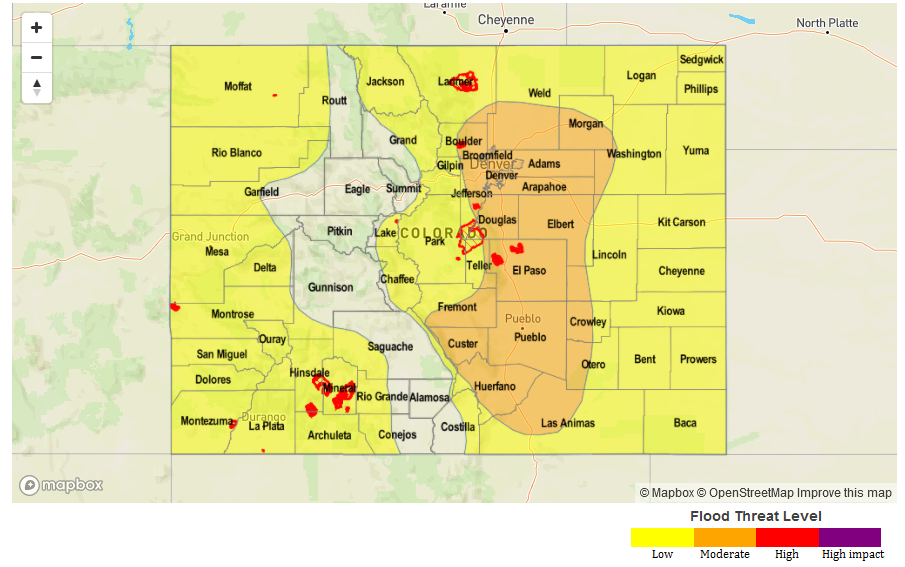 Zone-Specific Forecasts
Front Range, Southeast Mountains, Urban Corridor, Palmer Ridge, Northeast Plains, Southeast Plains, and Raton Ridge:
Scattered showers and thunderstorms are expected today. A few of the thunderstorms will become severe. Threats from severe storms will be heavy rain, strong winds, hail up to 1.5 inches in diameter, and a couple tornadoes. Maximum rain rates are as follows:
Front Range and Southeast Mountains: 0.8-1.2 inches/hour
Urban Corridor, Palmer Ridge, and Raton Ridge: 1.0-1.4 inches/hour
Northeast Plains and Southeast Plains: 1.5-2.0 inches/hour
Timing: Ongoing – Midnight, with lingering showers/thunderstorms into the morning hours tomorrow.
Northern Mountains, San Juan Mountains, Central Mountains, and San Luis Valley, Northwest Slope, Southwest Slope, and Grand Valley:
Scattered showers and thunderstorms are expected today. With the amount of anomalous moisture in the environment, efficient rainfall production from showers and thunderstorms is expected. A few thunderstorms will bring periods of heavy rain to the tune of 1.0-1.2 inches/hour, thus the low flood threat.
Timing: Ongoing – Midnight, with lingering showers/a few thunderstorms into the morning hours tomorrow.