Issue Date: 5/15/2017
Issue Time: 9:20 AM
A MODERATE FLOOD THREAT IS FORECAST TODAY FOR A PORTION OF THE ARKANSAS AND PURGATOIRE RIVERS DUE TO CONTINUED FLOODING FROM RECENT HEAVY RAINFALL.
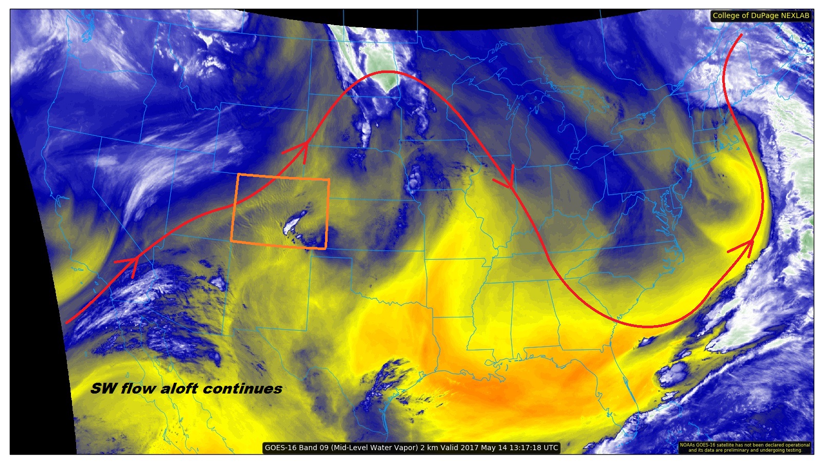
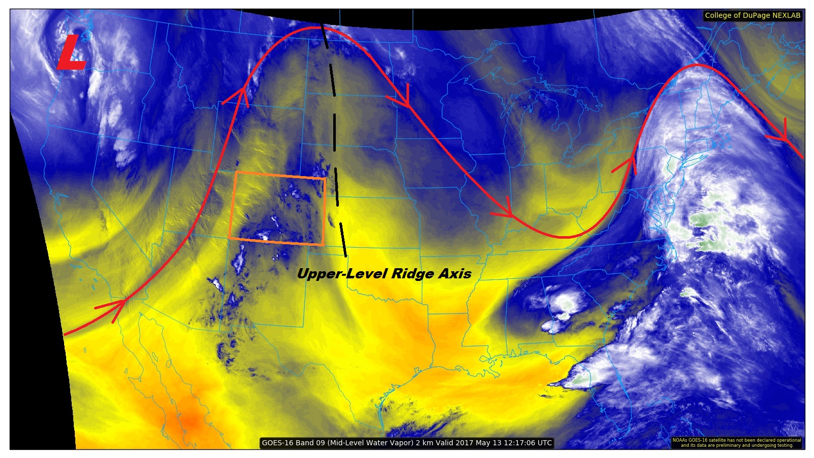
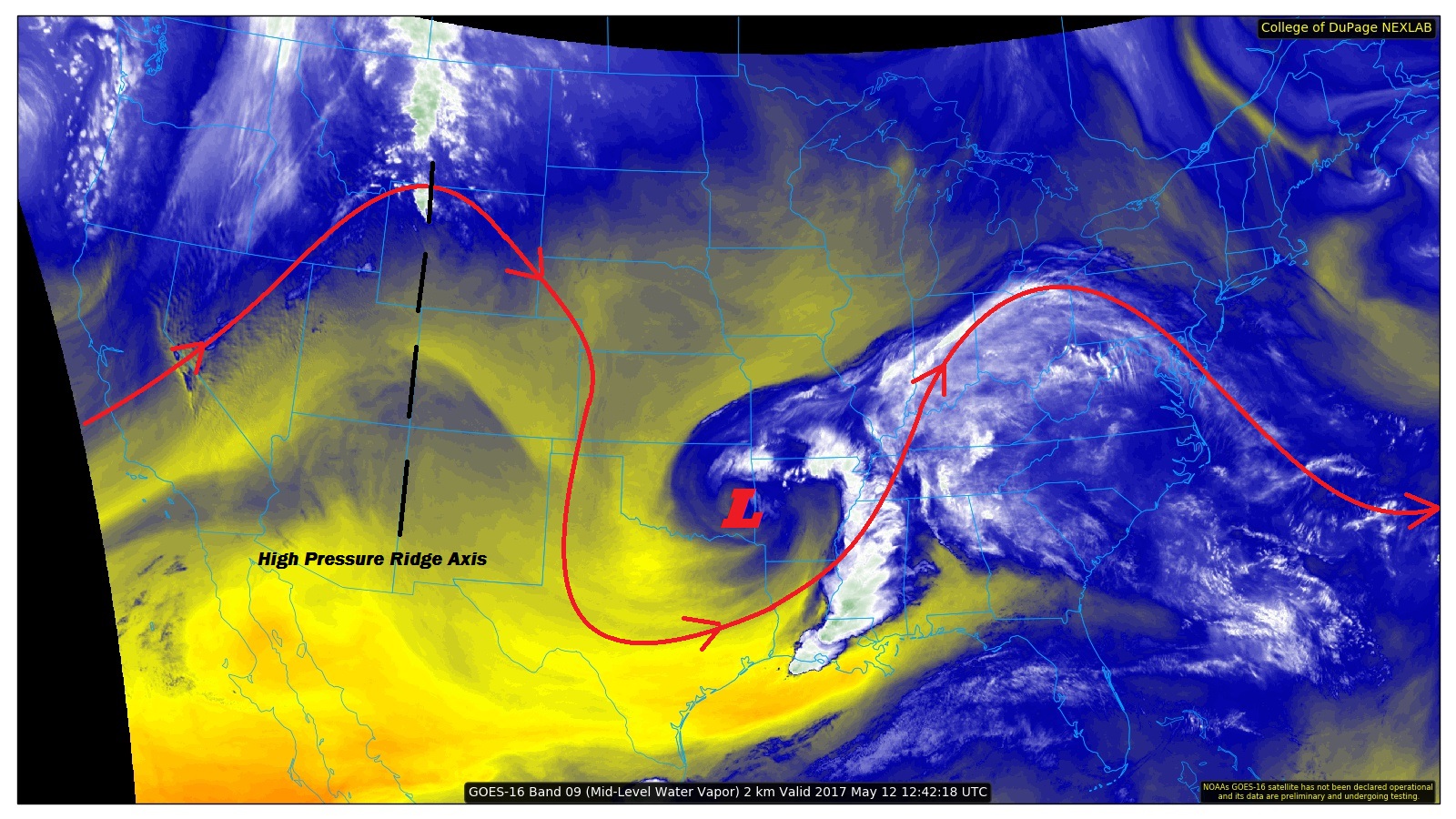
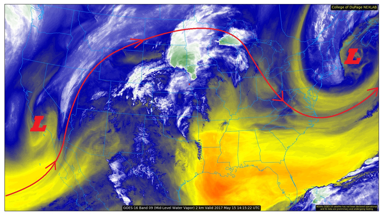
The upper trough will continue to dig along the West Coast today, placing the upper-level low over Southern California/Nevada today/tonight. Due to this, warm, southwest flow aloft will continue today, pushing temperatures above yesterday’s readings. Additionally, a bit of upper-level moisture will stream across the state, bringing a few extra high clouds for this afternoon and evening.
All is not clear, however, as a couple showers and thunderstorms are expected in a two areas. First, the Northern Mountains, and northern portions of the Front Range and foothills will notice a few isolated showers this afternoon/evening as a sufficient-enough moisture surge pushes through. These showers will be fighting very dry low-level air, so nothing more than a few sprinkles and gusty outflow winds are expected.
Second, a lee surface trough/dryline will lie across far eastern portions of the Eastern Plains and Northeast Plains. Along this boundary, a couple thunderstorms are expected to develop this afternoon/evening and quickly move eastward into Kansas. Brief periods of heavy rainfall will attend these storms, with strong winds, lightning, and hail up to 1.5 inches in diameter the main impacts. No flooding is expected due to quick storm motions. For more information regarding rain rates and timing, please see the zone-specific forecast discussions below.
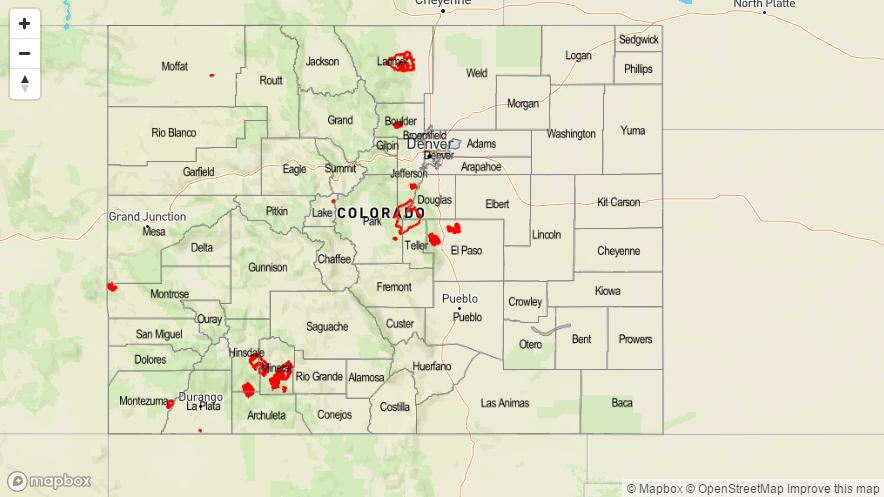
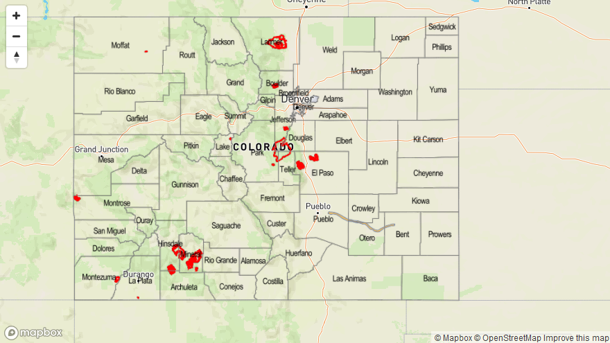
Today’s Flood Threat Map
For more information on today’s flood threat, see the map below (hover over threat areas for more details). For Zone-Specific forecasts, jump below the map.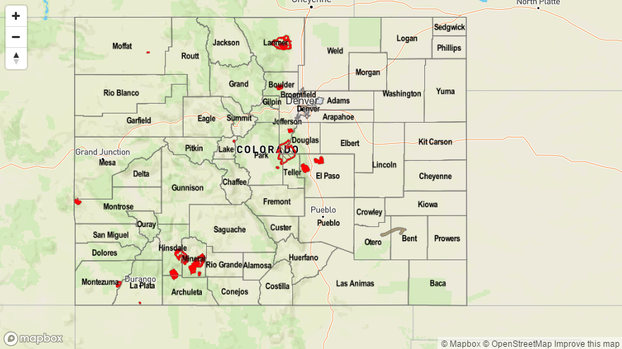

Zone-Specific Forecasts
Urban Corridor, Palmer Ridge, Northeast Plains, Southeast Plains, and Raton Ridge:
Mostly sunny skies are expected today with temperatures a few degrees warmer than yesterday’s readings. Far eastern portions of the Northeast and Southeast Plains will experience a couple thunderstorms this afternoon/evening before they race out of Colorado to the east. Maximum rain rates underneath thunderstorms will be 0.3-0.6 inches/hour.
Timing: 2 PM – 8 PM
Front Range and Northern Mountains:
Mostly sunny skies and dry conditions will be the story for the majority of the area. However, a couple of isolated showers are expected to develop late this afternoon and into the evening over the higher terrain. Gusty winds and a few sprinkles will be the only result.
Timing: 4 PM – Midnight
Northwest Slope, Central Mountains, Southeast Mountains, San Juan Mountains, San Luis Valley, Southwest Slope, and Grand Valley:
Mostly sunny skies and dry conditions are the story today, with increasing high clouds late this afternoon/evening. Fire danger is elevated today due to gusty winds and very little moisture, so be careful with anything that may start a fire today.