Issue Date: 5/12/2017
Issue Time: 8:27 AM
A MODERATE FLOOD THREAT IS FORECAST TODAY FOR A PORTION OF THE ARKANSAS RIVER DUE TO CONTINUED FLOODING FROM RECENT HEAVY RAINFALL.
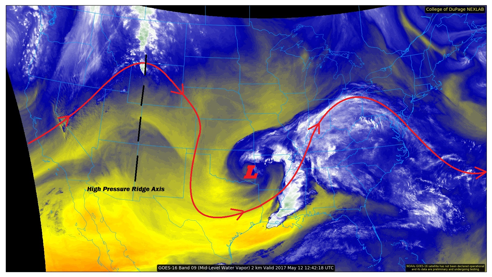
The water vapor image below shows a favorable pattern for a beautiful end to the work week here in Colorado. A high pressure ridge will slide across the state today, resulting in plenty of sunshine and above normal high temperatures for eastern Colorado and lower elevations of western Colorado.
Over the high country, in addition to the above normal temperatures, a few isolated-to-widely scattered showers and thunderstorms are expected. This is due to the combination of orographic effects, daytime heating, and residual moisture. Any rainfall, though, is expected to be light due to limited available moisture.
Today’s Flood Threat Map
For more information on today’s flood threat, see the map below (hover over threat areas for more details). For Zone-Specific forecasts, jump below the map.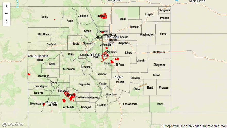

Zone-Specific Forecasts
Urban Corridor, Palmer Ridge, Northeast Plains, Southeast Plains, and Raton Ridge:
Mostly sunny skies with above average high temperatures will close out the work week across these regions. Due to the approach of the next low pressure system across the Pacific Northwest, gusty southerly winds are expected later this afternoon through tonight.
Front Range, Northern Mountains, Northwest Slope, Central Mountains, Southeast Mountains, San Juan Mountains, San Luis Valley, Southwest Slope, and Grand Valley:
Mostly sunny skies and above average temperatures will be the main story today. A few isolated-to-widely scattered showers/thunderstorms will interrupt the otherwise fantastic mid-May day across the high country. All rainfall is expected to be light, with gusty winds being the main impact. Rain rates will be less than 0.2 inches/hour.
Timing: 2 PM – 9 PM