Issue Date: 5/13/2017
Issue Time: 8:20 AM
A MODERATE FLOOD THREAT IS FORECAST TODAY FOR A PORTION OF THE ARKANSAS RIVER DUE TO CONTINUED FLOODING FROM RECENT HEAVY RAINFALL.
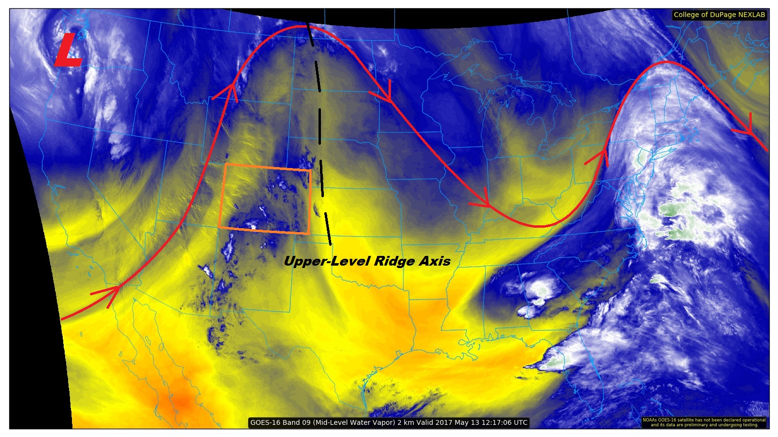
The upper-level ridge axis has slid to the east of Colorado, as evidenced on the water vapor image below. Due to this, southwesterly flow aloft has returned to the state, and within it, a weak disturbance is poised to rotate across the state today. Moisture will still be limited, especially in the lower levels of the atmosphere, so heavy rainfall is not expected. Instead, any of the showers/thunderstorms that do form will be high-based and produce very little rainfall at the surface. Coverage will be isolated-to-widely scattered, with activity beginning over the mountains and moving over the adjacent plains with time. Gusty outflow winds and lightning will be the main threats. Aside from the showers/thunderstorms, today’s high temperatures will be above average once again.
Today’s Flood Threat Map
For more information on today’s flood threat, see the map below (hover over threat areas for more details). For Zone-Specific forecasts, jump below the map.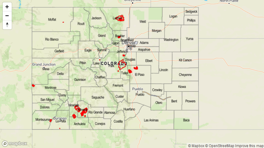

Zone-Specific Forecasts
Urban Corridor, Palmer Ridge, Northeast Plains, Southeast Plains, and Raton Ridge:
Mostly sunny skies will dominate the weather today, with high temperatures climbing 10-15 degrees above normal. A few high-based showers/thunderstorms are expected to move over the adjacent lower elevations from the mountains, bringing gusty winds and very little rainfall. Maximum rain rates will be 0.1-0.2 inches/hour.
Timing: 3 PM – 10 PM
Front Range, Southeast Mountains, Northern Mountains, Northwest Slope, Central Mountains, Grand Valley, San Juan Mountains, San Luis Valley, and Southwest Slope:
Mostly sunny skies and above average temperatures will be the main weather story today. A few isolated-to-widely scattered are expected this afternoon/evening, with the main impacts of gusty winds and some cloud-to-ground lightning. Limited moisture means very little rainfall is expected, with maximum rain rates of 0.1-0.2 inches/hour.
Timing: 2 PM – 10 PM, with one or two lingering showers until around midnight