Issue Date: 5/14/2017
Issue Time: 8:15 AM
A MODERATE FLOOD THREAT IS FORECAST TODAY FOR A PORTION OF THE ARKANSAS RIVER DUE TO CONTINUED FLOODING FROM RECENT HEAVY RAINFALL.
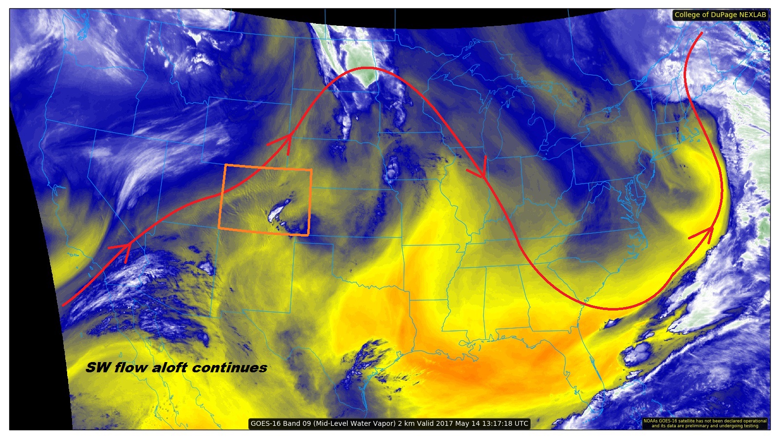
Warm and mainly dry southwesterly flow aloft continues today across Colorado, as noted in the water vapor image below. This will result in another day of dry conditions across most of the state, with the exception being portions of the Front Range, Urban Corridor, Northeast Plains, Southeast Plains, and Raton Ridge. A few factors will be at play, including: 1) the transport of low-level moisture back into the northern Front Range and foothills, 2) a surface front across northeast Colorado providing favorable wind shear/convergence, and 3) some southeast flow pulling moisture back into far eastern Colorado. Moisture will still remain shallow for these storms, which will limit the heavy rainfall potential, and thus, no flood threat is warranted. However, one or two of the storms will be on the strong-to-severe side, with the main impacts being strong winds and hail. For more information, regarding rain rates and timing, please see the zone-specific forecast discussions below.
Today’s Flood Threat Map
For more information on today’s flood threat, see the map below (hover over threat areas for more details). For Zone-Specific forecasts, jump below the map.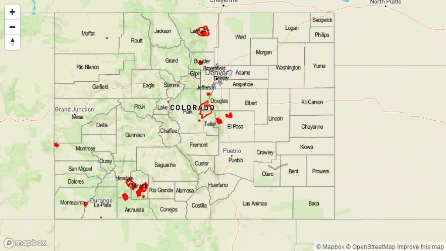

Zone-Specific Forecasts
Front Range, Urban Corridor, Palmer Ridge, Northeast Plains, Southeast Plains, and Raton Ridge:
Mostly sunny and dry for the majority of these regions today, with high temperatures just a few degrees cooler than yesterday. Only a couple showers/thunderstorms are expected, across northern portions of the Front Range, Urban Corridor, and Northeast Plains, and eastern portions of the Northeast Plains, Southeast Plains, and Raton Ridge. Heavy rainfall is not expected, with maximum rain rates in the 0.25-0.50 inches/hour range.
Timing: 3 PM – Midnight
Southeast Mountains, Northern Mountains, Northwest Slope, Central Mountains, Grand Valley, San Juan Mountains, San Luis Valley, and Southwest Slope:
Mostly sunny and dry conditions will be the name of the weather game today, with highs just a few degrees cooler than yesterday’s readings. Clouds will increase a bit during the afternoon over the higher terrain, but no rainfall is expected.