Issue Date: Friday, May 19th, 2017
Issue Time: 8:45AM MDT
— Flooding is NOT expected today
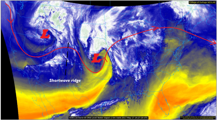
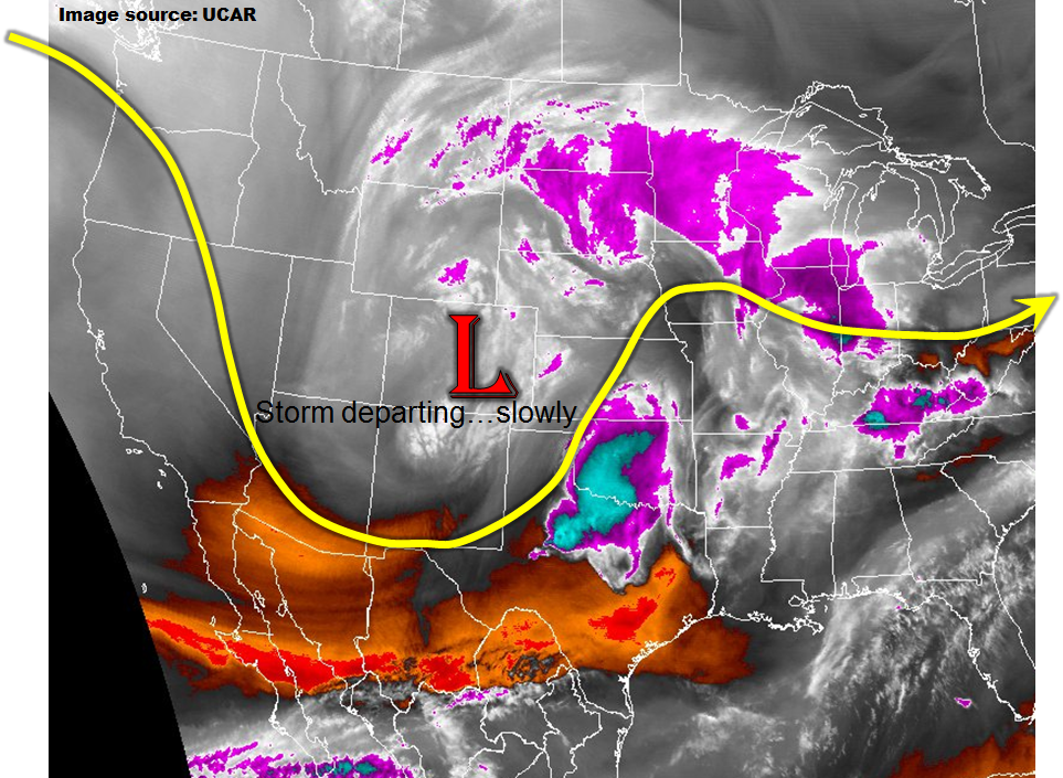
The impressive late season snowstorm that affected our entire state on Thursday will weaken and continue to trek eastward today. The water vapor image below shows that it is positioned across eastern Colorado as of this morning; by this evening, it will move into western Kansas. Most of eastern Colorado will continue to be under its influence today with numerous showers and perhaps a weak thunderstorm likely. However, with little to no instability and weaker dynamics, precipitation intensities will be lower than yesterday. Nonetheless, a few places along the Kansas and Nebraska borders may pick up over 1 inch of rainfall but distributed over many hours. Thus, we do not expect a flash flooding threat today.
Yesterday’s large precipitation totals have caused many creeks, streams and even larger rivers such as the South Platte and Arkansas to swell. Fortunately, this morning’s analysis indicates that all river crests over the next 24-48 hours are expected to stay below the Minor flood stage level. Thus, we do not expect substantial riverine flooding though low lying and poorly drained areas in the Front Range may continue to have standing water for the next day or two.
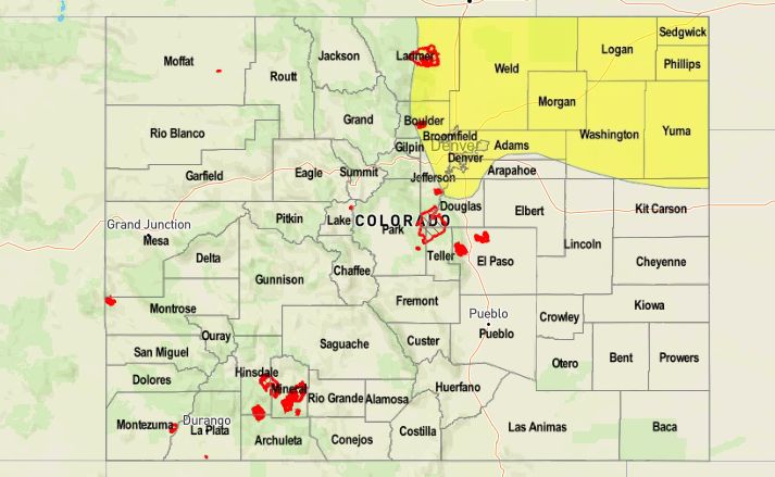
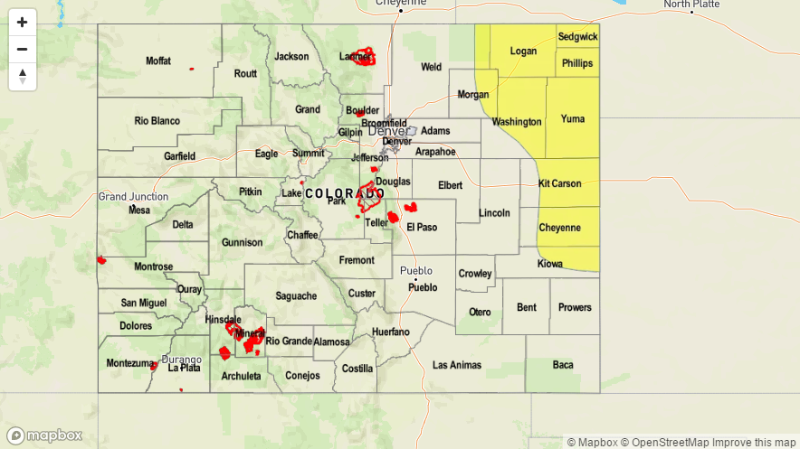
Today’s Flood Threat Map
For more information on today’s flood threat, see the map below (hover over threat areas for more details). For Zone-Specific forecasts, scroll below the map.

Zone-Specific Forecasts:
Northeast Plains, Southeast Plains, Palmer Ridge:
Overcast skies with numerous showers and perhaps a weak thunderstorm continuing throughout the day. Max 1-hour rainfall up to 0.8 inches (especially far east areas). Max 24-hour rainfall up to 1.3 inches. The strongest storms in the far southeast part of the state could produce hail up to 0.75 inches. The South Platte and Arkansas rivers will remain elevated from yesterday’s precipitation and today’s additional activity. However, all river crests are expected to remain below Minor flood stage. Flash flooding is also not expected today.
Primetime: 11AM to 9PM
Front Range, Urban Corridor, Raton Ridge, Southeast Mountains:
Mostly cloudy early then a few breaks in the clouds by late afternoon, with continued much below normal temperatures. Max 1-hour rainfall up to 0.4 inches possible with max 24-hour rainfall up to 0.7 inches. Flooding is not expected today.
Primetime: 11AM to 5PM
San Juan Mountains, Southwest Slope, Grand Valley, San Luis Valley, Northwest Slope, Northern Mountains, Central Mountains:
Mostly cloudy early then gradual clearing the afternoon, with warmer temperatures compared to yesterday. Isolated to scattered showers (higher elevation snow; snow level 8,000 feet rising to 10,000 feet by late afternoon) are possible especially in the morning through early afternoon. Max 1-hour rainfall up to 0.25 inches. Flooding is not expected today.
Primetime: 11AM to 3PM