Issue Date: Thursday, June 8th, 2017
Issue Time: 8:40AM MDT
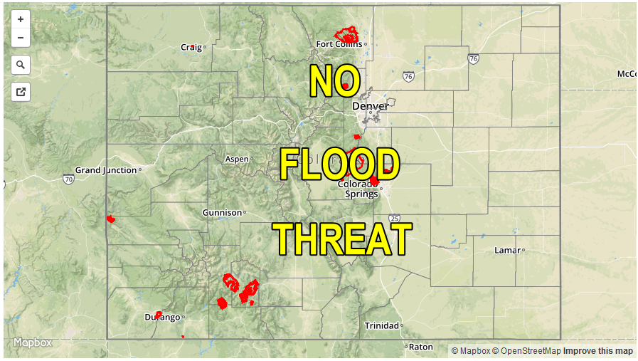
— Flooding is NOT expected today
— Multi-day period of elevated fire danger begins today for western Colorado
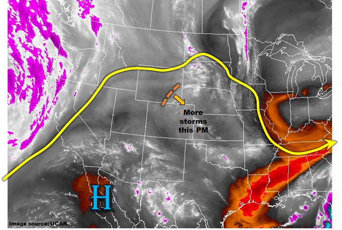
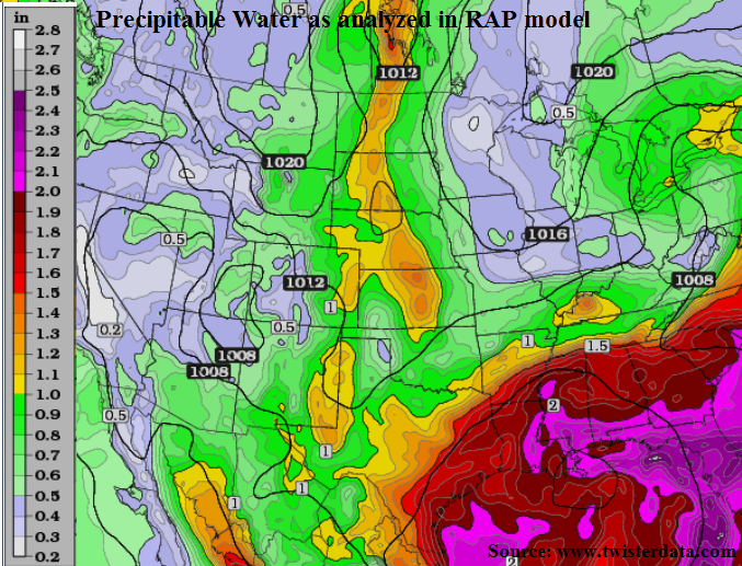
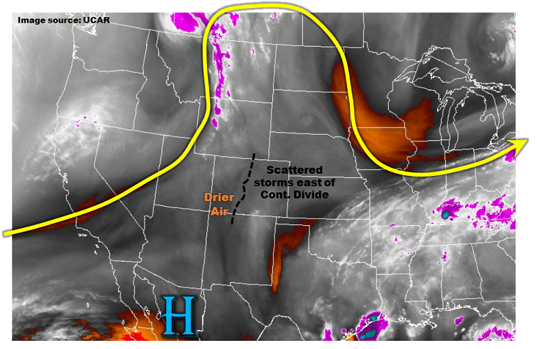
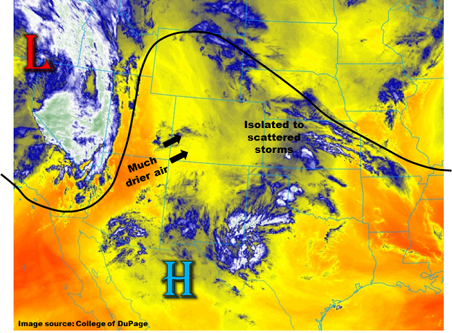
Much drier air is on its way into Colorado, as can be seen by the GOES-16 “Low-level water vapor” imagery shown below. While this morning’s Denver sounding still showed 0.71 inches of Precipitable Water, farther west Flagstaff had a reading of 0.14 inches and Salt Lake City with 0.20 inches. This air will make it to western Colorado by late afternoon, removing all chances for rainfall. Farther east on the other side of the Continental Divide, some drying will take place, but the diurnal lee-side trough will cause light easterly low-level flow that will continue to transport (or at least maintain) elevated moisture levels across the region. Thus, in the Northeast and Southeast Plains, isolated to scattered thunderstorms will be seen once again. However, with lower available moisture and faster steering winds, we expect localized pockets of heavy rainfall but without a flood threat.
Severe weather will be possible towards the Kansas/Nebraska border with large hail up to 1.5 inches being the main impact.
Across the western part of the state, a multi-day period of elevated fire danger will begin later this afternoon. Stay tuned to local National Weather Service products for more detailed information.
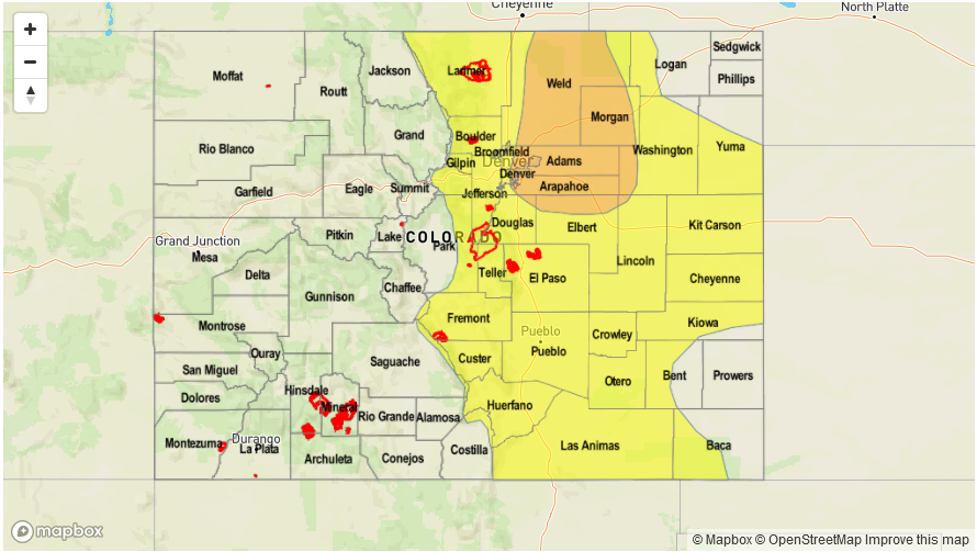
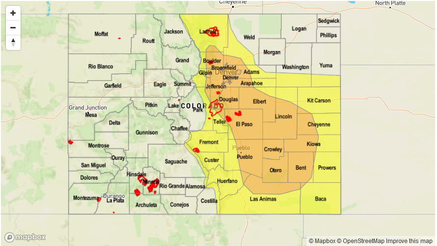
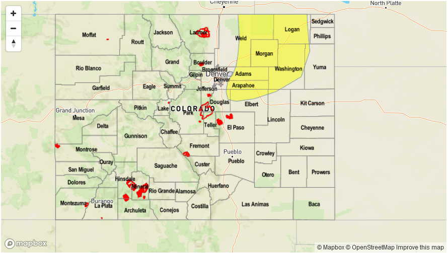
Today’s Flood Threat Map
For more information on today’s flood threat, see the map below (hover over threat areas for more details). For Zone-Specific forecasts, scroll below the map.
Zone-Specific Forecasts:
Front Range, Urban Corridor, Palmer Ridge, Raton Ridge, Southeast Mountains, Northeast Plains, Southeast Plains:
Mostly clear this morning then partly cloudy with isolated to scattered showers and thunderstorms by early afternoon. Storms will form over the higher terrain first, then move into lower elevations. Highest coverage will be in the foothills as well as farther east towards the KS/NE borders. Max 1-hour rainfall up to 0.8 inches towards the foothills, and up to 1.2 inches in the Northeast Plains and Southeast Plains. Hail up to 1.5 inches could accompany the strongest cells. Flooding is NOT expected today.
Primetime: 1PM to 8PM
Grand Valley, Northwest Slope, Northern Mountains, Central Mountains, Southwest Slope, San Juan Mountains, San Luis Valley:
Mostly sunny and continued warm today with gusty winds developing later in the afternoon especially towards the Utah border. Stay tuned to local National Weather Service forecasts for more detailed information.