Issue Date: Monday, June 5th, 2017
Issue Time: 9:48AM MDT
— LOW flood threat for parts of Urban Corridor and Northeast Plains
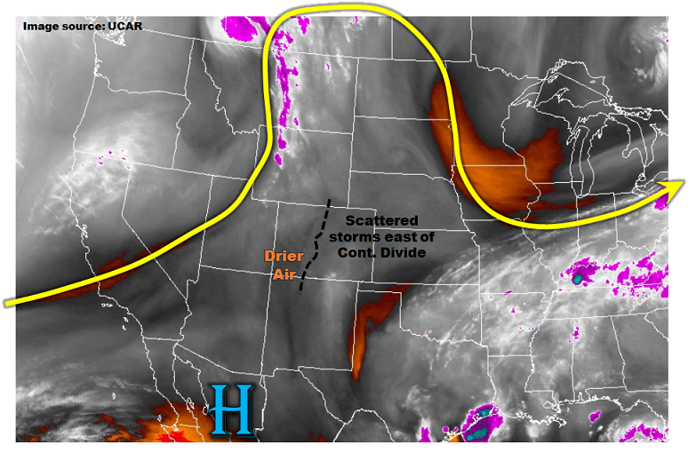
Colorado is positioned underneath a weak ridge centered over northwest Mexico, with an axis extending northward through the Canadian border. It is a tale of two atmospheres today. To the west of the Continental Divide, precipitable water (PW) values are in the 0.4 – 0.6 inch range, and only isolated showers and a weak storm are expected. Instead, hot weather will continue to be the story. To the east, morning PW values are in the 0.7 to 0.9 inch range and are expected to slowly increase as moist easterly flow is established with the afternoon development of a lee-side trough. Instability up to 1,800 J/kg will develop this afternoon in the foothills and western parts of the plains. In addition, very steep lapse rates up to 8C/km were noted across east-central Colorado, supportive of deep moist convection. Scattered storms are likely east of the Continental Divide, generally being limited to within 100-150 miles of the foothills. In terms of heavy rainfall potential, storms will be slow moving, with expected SSE motions of 15-20 mph. But acting against heavy rainfall will be weak shear, implying mostly “pulse” storms that will not be able to last long over any given locale. In all, a Low flood threat is warranted for parts of northeast Colorado for this afternoon and evening for isolated flash flooding. Hail up to 1.5 inches is possible with the strongest storms. Elsewhere in eastern Colorado expect a few heavy downpours, but not enough rain to warrant a flood threat.
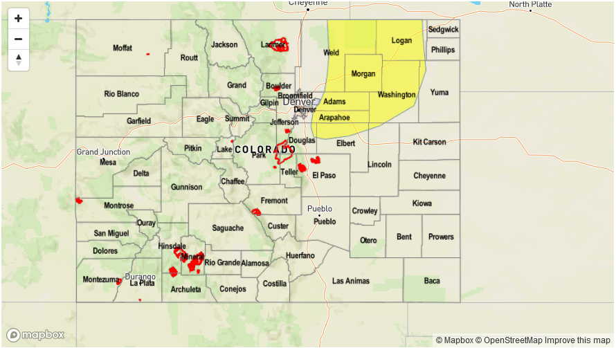
Today’s Flood Threat Map
For more information on today’s flood threat, see the map below (hover over threat areas for more details). For Zone-Specific forecasts, scroll below the map.

Zone-Specific Forecasts:
Front Range, Urban Corridor, Palmer Ridge, Raton Ridge, Southeast Mountains, Northeast Plains, Southeast Plains:
Mostly clear this morning then partly to mostly cloudy with scattered showers and thunderstorms developing shortly before noon. Storms will form over the higher terrain first, then move into lower elevations. Highest coverage will be in the foothills above 6,000 feet, but also in parts of the Northeast Plains. Max 1-hour rainfall up to 0.7 inches for most locations, but up to 1.5 inches for parts of the Northeast Plains where the highest instability and most favorable dynamics will be. A Low flood threat has been posted for parts of the region for isolated flash flooding.
Primetime: 11:30PM to 8PM
Grand Valley, Northwest Slope, Northern Mountains, Central Mountains, Southwest Slope, San Juan Mountains, San Luis Valley:
Sunny this morning then becoming partly cloudy with isolated showers and a weak thunderstorms developing by early afternoon over the higher elevations. Max 1-hour rainfall up to 0.5 inches. Flooding is not expected today.
Primetime: 11AM to 7PM