Issue Date: Monday, July 10, 2017
Issue Time: 09:45AM MDT
—Flooding is NOT expected today
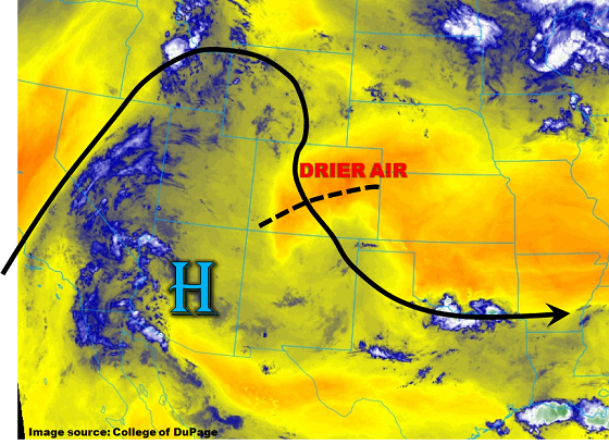
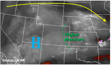
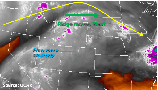
The upper level ridge shifts more to the east today while also becoming more zonal this afternoon. This westerly flow will allow a bit more mid-level moisture to build up over the high country west of the Continental Divide. Some embedded vorticitiy maximums in the zonal flow aloft will help produce a little extra lift over the northern portion of the state. Storms will develop with upslope flow early this afternoon over the higher terrain and should be more widespread in coverage than yesterday. Precipitable water values at Denver and Grand Junction this morning were 0.69 inches and 0.84 inches, respectively. Moisture is only expected to increase a little throughout the day, so all storms that form will have hourly precipitation rates under flood threat criteria with the main threat being small hail and gusty winds. Over the NE corner of the state, a weak cold front will set up this afternoon. This could help support some isolated severe weather in the Northeast Plains. These isolated storms could produce hail up to 1 inch diameter, wind gusts up to 60 mph and 1-hour rain rates up to 1 inch.
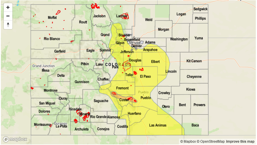
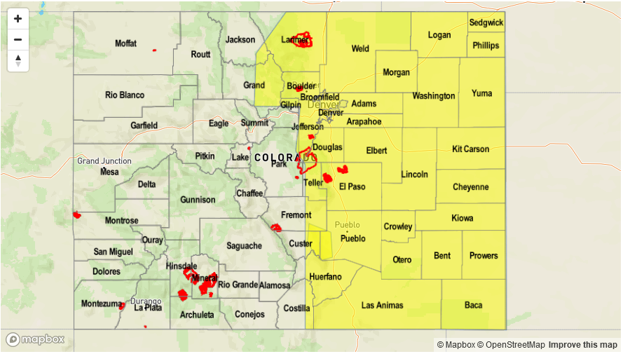
Today’s Flood Threat Map
For more information on today’s flood threat, see the map below (hover over threat areas for more details). For Zone-Specific forecasts, scroll below the map.
Zone-Specific Forecasts:
Northwest Slope, Northern Mountains, Front Range, Central Mountains, Urban Corridor, Palmer Ridge Northeast Plains, Grand Valley, San Juan Mountains, Southwest Slope, San Luis Valley, Southeast Mountains:
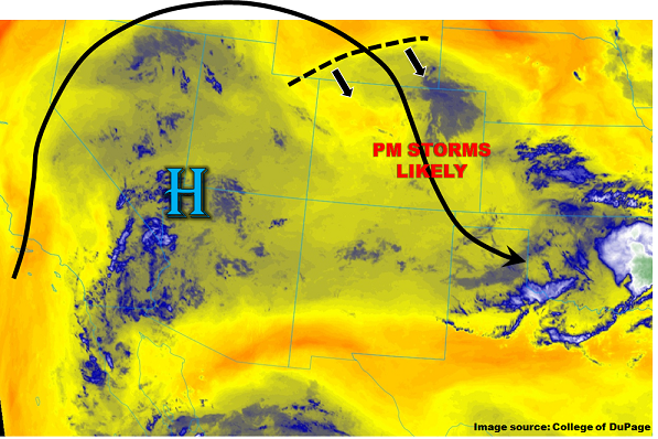
Sunny and then becoming partly cloudy with storms forming over the high country early this afternoon. Storms should be more widespread than yesterday with the main threat being gusty winds, small hail and lightning. A weak front will be positioned over the Northeast Plains near the NE border that may support some isolated severe storms later this afternoon. Max 1-hour rainfall rates of 0.75 inches are expected over the mountains. 1-hour rain rates over the Northeast Plains will be up to 1 inch. Flooding is not expected today.
Primetime: 11AM to 1AM
Southeast Plains, Raton Ridge:
Sunny throughout the day with high temperatures 5-10F above normal. Storms that develop over the higher terrain will not affect the Southeast Plains.