Issue Date: Friday, July 14, 2017
Issue Time: 10:30AM MDT
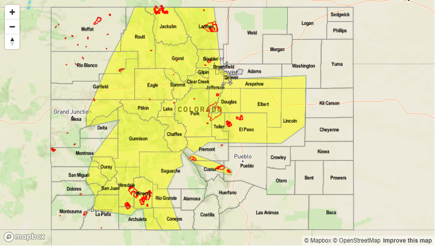
—HIGH flood threat for burn scars over the Southeast Mountains
—MODERATE flood threat for Palmer Ridge, Southeast Mountains, Southeast Plains, Raton Ridge and San Juan Mountains
—LOW flood threat for Front Range, Central Mountains, Grand Valley, Southwest Slope, Urban Corridor, Palmer Ridge
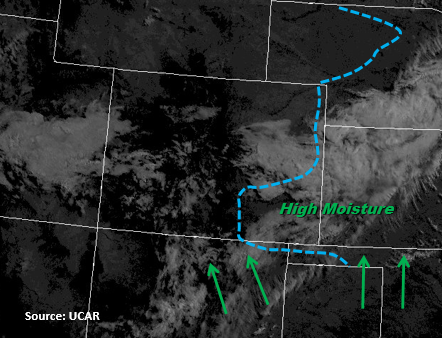
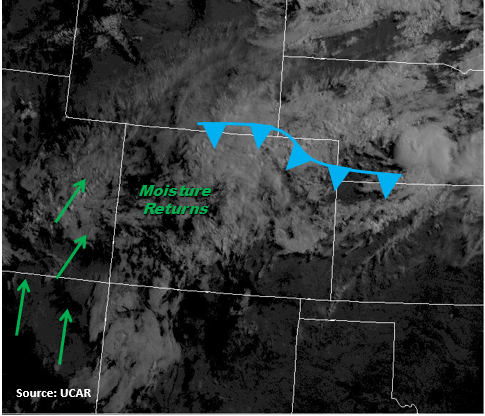
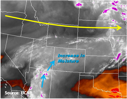
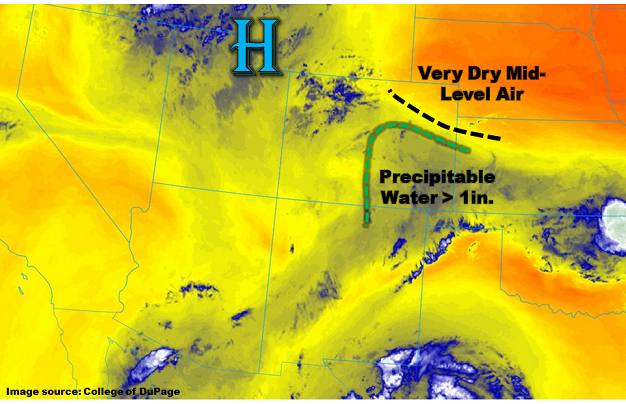
Only subtle changes are expected to today’s weather pattern, compared to what was observed on Thursday. As shown in the water vapor image, below, we continue to see a duel between the upper-level ridge just west of our state with copious amounts of low-level moisture available in southeast Colorado. Despite the fact the the ridge will strengthen today, once again, the moisture will win out today (at least for the roughly the southern half of the state). To the north, the water vapor imagery also shows a strong moisture gradient with a marked drop-off in relative humidity roughly between the 500-600 mb level: this is clearly seen on the 12Z Denver sounding this morning. This feature handily squashed convection convection forming north of the Palmer Ridge on Thursday and will continue to do so today.
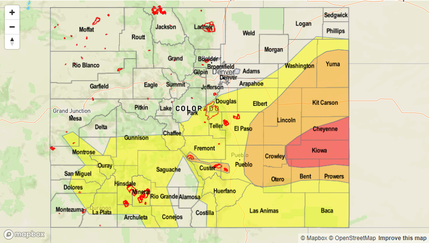
For southeast Colorado, storms will develop before noon, capable of producing rainfall up to 2.4 inches per hour. A broad Moderate flood threat has been posted, further warranted since wide parts of the area have received over 1 inch of rainfall in the past 48 hours (see Storm Total Precipitation map for more).
For southwest Colorado, efficient rainfall producing storms will once again form today. Guidance indicates the potential for slightly higher rain rates – warranting a small Moderate threat area surrounded by a Low threat.
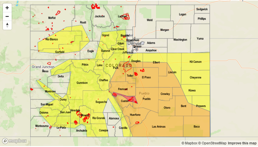
Today’s Flood Threat Map
For more information on today’s flood threat, see the map below (hover over threat areas for more details). For Zone-Specific forecasts, scroll below the map.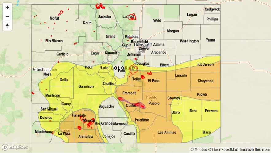

Zone-Specific Forecasts:
Southeast Mountains, Raton Ridge, Southeast Plains, Palmer Ridge:
Sunny early then storms developing by early afternoon. Max 1-hour rainfall up to 2.4 inches with max 3-hour rainfall up to 3.3 inches. Isolated flash flooding will be likely in the Moderate threat area, with mud flows and debris slides possible in the foothills. The 2016 fire burn areas have once again been placed under a High flood threat due to high confidence that over 0.5 inches of rainfall per hour is possible there.
Primetime: 11:30AM to 2AM (though highest rain rates will subside after 11PM)
San Juan Mountains, Southwest Slope, Grand Valley, Central Mountains, San Luis Valley:
Sunny early then thunderstorms and showers quickly developing by noon. Max 1-hour rain rates up to 1.2 inches with max 3-hour up to 1.9 inches. Parts of the San Juans have been placed under a Moderate flood threat with a Low flood threat surrounding that region. Debris slides and mud flows will be the main risks, though isolated flash flooding will also be possible.
Primetime: 11:30AM to 8:30PM
Northwest Slope, Northern Mountains, Front Range, Urban Corridor, Northeast Plains:
Sunny early then turning partly cloudy and warmer with an isolated to scattered showers and thunderstorms possible during the afternoon and evening. Max 1-hour rainfall up to 1.5 inches (far east) to 1.0 inches (central) and 0.5 inches (west). Flooding is not expected today.
Primetime: 11:30AM to 8:30PM