Issue Date: Friday, August 11, 2017
Issue Time: 10:20AM MDT
— LOW flood threat for portions of the Front Range, Urban Corridor, Palmer Ridge, Southeast Mountains, Raton Ridge
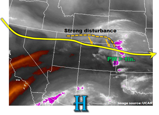
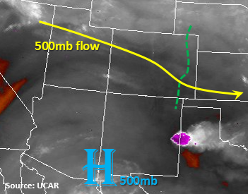
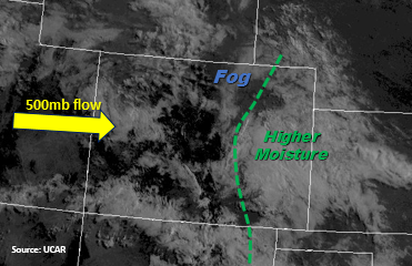
Cooler temperatures have arrived with the passage of the cold front yesterday. On visible satellite, there’s another round of dense fog along the northern Urban Corridor. This should begin to burn off with sunrise and partly cloudy skies are expected by late morning. Cloud cover and some light showers are present this morning in the southern portion of the state. This is being supported by a mid-level disturbance and should continue to move NE/E throughout the day. Unlike yesterday, there is no large-scale dynamic forcing for storms today and with these cooler temperatures and cloud cover, the far eastern plains should catch a break from the heavy PM rainfall. Precipitable Water (PW) values at Denver this morning were 0.85 inches and 0.74 inches at Grand Junction. These should increase throughout the day over the eastern portion of the state with the southerly and southeasterly flow. The flow around the high pressure, will continue to pull moisture in from AZ and NM over the SW corner of the state. Moisture will increase as dew points over AZ and NM are in the mid-50s and heating will help intensify the rainfall throughout the morning.
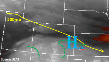
The wave associated with the storms over SW Colorado should begin to move to the E/NE throughout the day. Its arrival over the Southeast Mountains should enhance the daily upslope flow pattern and create widespread showers. As the storms move off the southern mountains, they will favor the higher terrains of the Raton and Palmer Ridges. Storms may produce gusty winds, small hail and heavy local rainfall. Threats over the mountains include mud flows and debris slides. Storms over urban areas may cause street and small stream flooding. Storm motion will be a bit slower than yesterday with E/SE movement, which will add to local totals. This storm motion may allow a storm to move through the Northeast Plains from the Cheyenne Ridge, but it should be late enough instability will be limited. Showers should decrease in intensity as the sun sets, but lighter showers will likely linger over the southern plains and mountains through the morning.
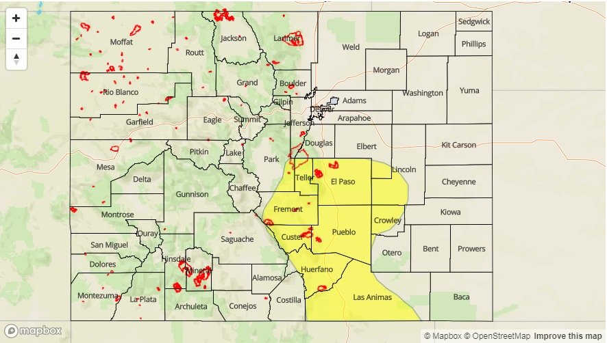
The Arkansas River basin has been a focus of our forecasts due to its high flow and saturated soils over the area increasing runoff. Widespread afternoon showers continue to elevate the river and only modest rainfall is needed for high runoff to cause flooding. At this time we do not expect major riverine flooding, but action levels could be met today along near La Junta and Las Animas. Stay tune to our twitter account for the latest information (@COFloodUpdates).
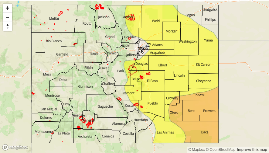
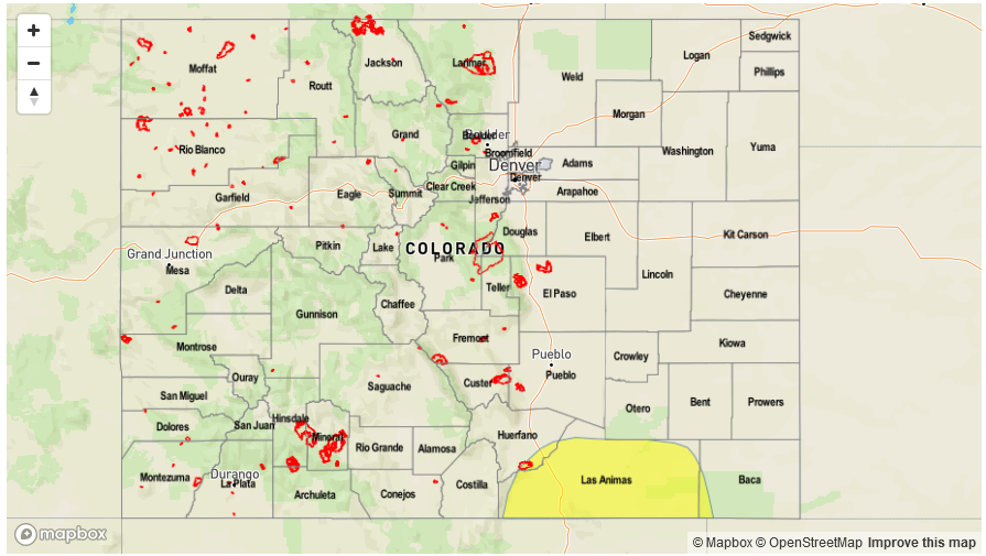
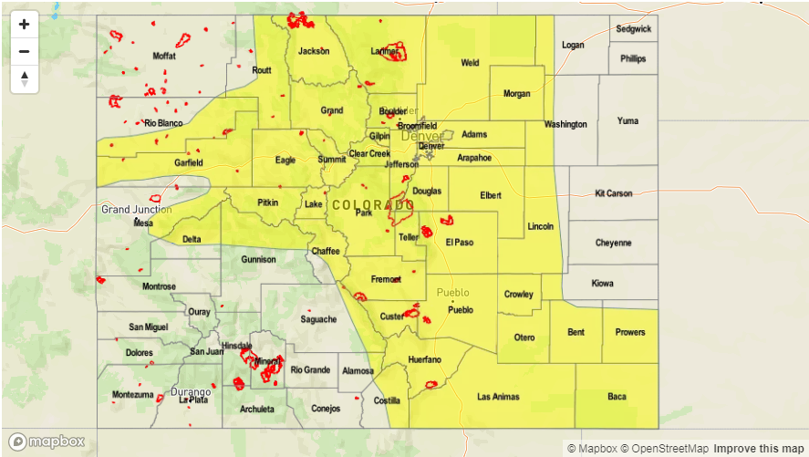
Today’s Flood Threat Map
For more information on today’s flood threat, see the map below (hover over threat areas for more details). For Zone-Specific forecasts, scroll below the map.

Zone-Specific Forecasts:
Front Range, Urban Corridor, Palmer Ridge, Northeast Plains, Southeast Mountains, Raton Ridge, Southeast Plains:
Partly cloudy and cool this morning but daytime heating should burn off some of the cloud cover. Some severe storms are possible today over the adjacent SE Plains and will favor the Palmer and Raton Ridge. Max 1-hour rainfall up to 1.6 inches (east), 1 inch (west). Riverine flooding along Fountain Creek and the Arkansas River will be monitored closely with saturated soils creating high runoff. Threats include urban and small stream flooding and debris slide (mountains). A Low flood threat has been issued today.
Primetime: 1:30PM to 11PM
Northwest Slope, Grand Valley, Southwest Slope, Northern Mountains, Central Mountains, San Juan Mountains, San Luis Valley:
Partly cloudy with rainfall become more intense throughout the day over the San Juan Mountains. Max 3-6 hour rainfall totals up to 0.7 inches (north) and 1.1 inches (south). There is a no flood threat for today.
Primetime: 10AM to 9PM