Issue Date: 5/6/2018
Issue Time: 7:35 AM
NO FLOOD THREAT IS FORECAST TODAY.
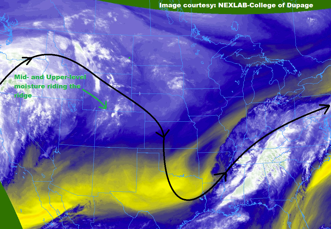
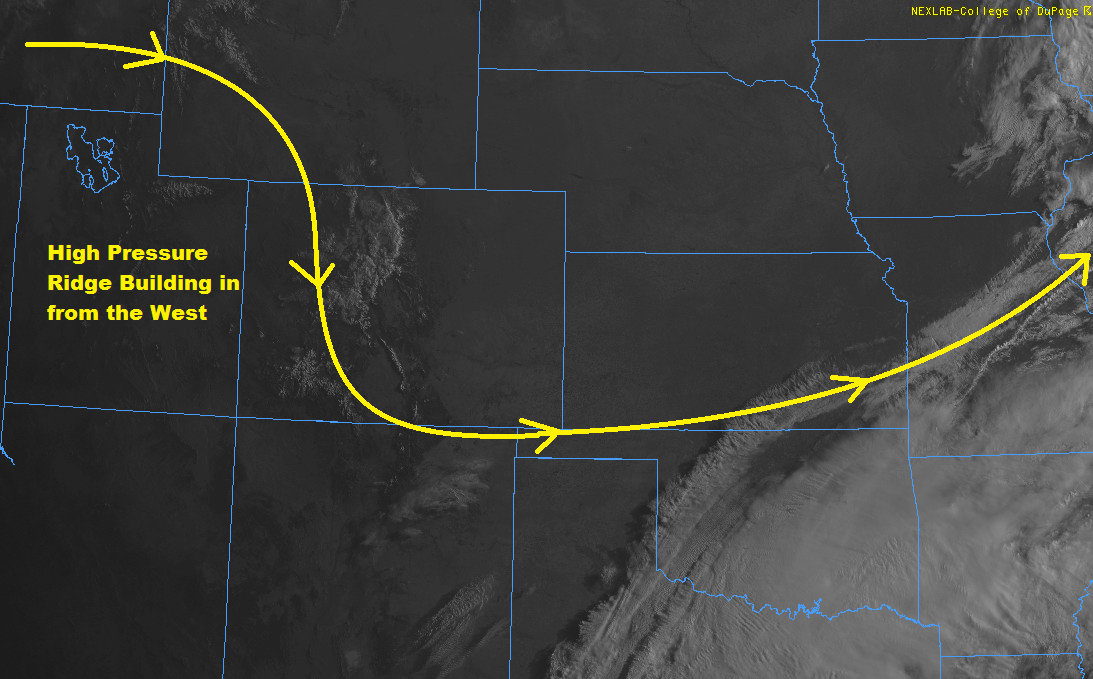
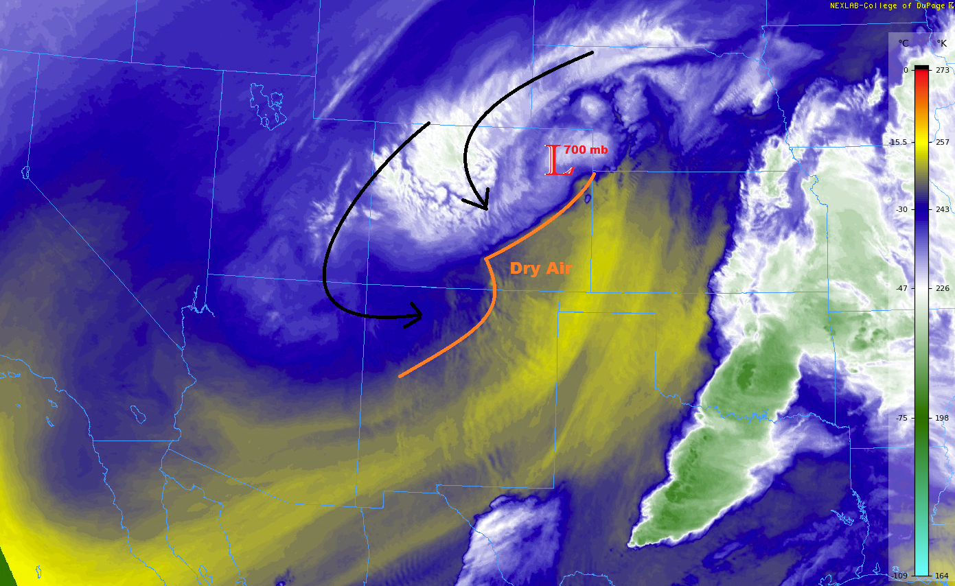
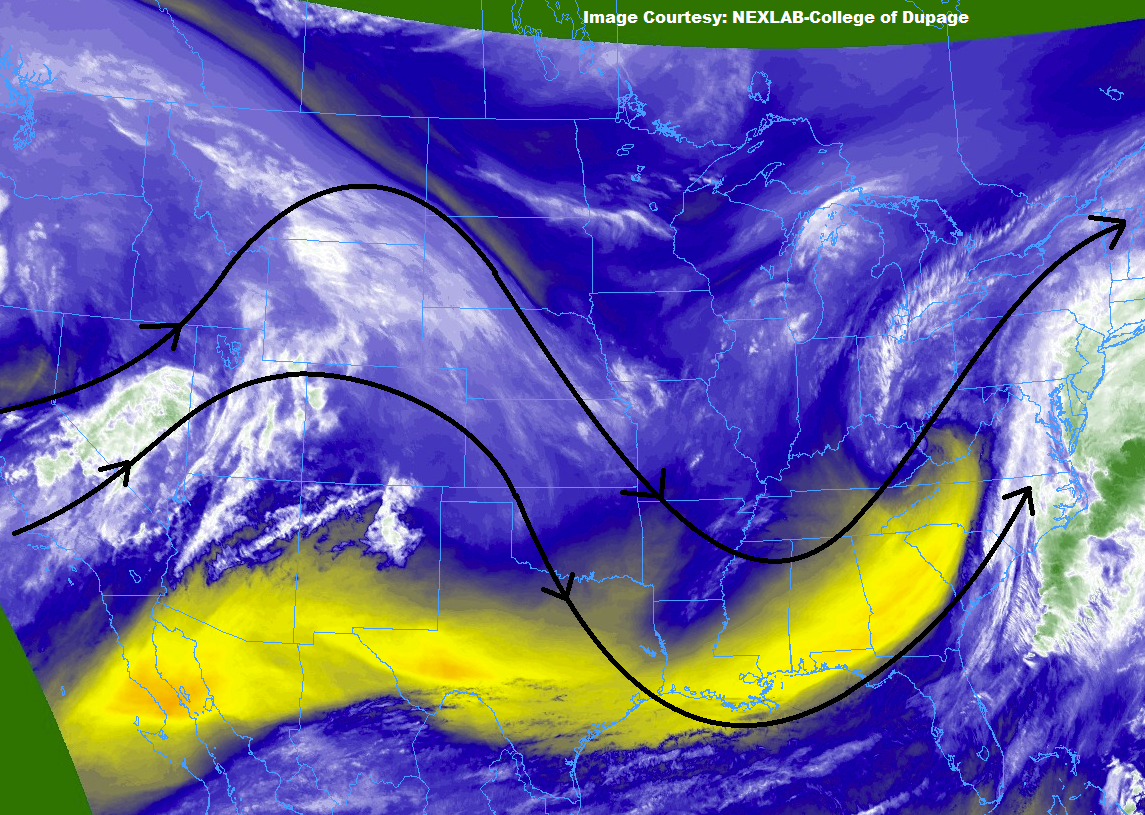
The high pressure ridge that we discussed yesterday continues to control the weather across Colorado, but it is beginning to have its authority challenged by an encroaching low-pressure system coming onshore the Pacific Northwest. From this low-pressure system is an ejecting, weak disturbance, accompanied by an increase in mid-/upper-level moisture (whites/greens in the water vapor image below). This disturbance will ripple through the high-pressure ridge today, providing support for isolated showers/thunderstorms this afternoon and evening. However, scant moisture in the low-levels will keep storms from producing much more than gusty winds, lightning, and plenty of virga, with only isolated areas of wetting rainfall. The best chance to see these wetting rains will be over the Front Range, Urban Corridor, Northeast Plains, Palmer, Ridge, and Southeast Plains, where low-level moisture will be best (relatively speaking).
For more information on the locations most likely to see this activity, please see the zone-specific forecast discussions below.
Today’s Flood Threat Map
For more information on today’s flood threat, see the map below (hover over threat areas for more details). For Zone-Specific forecasts, jump below the map.


Zone-Specific Forecasts
Front Range, Urban Corridor, Palmer Ridge, Northeast Plains, and Southeast Plains:
Most locations will remain dry today, but isolated, high-based thunderstorms will rumble during the afternoon and evening hours. Much of the rainfall will evaporate before reaching the ground, dotting the skies with streaks of virga. Brief periods of wetting rain will attend the stronger storms, with the best chances from Highway 50 northward. The main threat from any thunderstorm activity will be lightning and gusty winds, with maximum rain rates of 0.01-0.3 inches/hour being the best that they can muster.
Timing: 1 PM – 8 PM over the Front Range, 2 PM – 10 PM over the other regions
Northern Mountains, Northwest Slope, Central Mountains, Southeast Mountains, San Juan Mountains, Southwest Slope, Grand Valley, San Luis Valley, Raton Ridge:
Warm and dry will be the name of the weather game for most today, with bubbling cumulus clouds during the afternoon/evening dotting the skies over the high country. A few isolated, high-based showers/weak thunderstorms are expected over the higher elevations, but nothing much to write home about in the way of rainfall due to dry lower levels. Virga, lightning, and gusty winds will be the main impacts, with maximum rain rates in the 0.05-0.15 inches/hour range.
Timing: Noon – 8 PM