Issue Date: 5/3/2018
Issue Time: 8:10 AM
NO FLOOD THREAT IS FORECAST TODAY.
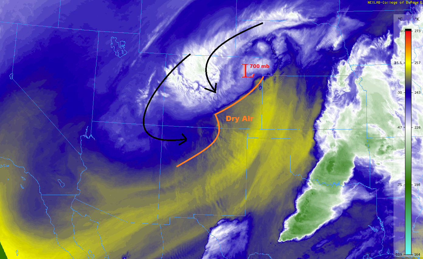
The 700 mb low feature (highlighted in the water vapor image below) is the one to watch today, as it slowly exits the state towards southwest Nebraska. Wraparound moisture from the north/northwest will be pulled across the state, eventually pushing out the dry air over Southeast Colorado, paving the way for all regions to see at least a little bit of rainfall (below 8000 feet) and snowfall (above 8000 feet) today. This is welcome news for a state that is struggling with the emergence of drought. Unfortunately, those areas of southern Colorado where drought is the worst will receive the least amount of rainfall today, as areas along and north of I-70 receive the lion’s share.
Generally speaking, most activity will be of the “garden-variety shower” nature, with a few thunderstorms mixing in during the afternoon and evening hours. Showers/storms will begin to diminish during the late evening/early nighttime hours, with the high country hanging on to showers the longest due to orographic effects. All activity should come to an end between 11 PM and 2 AM. For more details on rate rates and timing, please see the zone specific forecast discussions below.
Today’s Flood Threat Map
For more information on today’s flood threat, see the map below (hover over threat areas for more details). For Zone-Specific forecasts, jump below the map.


Zone-Specific Forecasts
Urban Corridor, Palmer Ridge, and Northeast Plains:
Scattered showers and a few thunderstorms are expected through today and into the evening, diminishing after sunset and coming to an end around Midnight. Heads up for some minor street/field ponding that may arise in poorly drained areas. Rain rates will generally be in the 0.1-0.2 inches/hour range, with maximum rain rates as follows:
Urban Corridor: 0.25-0.5 inches/hour
Palmer Ridge: 0.3-0.6 inches/hour
Northeast Plains: 0.6-1.0 inches/hour
Timing: 11 AM – Midnight
Raton Ridge and Southeast Plains:
Isolated-to-scattered showers and thunderstorms are expected to begin around lunchtime for northern portions of the Southeast Plains, eventually spreading south over the rest of the Southeast Plains and Raton Ridge regions. Most activity will be in the form of light showers, but a few thunderstorms will mix in bringing periods of moderate rainfall to a few locations. Not everyone will receive rain today, but any little bit helps. Maximum rain rates are as follows:
Raton Ridge: 0.1-0.25 inches/hour
Southeast Plains: 0.4-0.6 inches/hour
Timing: Noon – 1 AM
Northern Mountains, Northwest Slope, Front Range, Southeast Mountains, Central Mountains, San Juan Mountains, Grand Valley, San Luis Valley, and Southwest Slope:
Scattered showers/thunderstorms are expected to continue, increasing in coverage through the afternoon hours, and diminishing as the sun sets. Snow will the dominant precipitation type down to 8000-8500 feet, with rain expected below that. Periods of heavy snow in the highest elevations will lead to an additional 5-10 inches of snow in some locations, with a few locally higher amounts. Rainfall below 8000 feet will generally be light, with rain rates typically in the 0.05-0.15 inches/hour range, maxing out around 0.25 inches/hour under thunderstorms.
Timing: 11 AM – 2 AM