Issue Date: 5/5/2018
Issue Time: 7:15 AM
NO FLOOD THREAT IS FORECAST TODAY.
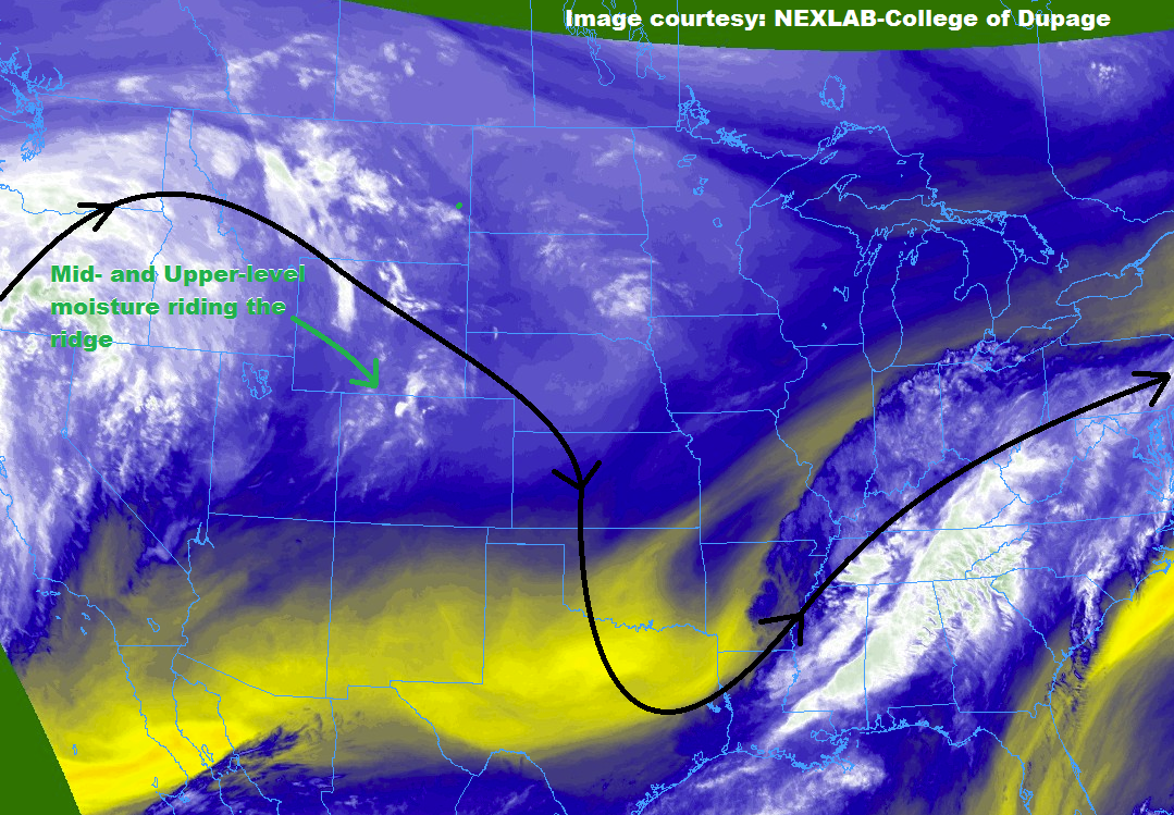
Today’s weather will provide a great start to the weekend as the warming trend of yesterday continues today. The high pressure ridge that we discussed yesterday continues to control the weather across Colorado, keeping most areas dry. However, there is a bit of mid- and upper-level moisture riding the ridge, which will push across Colorado accompanied by a weak disturbance this afternoon, providing a brief shot of isolated showers/thunderstorms. Low-level moisture is lacking, so most of this activity will result in nothing more than a sprinkle and gusty winds. The main threat will be cloud-to-ground lightning, so remember that if thunder roars, go indoors. For more information on the locations most likely to see this activity, please see the zone-specific forecast discussions below.
Today’s Flood Threat Map
For more information on today’s flood threat, see the map below (hover over threat areas for more details). For Zone-Specific forecasts, jump below the map.


Zone-Specific Forecasts
Urban Corridor, Palmer Ridge, Northeast Plains, Southeast Plains, and Raton Ridge:
The warming trend continues, and most locations will remain dry today. The best chance to see isolated, high-based showers/thunderstorms will be across the Urban Corridor and Northeast Plains, where moisture is best (relatively speaking). One or two isolated, high-based thunderstorms cannot be ruled out across the Palmer Ridge, Southeast Plains, and Raton Ridge, but the chance of occurrence for these regions is <15%. The main threat from any thunderstorm activity will be lightning and gusty winds – very little rainfall is expected. Maximum rain rates of 0.05-0.15 will the most the strongest among them can muster.
Timing: 1 PM – 9 PM
Northern Mountains, Front Range, Central Mountains, and Southeast Mountains:
Most areas will remain dry today, but an isolated shower/thunderstorm or two is expected across the area, mainly for the Northern Mountains and Front Range. For the Central Mountains and Southeast Mountains, moisture will remain too low, but virga should accompany the bubbling, high-based afternoon clouds. Any rainfall will be light, with maximum rain rates of around 0.05 inches/hour under the best thunderstorms.
Timing: Noon – 8 PM
Northwest Slope, San Juan Mountains, Grand Valley, San Luis Valley, and Southwest Slope:
Warm and dry is the name of the game today, with a few streaks of virga attending the high-based cumulus clouds that will bubble up during the afternoon hours over the higher elevations.