Issue Date: Monday May 14, 2018
Issue Time: 10:05AM MDT
— Flooding is NOT expected today
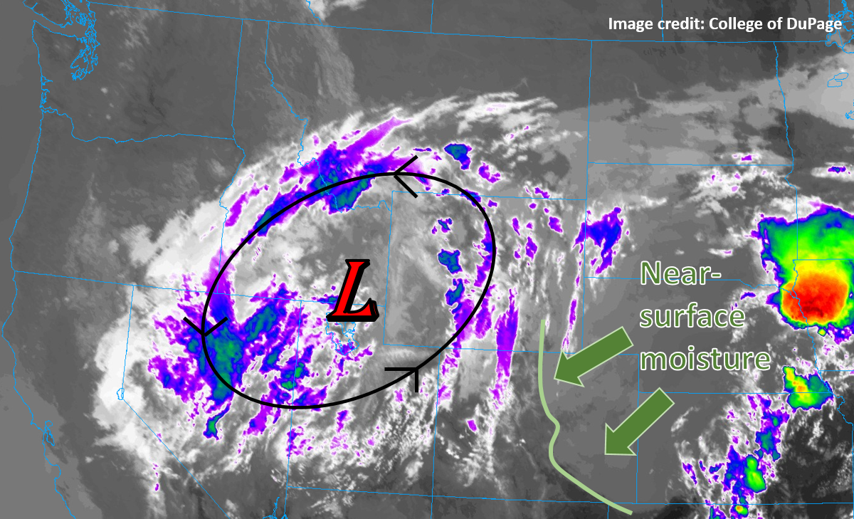
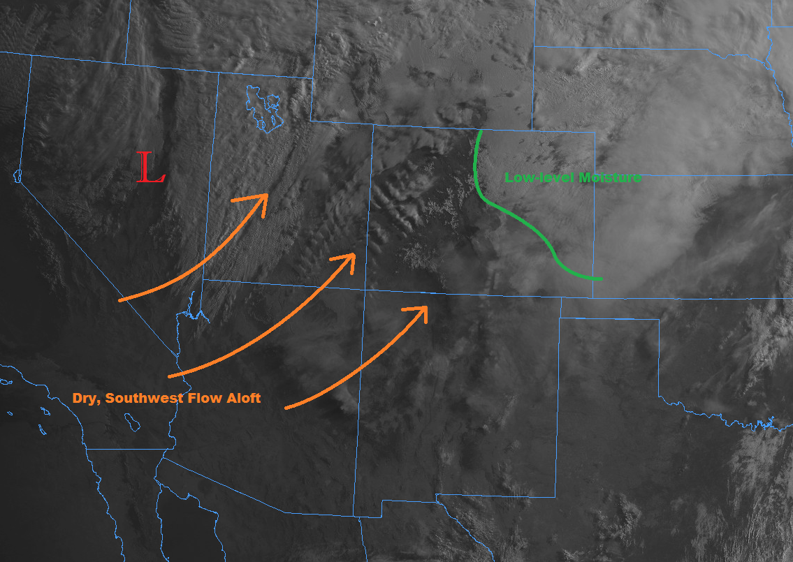
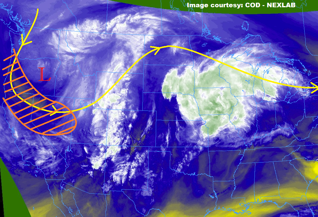
The low pressure system that has dominated Colorado’s weather pattern the last few days remains intact over Nevada. This disturbance will provide some upper-level support for thunderstorms in the form of minor shortwaves this afternoon. Southwest flow will continue, which will have various weather affects statewide. Over western Colorado, dry air will continue to be entrained from Arizona and New Mexico as indicated in the water vapor imagery below. The sounding at Grand Junction this morning indicates very little mid-level moisture, which will continue to mix out throughout the day. Thus (west), the isolated storms will be restricted to the Northern Mountains and Northwest Slope this afternoon with very limited rainfall.
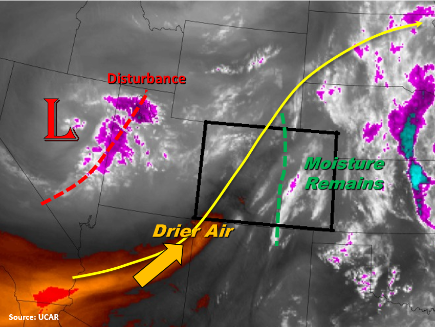
East of the Continental Divide, cooler and moist air remains after the passage of the frontal boundary. Upslope flow is expected to form this afternoon, favoring development of thunderstorms over the Front Range and Palmer Ridge. To the north, storms are expected to be more of a garden variety as they move into the Urban Corridor and Northeast Plains. Further south, more isolated, severe storms are expected to develop due to stronger daytime heating over the Palmer Ridge. The main threats will be large hail and gusty winds. Upslope flow continues into the evening and overnight creating more widespread but lighter showers over the eastern Southeast Plains and Raton Ridge. Flooding is not expected today.
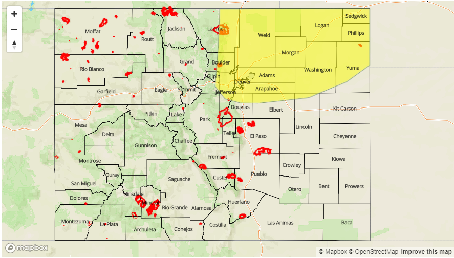
Today’s Flood Threat Map
For more information on today’s flood threat, see the map below. For Zone-Specific forecasts, scroll below the map.
Zone-Specific Forecasts:
Palmer Ridge, Front Range, Urban Corridor, Northeast Plains, Southeast Plains, Raton Ridge, Southeast Mountains:
Cloudy this morning with clearing expected this afternoon. Less clearing to the north will cause more garden variety showers with 1 hour rain rates up to 0.8 inches/hour. Further south, isolated, stronger thunderstorms will develop over the Palmer Ridge. Large hail up to nickel size can be expected under the core of the storms along with gusty winds. Max 1 hour rain rates up to 1 inch are possible. Scatter storms will persist overnight, but rainfall totals are expected to be under 0.5 inches. Minus some minor field ponding with the stronger, afternoon thunderstorms, flooding is not expected.
Primetime: 1PM to 7AM
Northwest Slope, Grand Valley, Southwest Slope, Northern Mountains, San Luis Valley, San Juan Mountains, Southeast Mountains, Central Mountains:
Warm and dry again today with a few broken clouds over the higher terrains. The Northern Mountains have the best chance for rainfall this afternoon, but storms will produce more gusty winds than rainfall. Rainfall totals are expected to be under 0.1 inches. Thus, flooding is not expected today.
Primetime: 12PM to 9PM