Issue Date: 5/11/2018
Issue Time: 8:40 AM
NO FLOOD THREAT IS FORECAST TODAY.
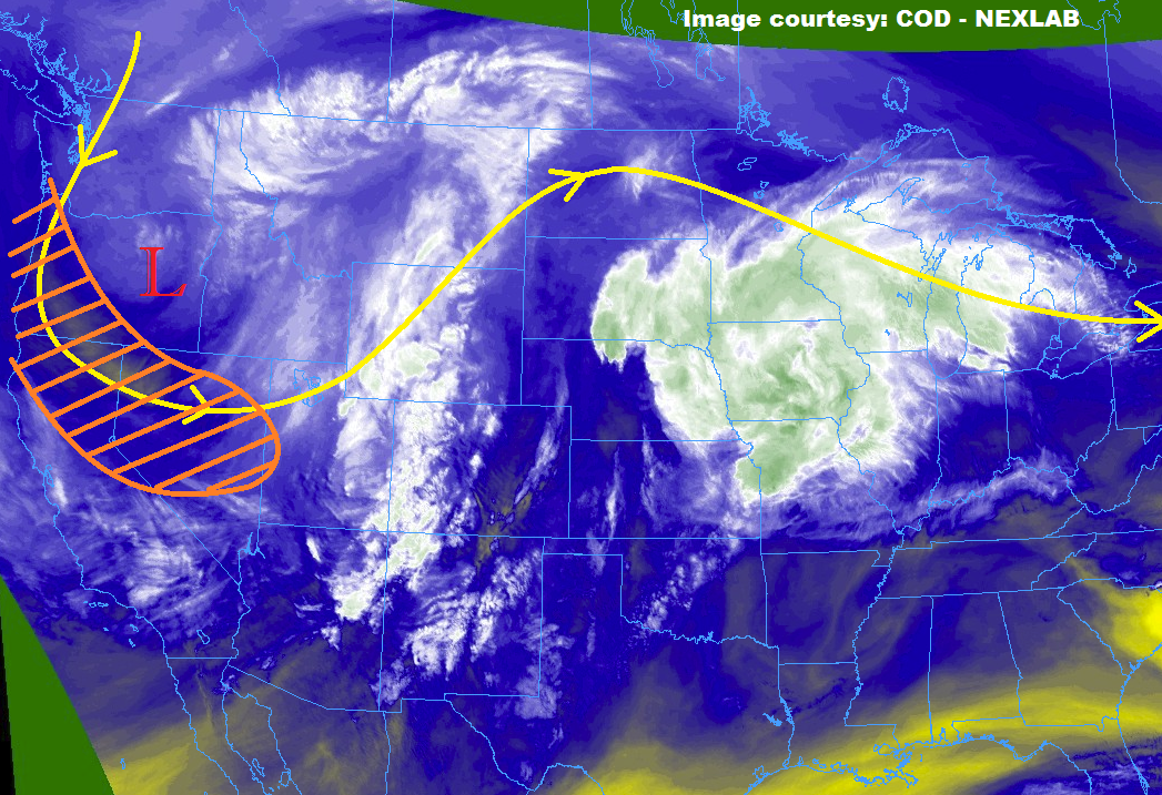
A dichotomy of weather conditions will exist today, with warm/dry conditions for the southern half of the state, and isolated-to-widely scattered showers/thunderstorms for the northern half of the state, where the better moisture/upper-level support will coincide. The upper-level support will be provided by a jet streak (orange hatched area on the water vapor image below) that will round the base of the upper-level trough, and position itself favorably to provide some broad-scale support for showers/thunderstorms over the northern half of Colorado. Better moisture than the last few days exists across the Northeast Plains, Urban Corridor, northern Palmer Ridge, and Front Range regions thanks to easterly low-level flow. This will help storms produce more rainfall than previous days, but still not enough to warrant a flood threat as deeper moisture is still lacking. For the High Country north of I-70 (and not including the Front Range), moisture is still lacking and will limit the coverage and rainfall potential of any activity in the area.
For the High Country south of I-70 and the Southeast Plains, Raton Ridge, and San Luis Valley regions, warm and dry is the name of the game. Dry, southwest flow aloft and a tightening pressure gradient will mean windy conditions and increased fire danger – in fact, Red Flag Warnings have been issued for much of the area. Check with your local National Weather Service office for more details.
Today’s Flood Threat Map
For more information on today’s flood threat, see the map below (hover over threat areas for more details). For Zone-Specific forecasts, jump below the map.


Zone-Specific Forecasts
Front Range, Urban Corridor, Palmer Ridge, and Northeast Plains:
Warm and dry for most, with isolated-to-scattered showers/thunderstorms expected this afternoon and evening, with one or two rumbling into the early morning hours across the far Northeast Plains. Relatively moist easterly low-level flow underneath southwest flow aloft will create an environment capable of producing a few strong-to-severe thunderstorms, with the main threats being large hail, strong winds, and lightning, with brief periods of moderate rainfall. Generally speaking, rain rates will remain in the 0.15-0.25 inches/hour range, with maximum rain rates of 0.4-0.8 inches/hour possible near the CO/WY border where upper-level support will be best.
Timing: 3 PM – Midnight, with a couple of isolated showers/storms lingering until 2-3 AM over the Northeast Plains
Northern Mountains and Northwest Slope:
Isolated-to-scattered showers/weak thunderstorms are expected this afternoon and evening, providing breaks from the otherwise dry and warm conditions. Due to dry, low-level conditions, expect plenty of virga and gusty winds from shower/thunderstorm activity, with very little in the way of rainfall. Maximum rain rates will be in the 0.05-0.15 inches/hour range. Cloud cover will keep high temperatures a bit below yesterday’s readings.
Timing: 11 AM – 6 AM
Central Mountains, Southeast Mountains, San Juan Mountains, Southwest Slope, Grand Valley, San Luis Valley, Raton Ridge, and Southeast Plains:
Warm, dry, and breezy will be the weather theme today, as tightening pressure gradients and dry, southwest flow aloft combine to produce critical fire weather conditions. As the surface boundary moves southward overnight across the Southeast Plains, an isolated stray shower is possible over northeast portions of the Southeast Plains. Any activity will produce gusty winds and virga, with little-to-no rainfall expected.