Issue Date: 5/12/2018
Issue Time: 8:03 AM
NO FLOOD THREAT IS FORECAST TODAY.
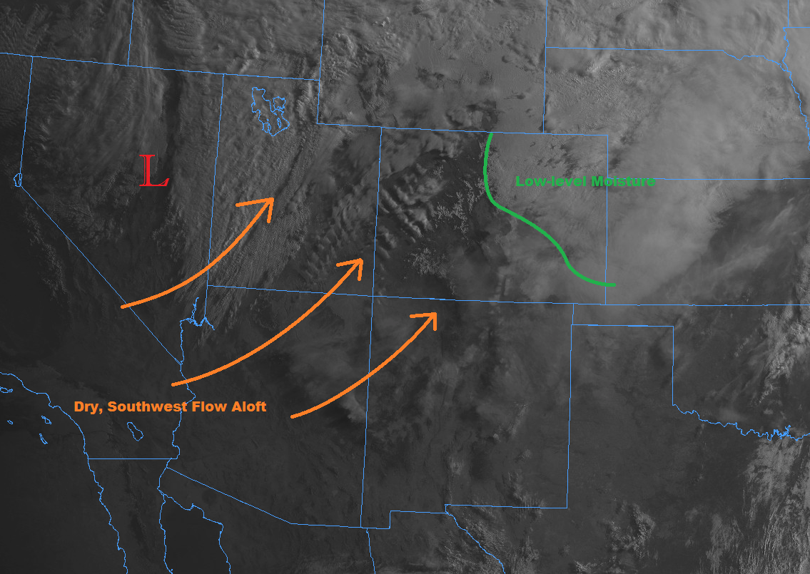
This morning started out with a mixture of fog, clouds, and pockets of drizzle east of the mountains, thanks to low-level, moist, upslope flow. Meanwhile, scattered mid-/high-clouds streamed over the High Country, associated with the upper-level low positioned over the Great Basin. The fog will scour out as the morning turns to the afternoon, but expect mostly cloudy skies to hang around north of the cool front across the Urban Corridor from Castle Rock northward, the Front Range foothills north of Highway 285, the northern half of the Palmer Ridge, the Northeast Plains, and far northeastern portions of the Southeast Plains. The air north of the cool front will be marked by plenty of moisture and cooler temperatures than yesterday, with a few isolated showers/thunderstorms expected during the late afternoon/evening hours. I have denoted the boundary of low-level moisture in green on the visible satellite image below. To the south of the cool front, breezy, warm, and mostly sunny will be the name of the game, with critical fire danger remaining in place.
For the High Country, it will be a windy and warm, with southwesterly flow ushering in dry air, increasing the fire danger. The exception to this rule will be the Front Range, where an isolated shower/weak thunderstorm or two cannot be ruled out during the late afternoon and evening hours, thanks to the moist, upslope flow from the east.
Today’s Flood Threat Map
For more information on today’s flood threat, see the map below (hover over threat areas for more details). For Zone-Specific forecasts, jump below the map.


Zone-Specific Forecasts
Front Range, Urban Corridor, Palmer Ridge, and Northeast Plains:
A couple isolated showers/weak thunderstorms are expected later this afternoon and into the evening hours, as the peak of daytime warmth works with a weak upper-level disturbance. Due to the relative coolness of the low-level air, and the warm, dry southwest flow aloft, it’s going to be difficult for storms to strengthen, keeping rainfall rates low. Generally speaking, rainfall rates will be in the 0.1-0.25 inches/hour range, with maximum rain rates under thunderstorms in the 0.3-0.6 inches/hour range.
Timing: 3 PM – 10 PM, with a shower or two possible into the early morning hours across the Urban Corridor and Northeast Plains
Northern Mountains, Northwest Slope, Central Mountains, Southeast Mountains, San Juan Mountains, Southwest Slope, Grand Valley, San Luis Valley, Raton Ridge, and Southeast Plains:
Warm, mostly sunny, and dry will be the name of the weather game across these regions, with breezy conditions elevating fire danger. Be sure to check with your local NWS office for more information regarding any Red Flag Warnings. The exception to the mostly sunny rule will be across far northeastern portions of the Southeast Plains, where low-level moisture will be in place behind a quasi-stalled surface boundary, leading to mostly cloudy skies. A stray shower/pocket of drizzle in the early morning hours tomorrow near the CO/KS border cannot be ruled out as the surface boundary pushes southward and upslope flow continues.