Issue Date: 5/26/2018
Issue Time: 7:30 AM
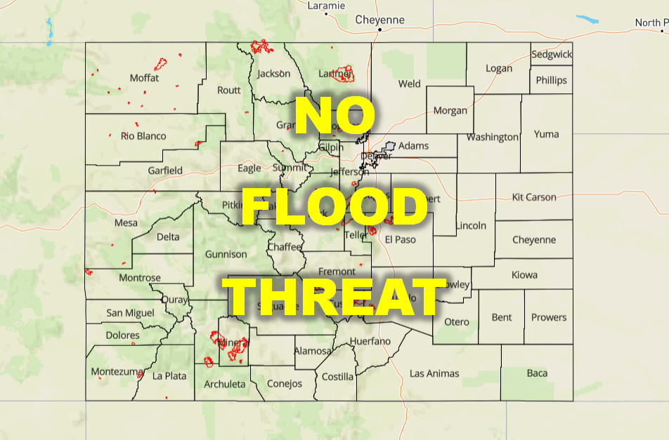
NO FLOOD THREAT IS FORECAST TODAY.
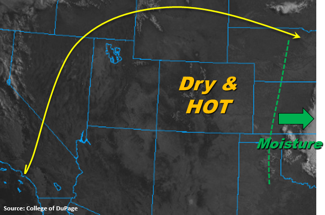
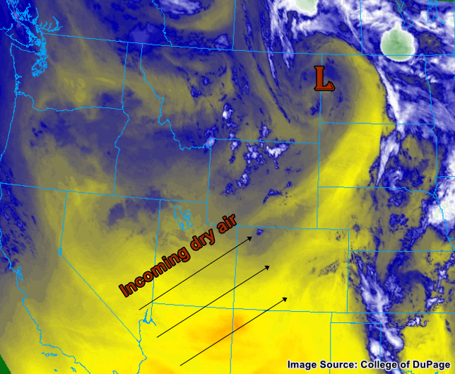
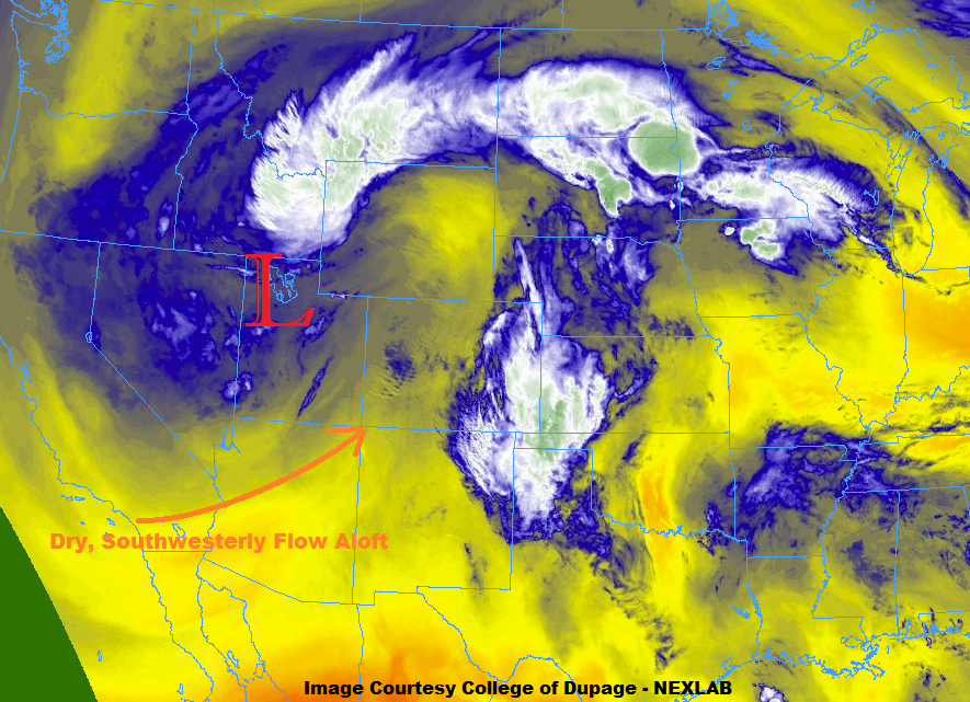
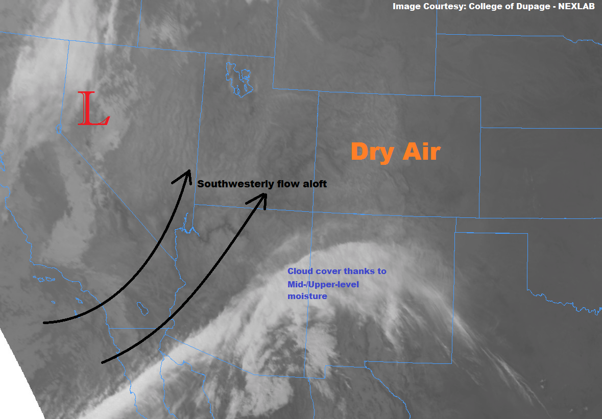
Memorial Day Weekend is being kicked off by hot and dry conditions statewide, as high pressure ridging aloft continues its hold on Colorado. The ridge axis is sliding eastward, however, and this will allow the southwesterly flow aloft to pull just a bit of the mid- & upper-level moisture from across Arizona and New Mexico into western Colorado. This moisture will be enough to kick off a couple afternoon/evening thunderstorms, aided by upslope flow and hot temperatures, but it won’t be enough to really create any wetting rains. Instead, dry thunderstorms, characterized by cloud-to-ground lightning, gusty winds, and little (if any) rainfall, are expected across the High Country, coinciding with low surface relative humidities (5-15%) and dry fuels thanks to worsening drought conditions. This is a dangerous cocktail for fire ignition and subsequent rapid fire growth, and extreme care must be taken for all regions west of I-25. Even if you aren’t included in the Red Flag Warning officially, the fire danger is still elevated.
For areas east of the mountains, hot and dry conditions will be widespread, with temperatures taking aim at record highs across the Urban Corridor and Northeast Plains. The record high for the date in Denver is 95°F, to give you an idea as to the magnitude of heat expected. High-based cumulus clouds will be about all the atmosphere can muster, with a few streaks of virga being present beneath the cloud bases. An isolated dry thunderstorm near the Cheyenne Ridge cannot be ruled out, but will most likely occur on the Wyoming side of the border.
Today’s Flood Threat Map
For more information on today’s flood threat, see the map below (hover over threat areas for more details). For Zone-Specific forecasts, jump below the map.


Zone-Specific Forecasts
Urban Corridor, Northeast Plains, Southeast Plains, Palmer Ridge, and Raton Ridge:
Hot and dry will be the name of the weather game today, with high temperatures reaching near-record levels across the Urban Corridor and Northeast Plains. High-based cumulus clouds will be the best Mother Nature can do with the only moisture existing 5km above the surface. An isolated, dry thunderstorm near the Cheyenne Ridge during the evening hours cannot be ruled out; if one does occur, it will produce gusty winds and lightning, and little (if any) rainfall. Some low clouds will be present during the morning hours tomorrow across the far eastern plains thanks to a surge of moisture from the Great Plains readying the atmosphere for thunderstorms tomorrow.
Timing: 6 PM – Midnight
Front Range, Northwest Slope, Northern Mountains, Central Mountains, Grand Valley, Southwest Slope, San Juan Mountains, Southeast Mountains, San Luis Valley:
Hot and dry, with a few isolated dry thunderstorms expected during the afternoon/evening. Little, if any, rainfall will occur. Fire danger is high across the area, so please use caution if you have any plans that could involve a spark of any kind (i.e., grilling). Red Flag Warnings have been issued across much of the area; be sure to check with your local NWS office for more information.
Timing: 3 PM – Midnight